1960s Maps of Cascade County, Montana
Explore 47 historic maps of Cascade County from the 1960s. These maps offer a rare glimpse into what life looked like during the 1960s — showing old roads, neighborhoods, homes, and landmarks that have changed or disappeared over time.
Whether you're researching your family's past, planning a metal detecting trip, or studying how Cascade County's landscape evolved across the 1960s, these high-resolution maps are a powerful tool for exploring the history of this region.
- Focus on a specific era: All maps on this page are from the 1960s, giving you a focused view of this time period.
- See what’s changed: Compare century-old streets, trails, and buildings to today's modern landscape using overlays and satellite layers.
- Research with precision: Use these maps for genealogy, historical research, land use analysis, or educational projects.
- View, download, or print: Maps are fully viewable online in high resolution, and can be downloaded or printed for your own records.
Start exploring Cascade County's history through authentic maps from the 1960s. This is your window into the past.
Cascade County, MT maps
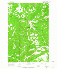
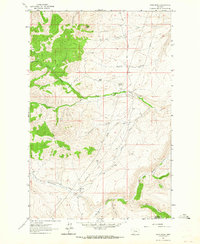
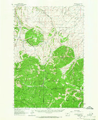
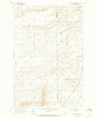
(47)- 1960 Map of Simms, 1962 Print
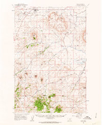 1960 Simms1962 Print · USGSWestern Montana's ranching and transit corridors are captured here during the mid-century, featuring the rugged volcanic mesas of the Sun River valley. Researchers can trace the legacy of the Mullan Road, the St Peter Mission, and the Eagle Rock Stage Station (Site).2 unique versions available
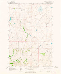
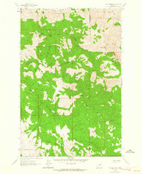
 - 1960 Map of Freezeout Lake, 1963 Print
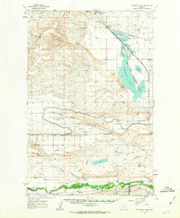 1960 Freezeout Lake1963 Print · USGSThe Teton County plains are shown in the early sixties as a hub of irrigation and rail activity. Researchers can trace the water-management systems through Bole and Riebeling, or locate family landmarks like the Hamilton Ranch and School Section.2 unique versions available
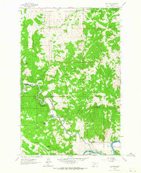
 - 1961 Map of White Sulphur Springs
 1961 White Sulphur Springs1961 Print · USGSThe Missouri River valley and central Montana highlands are captured here during a period of significant hydroelectric and rail expansion. Genealogists and rail historians can trace the paths of the Northern Pacific and Chicago Milwaukee St Paul and Pacific through settlements like White Sulphur Springs and Townsend.
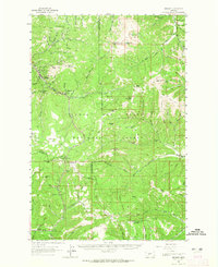
 - 1961 Map of Craig, 1964 Print
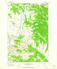 1961 Craig1964 Print · USGSThe settlement of Craig is captured in the early sixties, situated along the vital Great Northern rail corridor and the Missouri River. Local historians can trace the topography of Brewer Hill or locate the Wolf Creek Airway Beacon on the western heights.3 unique versions available
 - 1961 Map of Hardy, 1964 Print
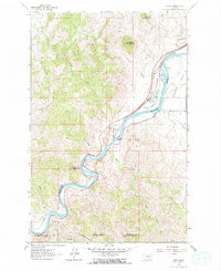 1961 Hardy1964 Print · USGSThe Missouri River canyon in the early sixties was a vital corridor for rail and water infrastructure. Researchers can trace the Great Northern tracks past Hardy, locate the Hardy Bridge, and find industrial features like Tintinger Siding.2 unique versions available
 - 1961 Map of Hound Creek Reservoir, 1964 Print
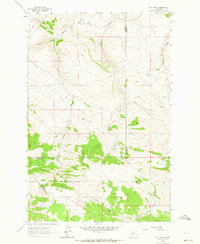
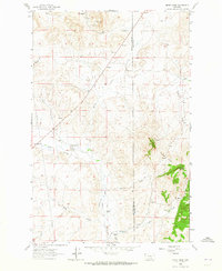
 1961 Hound Creek Reservoir1964 Print · USGSCascade County ranchlands are captured here in the early sixties, centered on the Montana Principal Meridian. Researchers can trace the legacy of the Sieben Ranch and locate remote landmarks like The Pinnacles and Hound Creek Reservoir.2 unique versions available
 - 1961 Map of Rocky Reef, 1964 Print
 1961 Rocky Reef1964 Print · USGSThe Missouri River and Great Northern railway define the valley floor in the early sixties before the terrain climbs toward the prominent Rocky Reef. Researchers can trace the Chestnut Valley Canal, locate the Chestnut Valley Cem, and explore the high country around Harris Mountain.
 - 1961 Map of Kings Hill, 1964 Print
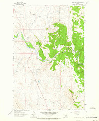
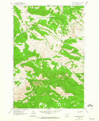
 1961 Kings Hill1964 Print · USGSThe high passes of Meagher and Cascade counties are captured here in the early 1960s, showing the intersection of three county lines. Trace mountain trails and recreation spots like Kings Hill Campground or landmarks such as Porphyry Peak and Kings Hill Pass.2 unique versions available
 - 1961 Map of Schrammeck Lake, 1964 Print
 1961 Schrammeck Lake1964 Print · USGSThe high plains of Cascade County are captured here in the early sixties, showing a landscape defined by ranching and vital water sources. Researchers can trace the early paths of Millegan Road or locate natural features like Schrammeck Lake and Bird Creek.2 unique versions available
 - 1961 Map of Neihart, 1964 Print
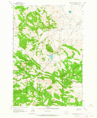
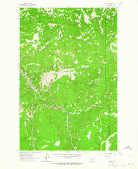 1961 Neihart1964 Print · USGSNeihart and the surrounding Little Belt Mountains are captured here in the early sixties, as the region's mining legacy remained etched into the landscape. Trace old workings at the Silver Dyke Mine or follow the waters of Belt Creek past Memorial Falls.2 unique versions available
 - 1961 Map of Coburn Mountain, 1964 Print
 1961 Coburn Mountain1964 Print · USGSCentral Montana ranching country is documented here in the early sixties as the county lines meet along the Dearborn River. Genealogists and researchers can locate the Dearborn Cem, the Sevenmile Sch, and the local Dearborn Ranch.3 unique versions available
 - 1961 Map of Dana Ranch, 1964 Print
 1961 Dana Ranch1964 Print · USGSThe ranching country of Central Montana is captured here in the early 1960s, showing the intersection of Cascade and Meagher Counties. Genealogists and local historians can trace family holdings like the Gordon Ranch, the Parsons Ranch, and the former town at Adel.2 unique versions available
 - 1961 Map of Barker, 1964 Print
 1961 Barker1964 Print · USGSDeep in the Little Belt Mountains during the early sixties, this map captures the mining legacy of Barker and Hughesville. Researchers can trace old prospecting routes like the Sawmill Trail and locate early Mines near Barker Mountain.
 - 1961 Map of The Sawteeth, 1964 Print
 1961 The Sawteeth1964 Print · USGSLewis and Clark County at the start of the 1960s was a landscape of remote mountain peaks and early mining interests. Researchers can trace the rugged Stickney Creek Trail, locate historic Prospects, and identify named landmarks like The Devils Kitchen and The Twin Sisters.
 - 1961 Map of Mid Canon, 1964 Print
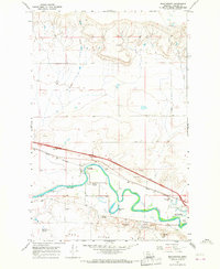
 1961 Mid Canon1964 Print · USGSThe river canyon country of central Montana in the early sixties showcases a transition from early homesteading to a modern rail-and-river corridor. Genealogists can trace family footprints at the McKinster Homestead or the Cook Homestead while following the Great Northern rail line.2 unique versions available
 - 1961 Map of Neihart, 1965 Print
 1961 Neihart1965 Print · USGSThe mining district around Neihart and the Lewis and Clark National Forest come alive in this early 1960s survey. Researchers can trace deep-mountain legacy sites like the Silver Dyke Mine, Kings Hill Pass, and the Yogo Lookout Tower.2 unique versions available
 - 1961 Map of Barker, 1966 Print
 1961 Barker1966 Print · USGSThe mining camps of Judith Basin are documented here in the early sixties, showing the remote peaks of the Little Belt Mountains. Genealogists and historians can trace the foundations of Barker and Hughesville, or find the Barker Cem and Chambers Mine.2 unique versions available
 - 1962 Map of Choteau
 1962 Choteau1962 Print · USGSThe Rocky Mountain Front meets the western plains in the early 1960s, showing a landscape defined by the Continental Divide. Genealogists and researchers can trace the tracks of the Great Northern and find settlements like Choteau, Augusta, and Bynum.
 - 1962 Map of B K Ranch, 1964 Print
 1962 B K Ranch1964 Print · USGSThe ranching and forest lands of Meagher County are captured here in the early sixties as the modern era of land management took hold. Researchers can trace historic creek drainages like Crooked Creek and find landmarks such as B K Ranch and Squaw Teat.2 unique versions available
 - 1962 Map of Middle Creek Lake, 1964 Print
 1962 Middle Creek Lake1964 Print · USGSThe high Montana backcountry of the 1960s reveals a rugged landscape of county boundaries and mountain outposts. Trace the remote network of a Pack Trail and Jeep Trail leading to Tyrell Camp, Hump Cabin, and Middle Creek Lake.2 unique versions available
 - 1962 Map of Candle Mountain, 1964 Print
 1962 Candle Mountain1964 Print · USGSThe high country of the Montana divide is captured here in the early sixties, showing the intersection of Lewis and Clark and Cascade counties. Outdoor historians can trace primitive routes like the Pack Trail through Helena National Forest and along Elkhorn Creek.
 - 1963 Map of Bowmans Corners NE, 1965 Print
 1963 Bowmans Corners NE1965 Print · USGSThe Montana foothills at the Lewis and Clark and Cascade county line appear here in the early sixties as a landscape of remote ranching and early irrigation. Researchers can locate the Olsen Place homestead and trace the path of the Crown Butte Canal near the slopes of Crown Butte.2 unique versions available
 - 1963 Map of Henry Creek, 1965 Print
 1963 Henry Creek1965 Print · USGSThe high plains of Lewis and Clark County were defined by livestock and irrigation in the early sixties. Researchers can trace historic property lines at Gardipee Ranch or locate water-rights infrastructure like Knudson Ditch and Garino Ditch.2 unique versions available
 - 1965 Map of White Sulphur Springs
 1965 White Sulphur Springs1965 Print · USGSCentral Montana in the late 1950s and early 60s reveals a rugged mountain landscape shaped by the Missouri River and the emergence of the Canyon Ferry Reservoir. Genealogists and local historians can trace legacy ranching sites, the Northern Pacific rail line, and remote schoolhouses like Cottonwood School and Spokane Creek School.
 - 1965 Map of Manchester, 1966 Print
 1965 Manchester1966 Print · USGSManchester and the Sun River valley are captured in the mid-1960s as the railroad and river networks shaped Cascade County life. Researchers can locate the Sunset Memorial Gardens Cem, trace the Great Northern tracks, or find local landmarks like Sun River Park.2 unique versions available
Showing maps 1-25 of 47
Top cities of Cascade County
- Great Falls historical maps
- Cascade historical maps
- Belt historical maps
- Stockett historical maps
- Neihart historical maps
Frequently asked questions
- What are the different types of historical maps available for Cascade County?
- What is the oldest map of Cascade County?
- Where can I purchase historical maps of Cascade County for my home or office?
- Where can I download high-res historical maps of Cascade County?
- Are there historical topographic maps available for Cascade County?
- Is there historical aerial imagery available for Cascade County?
- Where are historical maps of Cascade County sourced from?