1980s Maps of Cascade County, Montana
Explore 24 historic maps of Cascade County from the 1980s. These maps offer a rare glimpse into what life looked like during the 1980s — showing old roads, neighborhoods, homes, and landmarks that have changed or disappeared over time.
Whether you're researching your family's past, planning a metal detecting trip, or studying how Cascade County's landscape evolved across the 1980s, these high-resolution maps are a powerful tool for exploring the history of this region.
- Focus on a specific era: All maps on this page are from the 1980s, giving you a focused view of this time period.
- See what’s changed: Compare century-old streets, trails, and buildings to today's modern landscape using overlays and satellite layers.
- Research with precision: Use these maps for genealogy, historical research, land use analysis, or educational projects.
- View, download, or print: Maps are fully viewable online in high resolution, and can be downloaded or printed for your own records.
Start exploring Cascade County's history through authentic maps from the 1980s. This is your window into the past.
Cascade County, MT maps
(24)- 1982 Map of Highwood, 1983 Print
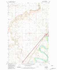
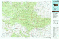
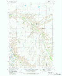 1982 Highwood1983 Print · USGSHighwood and the surrounding grain country are captured here in the early eighties, showing a landscape shaped by agricultural logistics and deep coulees. Trace the Old Railroad Grade past Highwood or locate the rural Cem near North Willow Creek.
 - 1982 Map of Blythe, 1983 Print
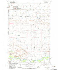
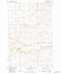
 1982 Blythe1983 Print · USGSThe Montana high plains and the border of Judith Basin are captured here in the early 1980s. Researchers can trace the path of the Burlington Northern railroad through Blythe or locate rural landmarks like Never Sweat Coulee and a remote landing strip.
 - 1982 Map of Belt, 1983 Print
 1982 Belt1983 Print · USGSBelt and the surrounding Cascade County ranchlands are captured here during the early eighties, showcasing a region defined by its mining and rail heritage. Genealogists and historians can locate the Wayne Tunnel, specific Mine locations near Belt, and community landmarks like Castner Park.
 - 1982 Map of Armington, 1983 Print
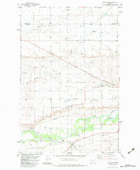
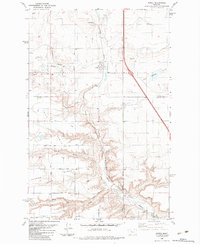
 1982 Armington1983 Print · USGSCascade County in the early eighties shows a landscape of deep creek valleys and high agricultural plateaus. Researchers can trace rural life through the Tiger Butte Community Center, Pleasant View Cemetery, and the rail lines of the Burlington Northern.
 - 1982 Map of Belt NE, 1983 Print
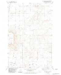
 1982 Belt NE1983 Print · USGSThe Montana ranchlands of the early eighties are mapped here along the border of Cascade and Chouteau counties. Researchers can trace rural landmarks and old watercourses like Willow Bend School, Willow Creek Ranch, and Big Willow Creek.
 - 1983 Map of Cascade Colony
 1983 Cascade Colony1983 Print · USGSMontana's high plains near the Sun River are captured here in the early 1980s, showcasing a landscape of isolated colonies and historic military lines. Trace the Old Fort Shaw Military Boundary past landmarks like Shaw Butte and the small Cem at Cascade Colony.
 - 1983 Map of Vaughn NE
 1983 Vaughn NE1983 Print · USGSThe high plains of Montana's Teton and Cascade counties are captured here in the early eighties, showing the expansive ranching country near the northern border. Local history researchers can pinpoint the Neuman School or trace the winding paths of Lake Creek and Flat Creek.2 unique versions available
 - 1983 Map of Fort Shaw
 1983 Fort Shaw1983 Print · USGSThe Sun River valley comes alive in the early 1980s, showing a landscape defined by frontier military history and an intricate irrigation network. Researchers can trace the Fort Shaw Military Reservation Boundary, the Old Railroad Grade, and settlements like Ashuelot.
 - 1983 Map of Simms
 1983 Simms1983 Print · USGSThe military and agricultural heritage of the Montana plains is visible here in the early 1980s. Genealogists and historians can trace the Old Fort Shaw Military Reservation Boundary and the path of the Old Railroad Grade past Simms.
 - 1983 Map of Vaughn
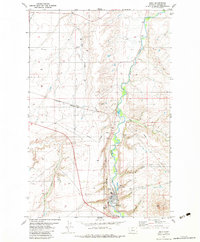
 1983 Vaughn1983 Print · USGSThe area around Vaughn and the Sun River valley is captured here in the early eighties as a hub of rail activity and irrigation. Trace the Burlington Northern tracks and the Old Railroad Grade near the Rodeo Ground and local gravel pits.2 unique versions available
 - 1983 Map of Fairfield
 1983 Fairfield1983 Print · USGSIn the early 1980s, Fairfield stood as a hub of the high Montana benches, shaped by a sophisticated network of canals and rail lines. Genealogists and historians can trace the Old Fort Shaw Military Reservation Boundary or locate families at Sunset Hills Cem.
 - 1983 Map of Ulm
 1983 Ulm1983 Print · USGSThe Missouri River valley in the early 1980s shows a landscape of wide river meanders and high plateau overlooks. Genealogists and local historians can trace the layout of Ulm, the Fair Haven Colony, and the historic Ulm Pishkun State Monument.2 unique versions available
 - 1983 Map of Sun River
 1983 Sun River1983 Print · USGSThe Sun River valley comes alive in the early eighties as an agricultural and irrigation hub. Researchers can trace the Old Railroad Grade and the Fort Shaw Military Reservation Boundary alongside the Sun River Valley Ch.
 - 1983 Map of Mount Cecelia
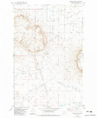
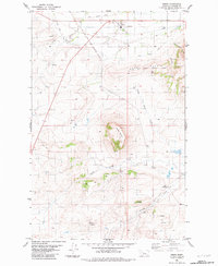
 1983 Mount Cecelia1983 Print · USGSCascade County in the early eighties was a landscape of high buttes and historic mission routes. Trace the path of the St Peter Mission Road as it passes landmarks like Mount Cecelia, China Mountain, and Mission Hill.
 - 1983 Map of Power
 1983 Power1983 Print · USGSPower and the surrounding plains of Teton County are captured here in the early 1980s, showing a landscape defined by tiered benches and rail-side agriculture. Researchers can trace the Burlington Northern line through Power and find the Power Community Cem.
 - 1983 Map of Fair Haven Colony
 1983 Fair Haven Colony1983 Print · USGSThe Cascade County plains come into focus in the early eighties, centered on the Fair Haven Colony. Researchers can trace the Old Fort Shaw Military Reservation Boundary or locate specific landmarks like Square Butte and the Landing Strip.2 unique versions available
 - 1983 Map of Telegraph Mountain
 1983 Telegraph Mountain1983 Print · USGSCascade County ranching and mission life are captured here during the early 1980s. Genealogists and local historians can trace the foundations of the area at St Peter, Sullivan School, and the Cem along the St Peter Mission Road.
 - 1983 Map of Nelson Island
 1983 Nelson Island1983 Print · USGSThe Missouri River flows through Cascade County in the early eighties, shaping a landscape of deep coulees and rail-side settlements. Genealogists and local historians can trace the foundations of this ranching country through the Castner Falls Cem, Travis School, and the winding Burlington Northern line.
 - 1983 Map of Cascade
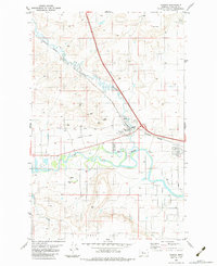
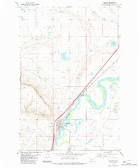 1983 Cascade1983 Print · USGSCascade is shown as a thriving river town in the late 1970s and early 80s, where the Missouri meets the wide valley floor. Researchers can trace the Burlington Northern tracks and find local landmarks like the Rodeo Ground and the Cem.
 - 1984 Map of Choteau
 1984 Choteau1984 Print · USGSThe Teton River country comes to life in this mid-eighties record of the Montana plains and mountains. Trace the footprints of early ranching and farming settlements like Farmington and Eastham Junction, or explore the unique Hutterite settlements at Miller Colony and New Rockport Colony.
 - 1984 Map of Fort Benton
 1984 Fort Benton1984 Print · USGSMid-century Montana life revolves around the river forks and rail lines in the years following the designation of the Wild and Scenic River. You can trace the Burlington Northern lines through Fort Benton, locate the Loma Ferry, and identify high points like Highwood Baldy or Square Butte.
 - 1984 Map of Belt
 1984 Belt1984 Print · USGSCentral Montana's high peaks and ranching benches are captured here in the early 1980s, documenting the region's mining and rail heritage. Genealogists and historians can locate remote mining outposts like Hughesville and Barker, or trace the Burlington Northern Railroad through Belt and Stanford.
 - 1984 Map of White Sulphur Springs
 1984 White Sulphur Springs1984 Print · USGSCentral Montana's mining and ranching corridors come to life in the mid-eighties, highlighting the high-country settlements of the Meagher and Judith Basin counties. Genealogists and historians can trace old mining claims like the Silver Dyke Mine and Broadwater Mines, or locate remote points like Checkerboard and Neihart.
 - 1987 Map of Lowry
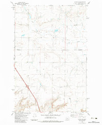
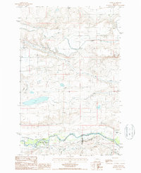 1987 Lowry1987 Print · USGSThe Montana high plains in the late eighties reveal a landscape defined by expansive irrigation projects and cattle ranching. Researchers can trace the path of the Greenfields Main Canal and locate rural landmarks like Lowry and the Hamilton Ranch.
End of results
Showing maps 1-24 of 24
Top cities of Cascade County
- Great Falls historical maps
- Cascade historical maps
- Belt historical maps
- Stockett historical maps
- Neihart historical maps
Frequently asked questions
- What are the different types of historical maps available for Cascade County?
- What is the oldest map of Cascade County?
- Where can I purchase historical maps of Cascade County for my home or office?
- Where can I download high-res historical maps of Cascade County?
- Are there historical topographic maps available for Cascade County?
- Is there historical aerial imagery available for Cascade County?
- Where are historical maps of Cascade County sourced from?