1960s Maps of Custer County, Montana
Explore 59 historic maps of Custer County from the 1960s. These maps offer a rare glimpse into what life looked like during the 1960s — showing old roads, neighborhoods, homes, and landmarks that have changed or disappeared over time.
Whether you're researching your family's past, planning a metal detecting trip, or studying how Custer County's landscape evolved across the 1960s, these high-resolution maps are a powerful tool for exploring the history of this region.
- Focus on a specific era: All maps on this page are from the 1960s, giving you a focused view of this time period.
- See what’s changed: Compare century-old streets, trails, and buildings to today's modern landscape using overlays and satellite layers.
- Research with precision: Use these maps for genealogy, historical research, land use analysis, or educational projects.
- View, download, or print: Maps are fully viewable online in high resolution, and can be downloaded or printed for your own records.
Start exploring Custer County's history through authentic maps from the 1960s. This is your window into the past.
Custer County, MT maps
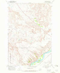
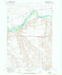
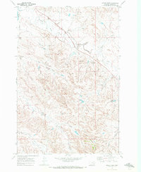
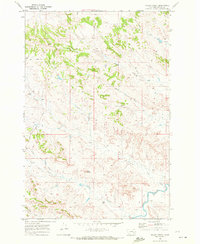
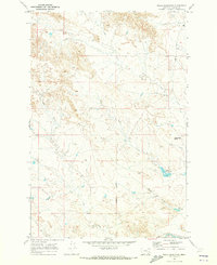
(59)- 1965 Map of Ekalaka
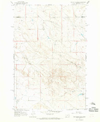
 1965 Ekalaka1965 Print · USGSThe High Plains of Montana and Wyoming appear here in the mid-1950s, as a sprawling landscape of remote ranchlands and rural school districts. Researchers can trace the locations of many small landmarks like Mitchell School, Broadus, and the Humbolt Hills.
 - 1965 Map of Twin Buttes School, 1968 Print
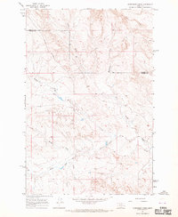
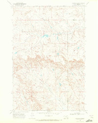
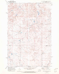
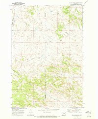
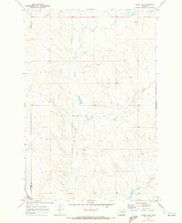
 1965 Twin Buttes School1968 Print · USGSEastern Montana ranching country is captured in the mid-sixties along the Prairie County and Custer County line. Researchers can locate remote landmarks like the Twin Buttes Sch, Hartwick Sch, and the Hamlick Reservoir.
 - 1965 Map of Morehouse Creek, 1969 Print
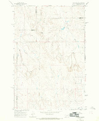
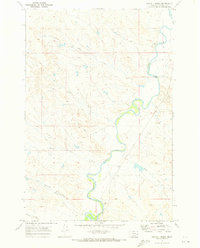
 1965 Morehouse Creek1969 Print · USGSEastern Montana rangeland at the mid-century reveals a territory defined by its watercourses and early ranching infrastructure. Researchers can trace the winding Custer Creek and its tributaries or locate old fence lines and the remote Caprock Road.
 - 1965 Map of Crow Rock SE, 1969 Print
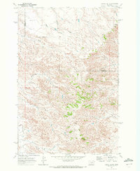
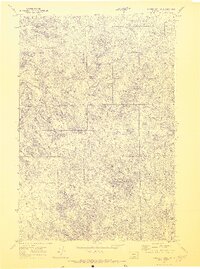
 1965 Crow Rock SE1969 Print · USGSCuster County and the surrounding plains are captured in the mid-1960s, a period when rural schoolhouses and remote survey points still defined the landscape. Researchers can locate the Fairview Sch and trace watercourses like Crow Rock Creek and Wolf Creek.
 - 1968 Map of Hathaway, 1972 Print
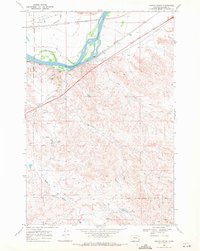
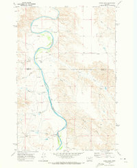
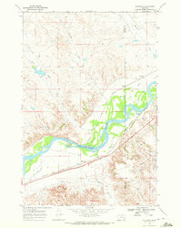 1968 Hathaway1972 Print · USGSEastern Montana's river-driven geography is well-preserved in this survey of the Yellowstone valley during the late sixties. You can trace the historic Lewis and Clark Trail alongside major rail lines and find local landmarks like Hathaway Cem and Sheffield.2 unique versions available
 - 1968 Map of Big Hill, 1972 Print
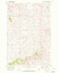
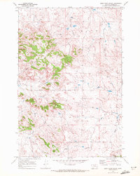
 1968 Big Hill1972 Print · USGSThe ranchlands of Custer County are captured in the late sixties, showing the vital corridor along the Yellowstone River. Trace the historical Old Fort Keogh Military Reservation Boundary and find technical landmarks like the Radio Tower and Miles City Municipal Airport.
 - 1968 Map of Miles City, 1972 Print
 1968 Miles City1972 Print · USGSThe confluence of the Yellowstone and Tongue Rivers defines this eastern Montana hub in the late sixties. Genealogists can trace family names at Calvary Cemetery and Sunset Memorial Gardens (Cem) or locate local landmarks like the Eastern Mont Fairground.2 unique versions available
 - 1968 Map of Lignite Creek, 1972 Print
 1968 Lignite Creek1972 Print · USGSCuster County's river valley and military history intersect in the late sixties as rail lines and historic routes trace the northern plains. Researchers can locate the Old Fort Keogh Military Reservation Boundary or follow the Lewis and Clark Trail past Paragon and Ulmer.2 unique versions available
 - 1968 Map of Butterfly Creek, 1972 Print
 1968 Butterfly Creek1972 Print · USGSEastern Montana cattle country comes into focus in the late 1960s as it straddles the Rosebud and Custer county line. Researchers can trace the winding drainages of South Sunday Creek, Sage Creek, and Butterfly Creek across the open plains.
 - 1968 Map of Paddy Fay Creek, 1972 Print
 1968 Paddy Fay Creek1972 Print · USGSCuster County's high plains meet the meandering river valley in the late sixties. Local historians can trace the Old Fort Keogh Military Reservation Boundary and the path of the Tongue and Yellowstone River Irrigation District Canal through the draws.
 - 1968 Map of Horton, 1972 Print
 1968 Horton1972 Print · USGSCuster County rail and river life are captured here in the late sixties, where the Yellowstone River corridor anchors the local landscape. Genealogists and historians can trace the paths of the Chicago Milwaukee St Paul and Pacific and the Lewis and Clark Trail near Horton and Paragon.2 unique versions available
 - 1968 Map of Hathaway NW, 1972 Print
 1968 Hathaway NW1972 Print · USGSThe high ranchlands of eastern Montana are captured here during the late 1960s, showing the intersection of Rosebud and Custer counties. Genealogists and researchers can trace family landmarks and water sources along Coal Creek, Whitetail Creek, and near Hathaway.
 - 1969 Map of Corral Butte, 1972 Print
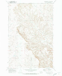
 1969 Corral Butte1972 Print · USGSCuster and Prairie counties in Eastern Montana are shown here as they appeared in the late sixties. Researchers can trace remote landmarks and water sources like Corral Butte, Big Peak, and the intricate path of Schlosser Creek across the high plains.
 - 1969 Map of Jack Creek NW, 1972 Print
 1969 Jack Creek NW1972 Print · USGSCuster County ranching country is captured here during the late sixties, showing a landscape defined by its remote drainage systems and vast open range. Researchers can trace historical fence lines and seasonal water sources like Moon Creek, Thorpe Creek, and Plunket Creek.
 - 1969 Map of Horse Creek, 1972 Print
 1969 Horse Creek1972 Print · USGSCuster County ranching country is captured here in the late sixties, showing a landscape shaped by the Pumpkin Creek drainage. Genealogists and researchers can trace the movement of water and livestock across jeep trails, past Pine Hill Reservoir and the local corral.
 - 1969 Map of Little Whitney Creek, 1972 Print
 1969 Little Whitney Creek1972 Print · USGSThe eastern Montana high plains appear in the late sixties as a landscape of remote ranching and seasonal waterways. Genealogists and local historians can locate the Whitney Creek School and trace landmarks like Long Dam and the Corral along the county line.
 - 1969 Map of Haines Springs, 1972 Print
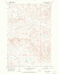
 1969 Haines Springs1972 Print · USGSCuster County ranching land and mineral exploration are captured in this Montana survey from the late sixties. Researchers can trace seasonal water sources like Fessler Springs and identify early industrial markers including an Oil Well and Drill Hole.2 unique versions available
 - 1969 Map of Moon Creek School, 1972 Print
 1969 Moon Creek School1972 Print · USGSIn the Custer County rangelands during the late sixties, this survey captures a remote ranching landscape centered on the Moon Creek Sch. Researchers can trace old livestock infrastructure and rural routes like Graveyard Creek Road and Horton Creek.
 - 1969 Map of Miller Creek, 1972 Print
 1969 Miller Creek1972 Print · USGSCuster County in the late 1960s was a landscape of deep-cut drainages and remote cattle range. Researchers can trace early ranching access via the Jeep Trails connecting Hansen to the landmark Twin Buttes and the winding Tongue River.
 - 1969 Map of Miller Creek SW, 1972 Print
 1969 Miller Creek SW1972 Print · USGSThe Rosebud and Custer county line divides this Montana landscape in the late sixties, showing a world of remote ranching and resource exploration. Trace the drainage of Hay Creek or locate landmarks like Baldy Butte and the Sweeney Creek Road.
 - 1969 Map of Spring Draw, 1973 Print
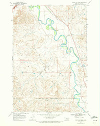
 1969 Spring Draw1973 Print · USGSThe Montana ranching frontier is captured here in the late sixties, where the Powder River divides the landscape of Prairie and Custer counties. Researchers can trace historic water rights and early land use through features like Flowing Wells, Spring Draw, and Corral Creek.
 - 1969 Map of Horse Creek Hill, 1973 Print
 1969 Horse Creek Hill1973 Print · USGSCuster County ranching country is captured here in the late sixties, showing a landscape defined by its vital water sources. Trace old ranching infrastructure through various wells, the path of Deadman Road, and the location of Clevenger Spring.
 - 1969 Map of Noble Reservoir, 1973 Print
 1969 Noble Reservoir1973 Print · USGSCuster County ranching country is shown here in the late sixties, where the high plains meet the Yellowstone drainage. Researchers can trace land use through Noble Reservoir, the heights of Steamboat Butte, and the winding path of Rice Creek.
 - 1969 Map of Angela NE, 1973 Print
 1969 Angela NE1973 Print · USGSCuster and Rosebud counties appear here in the late sixties, showing a landscape defined by ranching and the drainages of the high plains. Researchers can trace family-named sites like Mather Brothers Ranch and remote markers such as Bilges and Deadman Road.
 - 1969 Map of Circle L Creek, 1973 Print
 1969 Circle L Creek1973 Print · USGSCuster County ranching country comes into focus in the late sixties along the winding Tongue River valley. Trace the early road networks and water systems that shaped the landscape, from the Pumping Sta to family-named landmarks like Circle L Creek and Thorpe Creek.
Showing maps 1-25 of 59
Top cities of Custer County
Frequently asked questions
- What are the different types of historical maps available for Custer County?
- What is the oldest map of Custer County?
- Where can I purchase historical maps of Custer County for my home or office?
- Where can I download high-res historical maps of Custer County?
- Are there historical topographic maps available for Custer County?
- Is there historical aerial imagery available for Custer County?
- Where are historical maps of Custer County sourced from?