Old Maps of Meagher County, Montana for Hiking & Exploration
Hike through history with 477 historic maps of Meagher County. Explore old trails, ghost towns, and forgotten backroads — perfect for outdoor adventurers and local explorers.
- Rediscover forgotten places: Map out old mining camps, roads, and footpaths that no longer exist on modern maps.
- Layer with modern tools: Combine with LiDAR or satellite views to plan hikes through historical terrain.
- Made for exploration: Popular among hikers, overlanders, and local history lovers.
Use these maps to find adventure and explore the hidden past of Meagher County.
Meagher County, MT maps
(477)- 1886 Map of Great Falls
 1886 Great Falls1886 Print · USGSCentral Montana in the mid-1880s is defined by its great river systems and the early footprints of frontier outposts. Researchers can trace the early development of Great Falls, find the site of St. Peter's Mission, and locate river settlements like Truly and Fort Shaw.4 unique versions available
 - 1886 Map of Fort Logan
 1886 Fort Logan1886 Print · USGSCentral Montana in the mid-1880s was a landscape of military outposts and early mining camps. Researchers can trace the frontier development of Radersburg and Crow Creek City or locate the historic military presence at Ft Logan.5 unique versions available
 - 1886 Map of Little Belt Mts.
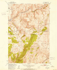
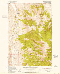
 1886 Little Belt Mts.1886 Print · USGSCentral Montana territory during the mid-1880s is captured here, showing the region's early mining camps and ranching hubs. Researchers can trace the early layouts of White Sulphur Spring and Neihart or locate landmarks like Copperopolis and Crazy Peak.
 - 1890 Map of Fort Benton
 1890 Fort Benton1890 Print · USGSUpper Missouri river country was transforming in the late nineteenth century as rail lines and ranching settlements expanded across the plains. Genealogists and historians can trace early land routes between Fort Benton, Stanford, and the mining district around Clendenin.
 - 1892 Map of Fort Benton
 1892 Fort Benton1892 Print · USGSUpper Missouri River country in the late nineteenth century shows the transition from river commerce to the iron horse. Genealogists and historians can trace early settlements like Stanford and Fort Benton alongside the St Paul Minneapolis and Manitoba Railroad.
 - 1894 Map of Little Belt Mts.
 1894 Little Belt Mts.1894 Print · USGSCentral Montana in the late nineteenth century is a land of emerging mining camps and river valley outposts. Historians can trace the early footprints of White Sulphur Spring, the copper prospects at Copperopolis, and the mountain terrain of Neihart.2 unique versions available
 - 1897 Map of Fort Benton
 1897 Fort Benton1897 Print · USGSUpper Missouri River territory is charted here during its transition from a river-based economy to a rail-and-ranching frontier. Researchers can trace the early layouts of Fort Benton and Stanford, or locate remote sites like Barker Mtn and Riceville.4 unique versions available
 - 1897 Map of Little Belt Mts.
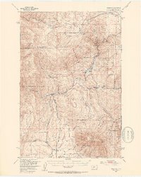
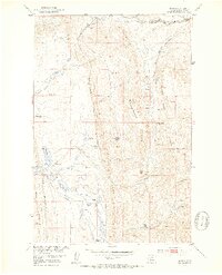
 1897 Little Belt Mts.1897 Print · USGSMeagher County and the central Montana high country are captured here in the 1890s, when mining camps and early ranching outposts were first being established. Researchers can trace the early layout of White Sulphur Springs and locate now-quiet sites like the Sapphire Mine or Copperopolis.
 - 1898 Map of Little Belt Mts.
 1898 Little Belt Mts.1898 Print · USGSCentral Montana in the late nineteenth century is a landscape of mountain mining camps and early ranching outposts. Genealogists and historians can trace the pioneer footprints of White Sulphur Springs, the operations at Sapphire Mine, and the route of Sixteenmile Creek.
 - 1902 Map of Little Belt Mts.
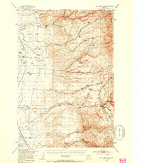
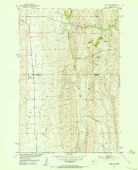
 1902 Little Belt Mts.1902 Print · USGSMeagher County at the close of the nineteenth century is a landscape of mountain mining camps and riverside settlements. Researchers can trace early industry and family roots near the Sapphire Mine, the town of White Sulphur Springs, and the camp at Neihart.3 unique versions available
 - 1948 Map of White Sulphur Springs, 1951 Print
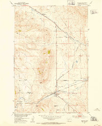
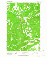
 1948 White Sulphur Springs1951 Print · USGSMontana's capital and the high country of the Big Belt Mountains come alive in this mid-century survey. Trace the early hydroelectric developments at Canyon Ferry Dam or follow the historic rail lines through Ringling and Townsend.
 - 1948 Map of Sixteen, 1953 Print
 1948 Sixteen1953 Print · USGSThe Gallatin County high country is shown here in the late 1940s as a vital corridor for the Milwaukee Road railroad. Genealogists and historians can trace the isolated settlement of Sixteen and the Robertson Ranch nestled among the peaks of Elkhorn Ridge.3 unique versions available
 - 1949 Map of Maudlow, 1954 Print
 1949 Maudlow1954 Print · USGSGallatin County ranching and railroad life are preserved here in the late 1940s as the high peaks meet the rail lines. Genealogists and historians can trace family landmarks like the Morgan Cemetery, Francis School, and the remote settlement of Maudlow.4 unique versions available
 - 1950 Map of Duck Creek Pass, 1953 Print
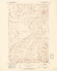
 1950 Duck Creek Pass1953 Print · USGSBroadwater County ranching and mining sites appear in detail during the early postwar era as the landscape shifted. Genealogists can locate family holdings like Merritt Ranch, several Gold Mines, and the Holy Cross Cem near the Missouri River.4 unique versions available
 - 1951 Map of Sixteen NE, 1952 Print
 1951 Sixteen NE1952 Print · USGSThe ranching country of central Montana is captured here just after mid-century as homesteads were consolidating. Genealogists and historians can trace family landmarks and land-use shifts through sites like Campbell Ranch, Heath Ranch, and the Oil Well on Elk Ridge.3 unique versions available
 - 1951 Map of Hamen, 1953 Print
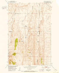
 1951 Hamen1953 Print · USGSMeagher County ranching life and the northern rail corridor are documented here during the early fifties. Genealogists and local historians can locate several family-named landmarks including Tip Top School, Loweth, and the Higgins Ranch.4 unique versions available
 - 1951 Map of Wolf Hill, 1953 Print
 1951 Wolf Hill1953 Print · USGSThe high country of Park and Meagher Counties is captured here in the early fifties, showing a ranching landscape in transition. Genealogists and historians can locate legacy homesteads like Arthur Ranch alongside industrial remnants such as an Oil Well (Abnd) and Coal Mine (Abnd).2 unique versions available
 - 1951 Map of Ringling, 1953 Print
 1951 Ringling1953 Print · USGSMeagher County ranching and rail travel intersect in the early fifties as the Milwaukee Road follows the creek through this Montana landscape. Genealogists can trace family holdings at the Adkison Ranch and Higgins Ranch or locate the Moss Agate stage site.3 unique versions available
 - 1951 Map of Black Butte Mountain, 1953 Print
 1951 Black Butte Mountain1953 Print · USGSMeagher County ranching and resource development are captured here in the early 1950s during the Missouri River Basin project. Genealogists and historians can locate family landmarks like J Stewart Ranch and Prescott Ranch, or trace the vicinity of a Copper Mine near Battle Creek.3 unique versions available
 - 1951 Map of Rimrock Divide, 1953 Print
 1951 Rimrock Divide1953 Print · USGSThe Crazy Mountains in the early fifties reveal a landscape of remote timber claims and high-country ranching. Genealogists can trace family legacies through the Rostad Ranch and abandoned sites like the Hoyem Homestead or Bill Bracket Place.2 unique versions available
 - 1954 Map of Great Falls
 1954 Great Falls1954 Print · USGSThe Missouri River valley in the mid-1950s is shown at a time of significant industrial and military growth. Genealogists and historians can locate early schools and rail stops like Tiger Butte Community Center, Fort Benton, and the Anaconda Wire Plant.4 unique versions available
 - 1957 Map of Great Falls
 1957 Great Falls1957 Print · USGSMontana's central plains and mountain foothills are captured here in the mid-fifties, showing the hub of Great Falls and the surrounding grain-shipping towns. Genealogists can trace family roots through the rail sidings of the Great Northern and small rural communities like Sand Coulee or Fort Benton.
 - 1958 Map of White Sulphur Springs, 1968 Print
 1958 White Sulphur Springs1968 Print · USGSCentral Montana in the late fifties was a landscape of high-country mining and newly formed reservoirs. You can trace the rail-and-river economy of the era through sites like Canyon Ferry Lake, the East Pacific Mine, and the historic Fort Logan.3 unique versions available
 - 1961 Map of White Sulphur Springs
 1961 White Sulphur Springs1961 Print · USGSThe Missouri River valley and central Montana highlands are captured here during a period of significant hydroelectric and rail expansion. Genealogists and rail historians can trace the paths of the Northern Pacific and Chicago Milwaukee St Paul and Pacific through settlements like White Sulphur Springs and Townsend.
 - 1961 Map of Kings Hill, 1964 Print
 1961 Kings Hill1964 Print · USGSThe high passes of Meagher and Cascade counties are captured here in the early 1960s, showing the intersection of three county lines. Trace mountain trails and recreation spots like Kings Hill Campground or landmarks such as Porphyry Peak and Kings Hill Pass.2 unique versions available
Showing maps 1-25 of 477
Top cities of Meagher County
Frequently asked questions
- What are the different types of historical maps available for Meagher County?
- What is the oldest map of Meagher County?
- Where can I purchase historical maps of Meagher County for my home or office?
- Where can I download high-res historical maps of Meagher County?
- Are there historical topographic maps available for Meagher County?
- Is there historical aerial imagery available for Meagher County?
- Where are historical maps of Meagher County sourced from?