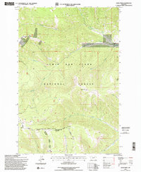
1990s Maps of Meagher County, Montana
Explore 38 historic maps of Meagher County from the 1990s. These maps offer a rare glimpse into what life looked like during the 1990s — showing old roads, neighborhoods, homes, and landmarks that have changed or disappeared over time.
Whether you're researching your family's past, planning a metal detecting trip, or studying how Meagher County's landscape evolved across the 1990s, these high-resolution maps are a powerful tool for exploring the history of this region.
- Focus on a specific era: All maps on this page are from the 1990s, giving you a focused view of this time period.
- See what’s changed: Compare century-old streets, trails, and buildings to today's modern landscape using overlays and satellite layers.
- Research with precision: Use these maps for genealogy, historical research, land use analysis, or educational projects.
- View, download, or print: Maps are fully viewable online in high resolution, and can be downloaded or printed for your own records.
Start exploring Meagher County's history through authentic maps from the 1990s. This is your window into the past.
Meagher County, MT maps
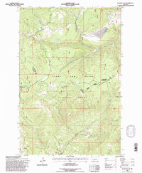
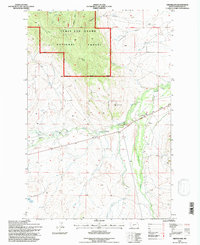
(38)- 1993 Map of Ringling
 1993 Ringling1993 Print · USGSMeagher County in the early nineties remains a landscape of high-altitude ranching and mining history framed by the Crazy Mountains. Researchers can trace the legacy of the silver boom at Castle Town and the Cumberland Mine or locate early rail sidings like Loweth and Bruno.
 - 1995 Map of Kings Hill, 1997 Print
 1995 Kings Hill1997 Print · USGSKings Hill Pass and the surrounding National Forest are captured here in the mid-nineties as a winter recreation destination. Researchers can trace the high-altitude trails around Porphyry Peak Lookout or locate the settlement of Forest Green near Sheep Creek.2 unique versions available
 - 1995 Map of Russian Flat, 1997 Print
 1995 Russian Flat1997 Print · USGSThe Little Belt Mountains in the mid-nineties reveal a landscape of forestry management and legacy mining operations across Meagher and Judith Basin counties. Local researchers can trace the locations of the New Deal Mine, the Hunter Spring Guard Station, and the distinct Elephant Rock.2 unique versions available
 - 1995 Map of White Sulphur Springs, 1997 Print
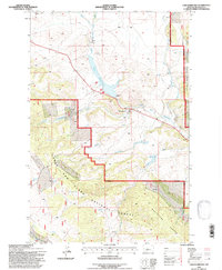
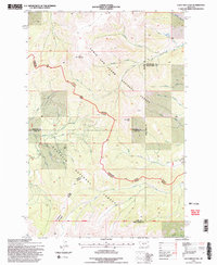
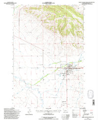 1995 White Sulphur Springs1997 Print · USGSWhite Sulphur Springs is depicted in the mid-1990s as a vital hub of ranching and timber at the foot of the Park Hills. Genealogists and local historians can trace the town's expansion near the Mayn Cemetery and the industrial infrastructure at Mill Siding and Douglas Studs.
 - 1995 Map of Lennep, 1997 Print
 1995 Lennep1997 Print · USGSCentral Montana ranching and forest lands are captured in the mid-1990s as they center on the valley of the South Fork Musselshell River. Researchers can trace the Old Railroad Grade and locate family landmarks like Bonanza Ranch, Voldseth Ranch, and the settlement of Lennep.
 - 1995 Map of Belt Park Butte, 1997 Print
 1995 Belt Park Butte1997 Print · USGSHigh in the Little Belts during the mid-nineties, this survey captures the mining and forest history of the Neihart area. Trace early land use through family-named landmarks like Johannesburg, Neihart Cem, and Rocking Chair Park.
 - 1995 Map of Millegan, 1997 Print
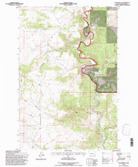
 1995 Millegan1997 Print · USGSThe Smith River canyon country in the mid-1990s reveals a rugged landscape where the Lewis and Clark National Forest meets private ranch lands. Researchers can trace the remote settlement at Millegan, locate the Dick Anderson Cabin, and follow primitive 4WD trails across Millegan Hill.
 - 1995 Map of Sheep Mountain, 1997 Print
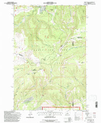
 1995 Sheep Mountain1997 Print · USGSThe high country of Meagher County is captured here in the mid-nineties, showing the interface between the Lewis and Clark National Forest and the surrounding terrain. Researchers can trace the watercourses of Sheep Creek and locate landmarks like Elk Horn Pass or the broad Sheep Creek Bar.
 - 1995 Map of Checkerboard, 1997 Print
 1995 Checkerboard1997 Print · USGSCentral Montana ranching and forest lands are captured in the mid-1990s as the Musselshell River winds through the valley. Trace the hydrology of the region through Bair Reservoir, Checkerboard, and family-named features like Stohr Creek.
 - 1995 Map of Castle Town, 1997 Print
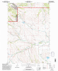
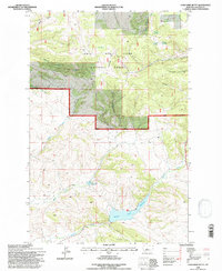
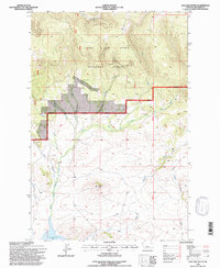
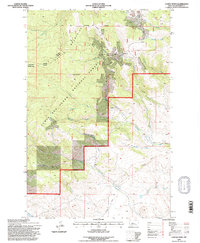 1995 Castle Town1997 Print · USGSThe Castle Mountains mining district is captured here during the mid-nineties, showing the enduring footprint of silver-era industry. Genealogists and historians can trace the foundations of Castle Town and Robinson or locate remote sites like the Cumberland Mine and Castle Cem.2 unique versions available
 - 1995 Map of Monument Peak, 1997 Print
 1995 Monument Peak1997 Print · USGSMeagher County's high wilderness is captured here in the mid-1990s, showcasing the complex drainage of the Lewis and Clark National Forest. Trace remote mountain landmarks and historic mining activity through labels like Monument Peak Lookout, Mount Vesuvius, and several isolated prospects.
 - 1995 Map of Strawberry Butte, 1997 Print
 1995 Strawberry Butte1997 Print · USGSMeagher County's high forest lands are captured here in the mid-1990s, showing a remote landscape of peaks and headwaters. Researchers can locate several Prospects and trace the drainage of Sheep Creek past landmarks like Strawberry Butte and Moose Pass.
 - 1995 Map of Deep Creek Park, 1997 Print
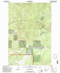
 1995 Deep Creek Park1997 Print · USGSThe Little Belt Mountains of Central Montana are shown here in the mid-1990s during a period of active Forest Service management. Researchers can trace land use via noted prospects and local landmarks like Simmons Park, Kings Hill Butte, and the Figure 8 Loop.
 - 1995 Map of Cinnamon Peak, 1997 Print
 1995 Cinnamon Peak1997 Print · USGSMeagher and Wheatland counties are shown during the mid-nineties as the Forest Service managed the timber and ranching lands of the Highwood and Little Belt range areas. Researchers can find old landmarks like Pump Ranch, the Bear Spring Station, and the peak of Cinnamon Peak.
 - 1995 Map of Moose Mountain, 1997 Print
 1995 Moose Mountain1997 Print · USGSThe high Little Belt Mountains of Meagher County are captured here in the mid-1990s, dominated by the Lewis and Clark National Forest. Trace family-named landmarks and infrastructure like Kings Hill, Holstrom Ditch, and Jumping Creek.
 - 1995 Map of Lingshire NE, 1997 Print
 1995 Lingshire NE1997 Print · USGSMeagher County's high country is captured here in the mid-1990s, where the winding Smith River cuts through the Lewis and Clark National Forest. Researchers can trace the drainage of Tenderfoot Creek and locate remote mining Prospects tucked away near Black Canyon.
 - 1995 Map of Groveland, 1997 Print
 1995 Groveland1997 Print · USGSMeagher County ranchlands and timber meet in the mid-nineties along the river valley near Groveland. Local historians can trace family-named landmarks and historical infrastructure like the 71 Ranch, the Voldseth Reservoir, and the Old Railroad Grade.
 - 1995 Map of Loco Mountain, 1997 Print
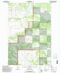
 1995 Loco Mountain1997 Print · USGSThe high peaks of the Lewis and Clark National Forest meet the Gallatin National Forest in the 1990s. Trace the remote headwaters of the Shields River, the climb to Loco Mountain, and the route of the Musselshell Big Timber forest road.2 unique versions available
 - 1995 Map of Daisy Peak, 1997 Print
 1995 Daisy Peak1997 Print · USGSThe high headwaters of the Judith River are captured in the mid-1990s as they flow through the Little Belt Mountains. Researchers can trace old forest management sites like the Daisy Guard Station (Site) and remote landmarks including Mount High and Johnson Park.
 - 1995 Map of Coxcombe Butte, 1997 Print
 1995 Coxcombe Butte1997 Print · USGSMeagher County in the mid-1990s showcases a critical high-country watershed within the Lewis and Clark National Forest. Researchers can trace the water network from Coxcombe Butte down through Buckingham Reservoir and Newlan Creek Reservoir.
 - 1995 Map of Hoover Spring, 1997 Print
 1995 Hoover Spring1997 Print · USGSMeagher County's high-country drainages are captured in the mid-1990s as the wilderness of the Lewis and Clark National Forest remains largely untouched. Trace the headwaters of the South Fork Judith River and identify local landmarks like Brock Ranch and Hoover Spring.2 unique versions available
 - 1995 Map of Bubbling Springs, 1997 Print
 1995 Bubbling Springs1997 Print · USGSThe high meadows and research lands of the Lewis and Clark National Forest are shown here in the mid-1990s. Researchers can locate mineral Prospects, the Tenderfoot Creek Experimental Forest, and named meadows like Iron Mines Park.
 - 1995 Map of Thunder Mountain, 1997 Print
 1995 Thunder Mountain1997 Print · USGSThe high peaks of the Little Belt Mountains are captured here during the mid-nineties, showing the rugged management area of the Kings Hill Ranger District. Researchers can trace old mining interest through numerous prospects and follow backcountry routes like the Circle Trail.
 - 1995 Map of Volcano Butte, 1997 Print
 1995 Volcano Butte1997 Print · USGSMeagher County's high-country terrain is captured here in the mid-1990s, during a period of active forest management and conservation. Researchers can locate remote industrial sites like the Copper State Mine or trace the drainage of the North Fork Smith River near Lake Sutherlin.
 - 1995 Map of Sand Point, 1997 Print
 1995 Sand Point1997 Print · USGSThe high Divide country of central Montana is captured here during the mid-1990s as it transitions between industrial use and forest management. Researchers can trace the drainage patterns of Harrison Creek, locate numerous old Mines, or identify the remote Middle Fork Ranch site.2 unique versions available
Showing maps 1-25 of 38
Top cities of Meagher County
Frequently asked questions
- What are the different types of historical maps available for Meagher County?
- What is the oldest map of Meagher County?
- Where can I purchase historical maps of Meagher County for my home or office?
- Where can I download high-res historical maps of Meagher County?
- Are there historical topographic maps available for Meagher County?
- Is there historical aerial imagery available for Meagher County?
- Where are historical maps of Meagher County sourced from?