1970s Maps of Meagher County, Montana
Explore 41 historic maps of Meagher County from the 1970s. These maps offer a rare glimpse into what life looked like during the 1970s — showing old roads, neighborhoods, homes, and landmarks that have changed or disappeared over time.
Whether you're researching your family's past, planning a metal detecting trip, or studying how Meagher County's landscape evolved across the 1970s, these high-resolution maps are a powerful tool for exploring the history of this region.
- Focus on a specific era: All maps on this page are from the 1970s, giving you a focused view of this time period.
- See what’s changed: Compare century-old streets, trails, and buildings to today's modern landscape using overlays and satellite layers.
- Research with precision: Use these maps for genealogy, historical research, land use analysis, or educational projects.
- View, download, or print: Maps are fully viewable online in high resolution, and can be downloaded or printed for your own records.
Start exploring Meagher County's history through authentic maps from the 1970s. This is your window into the past.
Meagher County, MT maps
(41)- 1971 Map of Battle Mountain, 1974 Print
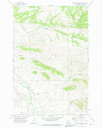
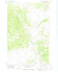
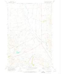
 1971 Battle Mountain1974 Print · USGSMeagher County in the early 1970s shows a landscape of high-mountain recreation and forest management. Hikers and historians can trace the paths through Klondike Pass, the slopes of the Grass Mountain Ski Area, and primitive routes like the Pack Trail near Battle Mountain.
 - 1971 Map of White Sulphur Springs, 1974 Print
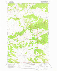
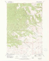
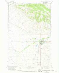 1971 White Sulphur Springs1974 Print · USGSMeagher County's mountain-valley landscape is documented here in the early 1970s, focused on the rail-head and ranching activity of the day. Researchers can trace the path of the White Sulphur Springs and Yellowstone Park Railway or locate landmarks like Douglas Studs and Mayn Cem.
 - 1971 Map of Bald Hills, 1974 Print
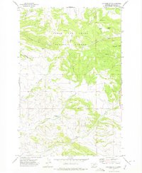
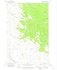
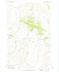
 1971 Bald Hills1974 Print · USGSThe Meagher County wilderness in the early 1970s is revealed here as a landscape of remote ridges and deep gulches. Local historians and hunters can trace high-altitude routes like the Pack Trail past Old Baldy, Zehntner Ranch, and early mining prospects.
 - 1971 Map of Monument Peak, 1974 Print
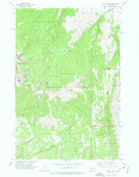
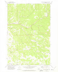
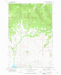
 1971 Monument Peak1974 Print · USGSMeagher County's high country is captured here in the early 1970s, showing a landscape defined by forest service management and rugged peaks. Explore the primitive backcountry via the Pack Trail to find the Lookout Tower on Monument Peak or trace the headwaters of Tenderfoot Creek.
 - 1971 Map of Charcoal Gulch, 1974 Print
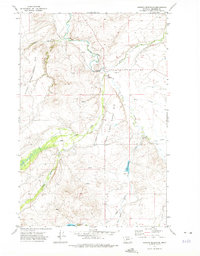
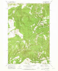
 1971 Charcoal Gulch1974 Print · USGSMeagher County at the dawn of the 1970s reveals a backcountry landscape of forest management and early resource extraction. Researchers can locate the Newlan Creek Guard Station and trace numerous unnamed Prospects and water sources like Charcoal Spring and Crater Lake.
 - 1971 Map of Whitetail Reservoir, 1974 Print
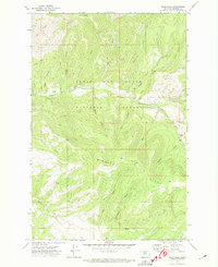
 1971 Whitetail Reservoir1974 Print · USGSMeagher County in the early seventies shows a landscape defined by the upper reaches of the Smith River and high forest ridges. Researchers can trace the hydrology of the Lewis and Clark National Forest and landmarks like Whitetail Reservoir and Mud Spring.
 - 1971 Map of Deep Creek Park, 1974 Print
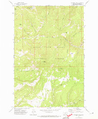
 1971 Deep Creek Park1974 Print · USGSThe high Divide country of Montana is captured here in the early seventies, spanning the border of Cascade and Meagher Counties. Local historians and hikers can trace primitive routes to Simmons Park, Desolation Peak, and the waters of Temple Gulch.
 - 1971 Map of Sheep Mountain, 1974 Print
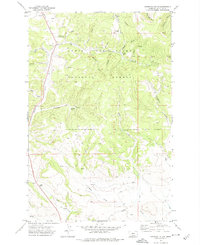
 1971 Sheep Mountain1974 Print · USGSThe high country of Meagher County in the early seventies is meticulously documented in this forest survey. Researchers can trace the path of the Pack Trail or locate family-named landmarks like Sheep Mountain and Rocky Ridge.
 - 1971 Map of Coxcombe Butte, 1975 Print
 1971 Coxcombe Butte1975 Print · USGSThe high country of Meagher County is captured here in the early 1970s, dominated by the timbered slopes of the Lewis and Clark National Forest. Researchers can locate family-named landmarks like Abbott Gulch and Thornquist Gulch or trace the drainage of Newlan Creek.
 - 1971 Map of Mount Edith, 1975 Print
 1971 Mount Edith1975 Print · USGSThe high Big Belt Mountains come into focus in the early 1970s, showing the rugged boundary between Broadwater and Meagher counties. Modern explorers can trace trails to Edith Lake or locate old Prospect sites near Holloway Gulch.3 unique versions available
 - 1971 Map of Devils Footstool, 1975 Print
 1971 Devils Footstool1975 Print · USGSMeagher County in the early 1970s is shown as a rugged intersection of National Forest lands and river-cut valleys. Researchers can trace the winding Smith River past family-named landmarks like Songster Butte and the curious Devils Footstool.
 - 1971 Map of Conway Ridge, 1975 Print
 1971 Conway Ridge1975 Print · USGSThe high range of the Montana-Meagher county line comes into focus in the 1970s, showing a landscape defined by water and altitude. Researchers can trace the drainages of Hound Creek and Coal Creek or locate landmarks like Streeter Hill and Mowing Machine Coulee.
 - 1971 Map of Manger Park, 1975 Print
 1971 Manger Park1975 Print · USGSMeagher County during the early 1970s shows a landscape of high summits and essential rail lines. Trace the route of the White Sulphur Springs and Yellowstone Park Railway or locate remote high-country landmarks like Manger Park and Warm Springs.
 - 1971 Map of Sulphur Bar Creek, 1975 Print
 1971 Sulphur Bar Creek1975 Print · USGSBroadwater County in the early 1970s was a landscape of remote mountain passes and ancient routes within the Helena National Forest. Researchers can trace the path of the Flathead Indian Trail and locate historical landmarks like Munding Flat and Black Butte.
 - 1971 Map of Alkali Lake, 1975 Print
 1971 Alkali Lake1975 Print · USGSMeagher County ranching and forest lands are captured here in the early 1970s. Trace the layout of the Springdale Colony and its nearby Cem, or follow the Jeep Trail as it climbs toward the timber of the Helena National Forest.
 - 1971 Map of Millegan, 1975 Print
 1971 Millegan1975 Print · USGSThe ranching landscape of Cascade County is captured here in the early 1970s, focused on the winding river canyons and high prairies. Trace old access routes along the Smith River and the small settlement at Millegan or explore family landmarks like Simmons Park.
 - 1971 Map of Hanson Reservoir, 1975 Print
 1971 Hanson Reservoir1975 Print · USGSMeagher County ranching country and the winding Smith River corridor are documented here in the early seventies. Researchers can trace land use patterns across Upper Birch Creek Bar, the storage at Hanson Reservoir, and old fence lines.
 - 1971 Map of Gipsy Lake, 1975 Print
 1971 Gipsy Lake1975 Print · USGSMeagher County's high forest country is captured in the early 1970s, showcasing a landscape shaped by remote mining and federal forest management. Researchers can locate specific sites like the Porcupine Mine, the Bigler Mine, and the Thompson Gulch Guard Sta.
 - 1971 Map of Catlin Spring, 1975 Print
 1971 Catlin Spring1975 Print · USGSCentral Montana ranching country and rail corridors are captured in the early 1970s. Trace the path of the White Sulphur Springs and Yellowstone Park Railway and locate water sources like Wertz Reservoir and Catlin Spring.
 - 1971 Map of Blankenbaker Flats, 1975 Print
 1971 Blankenbaker Flats1975 Print · USGSThe high country of the Little Belt Mountains is captured here in the early 1970s, spanning the Cascade and Meagher county line. Researchers can trace old mountain routes like the Pack Trail and locate isolated Prospects near Monument Ridge.
 - 1971 Map of Fort Logan, 1975 Print
 1971 Fort Logan1975 Print · USGSMeagher County's ranching and military heritage is on full display in the early 1970s. Trace the Old Military Reservation Boundary near Fort Logan or locate family history at Kinyon Cem and the various reservoirs.
 - 1972 Map of Volcano Butte, 1975 Print
 1972 Volcano Butte1975 Print · USGSMeagher County during the early 1970s was a landscape of remote timberlands and high-country drainages. Researchers can trace the legacy of resource extraction at the Copper State Mine or follow the Jamison Trail past Volcano Butte.
 - 1972 Map of Daisy Peak, 1975 Print
 1972 Daisy Peak1975 Print · USGSThe high country of the Little Belt Mountains is captured here in the early seventies, spanning the borders of Judith Basin, Meagher, and Wheatland counties. Trace the locations of the Daisy Guard Sta (Site) and explore the route of the Smith Creek Pack Trail through Haymaker Park.
 - 1972 Map of Virginia Peak, 1975 Print
 1972 Virginia Peak1975 Print · USGSThe high divide between Meagher and Park counties is mapped in the early seventies, showing a landscape defined by the Shields River and national forest boundaries. Trace the locations of early outposts like the Bennett Creek Guard Sta and landforms such as Virginia Peak and Target Rock.
 - 1972 Map of Castle Town, 1975 Print
 1972 Castle Town1975 Print · USGSThe Castle Mountains silver district is captured here in the early 1970s, showcasing a landscape shaped by mining and timber. Researchers can trace the Old Railroad Grade and locate old workings like the Cumberland Mines and Castle Town.2 unique versions available
Showing maps 1-25 of 41
Top cities of Meagher County
Frequently asked questions
- What are the different types of historical maps available for Meagher County?
- What is the oldest map of Meagher County?
- Where can I purchase historical maps of Meagher County for my home or office?
- Where can I download high-res historical maps of Meagher County?
- Are there historical topographic maps available for Meagher County?
- Is there historical aerial imagery available for Meagher County?
- Where are historical maps of Meagher County sourced from?