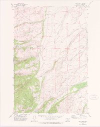
1971 Map of Gipsy Lake
USGS Topo · Published 1975About this map
Helena National Forest dominates the southwestern corner of this topographic survey, where a high-elevation landscape is defined by its mining history and remote drainage systems. The presence of the Thompson Gulch Guard Sta serves as a central point for managing this rugged timberland. Along the steep slopes of Camas Ridge, the industrial heritage of Meagher County is evident through several named workings, including the Porcupine Mine, Snowbank Mine, and Bigler Mine.
Find a feature on this map
26 named features on this map. Tap any name to fly to it.
Don’t see what you’re looking for? This feature index may not catch every label — zoom into the map to look around manually.
Map Details
Editions of this 1971 Gipsy Lake Map
This is the sole edition of this map. No revisions or reprints were ever made.
Other maps of this area

1886 · Fort Logan
USGS Topo · 1:250,000

1948 · White Sulphur Springs
USGS Topo · 1:250,000

1950 · Duck Creek Pass
USGS Topo · 1:62,500

1958 · White Sulphur Springs
USGS Topo · 1:250,000

1961 · White Sulphur Springs
USGS Topo · 1:250,000

1965 · White Sulphur Springs
USGS Topo · 1:250,000

1966 · Boulder Baldy
USGS Topo · 1:24,000

1966 · Watson
USGS Topo · 1:24,000
1971 · Whitetail Reservoir
USGS Topo · 1:24,000
1971 · Mount Edith
USGS Topo · 1:24,000