Old Maps of Perkins County, Nebraska for Genealogy
Trace your family roots with 185 historic maps of Perkins County. These high-res maps reveal old neighborhoods, homesites, landmarks, and streets — helping you uncover where your ancestors lived and how the area evolved over time.
- Explore historic neighborhoods: Identify where your relatives may have lived in the 1800s or 1900s.
- Compare maps over time: Trace the changes in streets, buildings, and landmarks for multi-generational research.
- Perfect for genealogy & ancestry research: Used by family historians and researchers to map out lineage and migration.
These maps are an incredible resource for exploring your personal connection to Perkins County's past.
Perkins County, NE maps
(185)- 1897 Map of Ogallala, 1957 Print
 1897 Ogallala1957 Print · USGSWestern Nebraska at the end of the nineteenth century was a corridor of pioneer transit and emerging ranch life. Genealogists and historians can trace the Old California Trail, the Union Pacific rail line, and numerous family homesteads like Kingsley's Ranch.
 - 1898 Map of Paxton, 1960 Print
 1898 Paxton1960 Print · USGSWestern Nebraska at the end of the nineteenth century reveals a landscape defined by the convergence of the Platte rivers and the arrival of the railroad. Researchers can trace early ranching sites like Duck Brand Ranch and the vital canal network including the Paxton and Hershey Canal.
 - 1900 Map of Chappell
 1900 Chappell1900 Print · USGSWestern Nebraska at the dawn of the new century is captured here as a landscape of early irrigation and historic pioneer trails. Trace the path of the Old California Trail past Ash Hollow or locate ranching outposts like Coombe's Ranch and Libbey's Ranch.3 unique versions available
 - 1900 Map of Ogallala
 1900 Ogallala1900 Print · USGSThe Platte River valley in the late 1890s shows the crucial intersection of the Union Pacific R. R. and the historic Old California Trail. Researchers can trace early irrigation canals and family-owned landmarks like Fairchild's Ranch and California Hill.6 unique versions available
 - 1901 Map of Paxton
 1901 Paxton1901 Print · USGSThe confluence of the Platte Rivers in western Nebraska appears here at a pivotal moment for irrigation and rail expansion. Researchers can trace early water rights through the Sutherland Canal and locate historic livestock operations like Duck Brand Ranch and Knights Ranch.4 unique versions available
 - 1954 Map of Sterling
 1954 Sterling1954 Print · USGSNortheastern Colorado and the Nebraska borderlands are defined by the river-and-rail corridors of the mid-twentieth century. Researchers can trace the development of agricultural hubs from Sterling and Fort Morgan to smaller rail stops along the Union Pacific and Burlington Northern lines.3 unique versions available
 - 1954 Map of Scottsbluff, 1958 Print
 1954 Scottsbluff1958 Print · USGSThe Nebraska Panhandle's iconic landmarks and rail corridors are captured here during the mid-1950s. Researchers can trace the path of the North Platte River past Chimney Rock or locate the sprawling Sioux Ordnance Depot and the historic streets of Sidney.3 unique versions available
 - 1954 Map of McCook, 1966 Print
 1954 McCook1966 Print · USGSSouthwest Nebraska in the mid-fifties reveals a landscape shaped by major water projects and the Chicago Burlington and Quincy RR. Trace ancestral roots and defunct rail stops in McCook, Wauneta, and along the shores of Swanson Lake.2 unique versions available
 - 1954 Map of North Platte, 1968 Print
 1954 North Platte1968 Print · USGSThe Nebraska Sand Hills and the Platte River valley are captured here during a period of mid-century growth and agricultural expansion. Trace the vast irrigation network of the Sutherland Canal, locate old rural schoolhouses like Rose Hill School, and find family holdings such as Conrey Ranch.3 unique versions available
 - 1956 Map of North Platte
 1956 North Platte1956 Print · USGSThe Nebraska Sand Hills meet the high plains river valleys in the mid-1950s, a period of intensive water management and rail commerce. Genealogists and historians can trace early prairie settlements like Stapleton and Tryon, or follow the industrial corridor of the Union Pacific through North Platte.
 - 1957 Map of North Platte
 1957 North Platte1957 Print · USGSThe Nebraska Sand Hills and the Platte River valley are captured here in the mid-fifties as the ranching and irrigation economy matured. Genealogists and historians can locate family-named schoolhouses like Maire School or trace the railroad hubs at North Platte and the Fort McPherson National Cemetery.
 - 1957 Map of McCook
 1957 McCook1957 Print · USGSSouthwestern Nebraska in the mid-fifties is captured here during a period of significant water development and rail-based commerce. Researchers can trace the path of the Chicago Burlington and Quincy through Indianola and Bartley, or locate rural settlements like Chase Village and Ough near the Sand Hills.
 - 1958 Map of McCook
 1958 McCook1958 Print · USGSSouthwest Nebraska during the late fifties reveals a landscape of massive new reservoirs and established rail hubs like McCook. Genealogists can trace family footprints through rural centers like St Johns Church and the many grain elevators along the Union Pacific RR.2 unique versions available
 - 1958 Map of Scottsbluff
 1958 Scottsbluff1958 Print · USGSThe Nebraska panhandle in the late fifties was a vital corridor of rail-and-river transport defined by the North Platte River and the Union Pacific. Genealogists and historians can trace rail stops like Reddus Station, explore the grounds of the Sioux Ordnance Depot, or locate landmarks like Chimney Rock.2 unique versions available
 - 1958 Map of Sterling
 1958 Sterling1958 Print · USGSNortheastern Colorado thrived along the river and rail corridors during the late fifties. Genealogists and historians can trace family-named irrigation works like Davis Brothers Ditch and agricultural hubs from Peetz to Fort Morgan.
 - 1961 Map of Brandon NE, 1963 Print
 1961 Brandon NE1963 Print · USGSPerkins County's high plains terrain is documented in the early sixties, showing the vast grid of rural roads and section lines. Historians can trace the distinct topographic character of Highland and the Eckeryo region across this detailed survey.
 - 1961 Map of Lamar NE, 1963 Print
 1961 Lamar NE1963 Print · USGSWestern Nebraska ranching country and the high plains are detailed here in the early sixties. Researchers can trace land holdings and fence lines between Stephenson and McCoy, or follow the winding course of Spring Creek through Lisbon Valley.
 - 1961 Map of Brandon NW, 1963 Print
 1961 Brandon NW1963 Print · USGSPerkins County at the start of the 1960s reveals a quiet agricultural landscape of the Nebraska high plains. Genealogists and local historians can locate School No 7 and trace the section roads through the expansive Highland terrain.
 - 1961 Map of Big Springs, 1963 Print
 1961 Big Springs1963 Print · USGSSettlement and irrigation define the Nebraska-Colorado borderlands in the early sixties, centered on the South Platte River. Researchers can trace the Union Pacific rail corridor and find local landmarks like the Big Springs Cem and Cottonwood Corner Sch.2 unique versions available
 - 1961 Map of Brandon SE, 1963 Print
 1961 Brandon SE1963 Print · USGSPerkins County at the start of the sixties was a landscape of precision section lines and rail transit. Trace the path of the Chicago Burlington and Quincy railroad and find local markers like School No 50 and the Gravel Pit.2 unique versions available
 - 1961 Map of Brule, 1963 Print
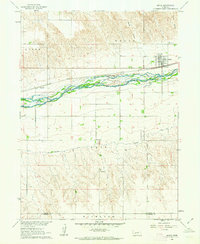 1961 Brule1963 Print · USGSBrule and the surrounding Keith County plains are captured here in the early 1960s as a vital corridor for rail and irrigation. Genealogists and local historians can trace family-named sites like Megeath and School No 61 alongside the winding South Platte River.
 - 1961 Map of Lamar NW, 1963 Print
 1961 Lamar NW1963 Print · USGSThe high plains along the Perkins and Chase County line are captured here in the early sixties, showing a landscape defined by organized agricultural tracts. Genealogists and historians can locate Greenfield Ch and the distinct boundaries of Grace and Macedonia.2 unique versions available
 - 1961 Map of Brandon, 1963 Print
 1961 Brandon1963 Print · USGSThe rural plains of Perkins County come into focus in the early sixties, centered on the railroad town of Brandon. Researchers can trace the legacy of early prairie education at School No 84 and School No 61 or follow the heavy rail traffic of the Chicago Burlington and Quincy.2 unique versions available
 - 1961 Map of Brule SE, 1963 Print
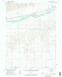 1961 Brule SE1963 Print · USGSIn the early 1960s, the Nebraska plains near the South Platte River remained a landscape of rural schoolhouses and rail-side industry. Genealogists and researchers can trace the locations of School No 9, Searle Airport, and the Union Pacific line.2 unique versions available
 - 1962 Map of Venango NE, 1963 Print
 1962 Venango NE1963 Print · USGSThe high plains of the Colorado and Nebraska border are captured here in the early sixties, showing the rural section grid of Sedgwick and Perkins counties. Local historians can locate the East Plainview Sch and early industrial sites like several Gravel Pits.
Showing maps 1-25 of 185
Top cities of Perkins County
Frequently asked questions
- What are the different types of historical maps available for Perkins County?
- What is the oldest map of Perkins County?
- Where can I purchase historical maps of Perkins County for my home or office?
- Where can I download high-res historical maps of Perkins County?
- Are there historical topographic maps available for Perkins County?
- Is there historical aerial imagery available for Perkins County?
- Where are historical maps of Perkins County sourced from?