
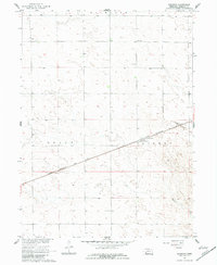
1961 Map of Brandon
USGS Topo · Published 1963About this map
Brandon serves as the central hub of this Perkins County landscape, situated along the vital corridor of the Chicago Burlington and Quincy railroad. This early 1960s survey illustrates a region defined by expansive agricultural sections and a network of unimproved roads that connected the rural population to essential local services. Education in the district was anchored by dispersed landmarks like School No 84 in the northern reaches and School No 61 to the south. The physical terrain is marked by intermittent drainage patterns leading toward Spring Creek, while localized industrial activity is evidenced by several Sandpits and a smaller Sandpit located near the rail line. The division between the townships of Grace and Lisbon bisects the area, highlighting the formal surveyor's grid that organized Nebraska's plains into the 20th century.
Find a feature on this map
9 named features on this map. Tap any name to fly to it.
Don’t see what you’re looking for? This feature index may not catch every label — zoom into the map to look around manually.
Map Details
Editions of this 1961 Brandon Map
2 editions found
Other maps of this area

1954 · Sterling
USGS Topo · 1:250,000

1954 · McCook
USGS Topo · 1:250,000

1957 · McCook
USGS Topo · 1:250,000

1958 · McCook
USGS Topo · 1:250,000

1958 · Sterling
USGS Topo · 1:250,000

1961 · Brandon NE
USGS Topo · 1:24,000

1961 · Lamar NE
USGS Topo · 1:24,000

1961 · Brandon NW
USGS Topo · 1:24,000

1961 · Brandon SE
USGS Topo · 1:24,000

1961 · Lamar NW
USGS Topo · 1:24,000