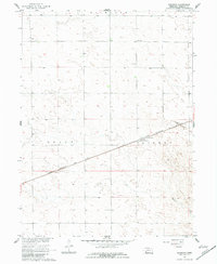
1961 Map of Brandon
USGS Topo · Published 1983About this map
Brandon occupies a central role in this Perkins County landscape, serving as a primary point along the Chicago Burlington and Quincy railroad. The geography is defined by a series of surveyed sections and townships, marked by historical boundaries such as Grace and Lisbon. The terrain shows a pattern of early 1960s rural infrastructure, where local education was centered at School No 84 and School No 61, reflecting the organized settlement of the Nebraska plains.
Find a feature on this map
9 named features on this map. Tap any name to fly to it.
Don’t see what you’re looking for? This feature index may not catch every label — zoom into the map to look around manually.
Map Details
Editions of this 1961 Brandon Map
2 editions found

Other maps of this area

1954 · Sterling
USGS Topo · 1:250,000

1954 · McCook
USGS Topo · 1:250,000

1957 · McCook
USGS Topo · 1:250,000

1958 · McCook
USGS Topo · 1:250,000

1958 · Sterling
USGS Topo · 1:250,000

1961 · Brandon NE
USGS Topo · 1:24,000

1961 · Lamar NE
USGS Topo · 1:24,000

1961 · Brandon NW
USGS Topo · 1:24,000

1961 · Brandon SE
USGS Topo · 1:24,000

1961 · Lamar NW
USGS Topo · 1:24,000