1950s Maps of Humboldt County, Nevada
Explore 20 historic maps of Humboldt County from the 1950s. These maps offer a rare glimpse into what life looked like during the 1950s — showing old roads, neighborhoods, homes, and landmarks that have changed or disappeared over time.
Whether you're researching your family's past, planning a metal detecting trip, or studying how Humboldt County's landscape evolved across the 1950s, these high-resolution maps are a powerful tool for exploring the history of this region.
- Focus on a specific era: All maps on this page are from the 1950s, giving you a focused view of this time period.
- See what’s changed: Compare century-old streets, trails, and buildings to today's modern landscape using overlays and satellite layers.
- Research with precision: Use these maps for genealogy, historical research, land use analysis, or educational projects.
- View, download, or print: Maps are fully viewable online in high resolution, and can be downloaded or printed for your own records.
Start exploring Humboldt County's history through authentic maps from the 1950s. This is your window into the past.
Humboldt County, NV maps
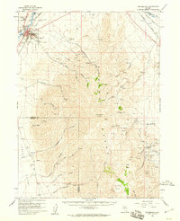
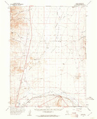
(20)- 1954 Map of Vya, 1967 Print
 1954 Vya1967 Print · USGSThe tri-state corner of Nevada, Oregon, and California appears here in the mid-fifties, dominated by wildlife refuges and massive naval gunnery ranges. Trace isolated high-desert outposts like Vya and Soldier Meadow Ranch or find historic workings at the Ashdown Mine.3 unique versions available
 - 1955 Map of McDermitt
 1955 McDermitt1955 Print · USGSNorthern Nevada in the mid-fifties shows a landscape of mining camps and vast cattle ranges. Trace the early footprints of Tuscarora or the remote Cordero Mine and National Mine tucked into the high desert peaks.3 unique versions available
 - 1955 Map of Jordan Valley, 1963 Print
 1955 Jordan Valley1963 Print · USGSThe high desert of Malheur County comes alive in the mid-1950s, showing the isolated ranching outposts and deep canyons along the Idaho border. Researchers can trace the remote reaches of the Owyhee River, the cattle town of Jordan Valley, and mining landmarks like War Eagle Mountain.3 unique versions available
 - 1955 Map of Lovelock, 1963 Print
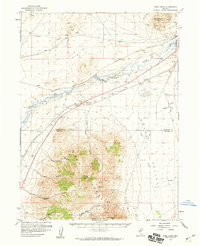
 1955 Lovelock1963 Print · USGSNorthwestern Nevada’s vast desert basins and military ranges are captured here in the mid-fifties, showing a landscape defined by the Humboldt River and the great Pyramid Lake. Genealogists and historians can trace isolated rail stops like Gerlach and Empire, or locate historic workings such as the Golden Eagle Mine and Pershing Mine.5 unique versions available
 - 1955 Map of Winnemucca, 1968 Print
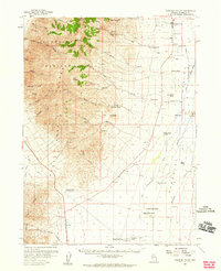
 1955 Winnemucca1968 Print · USGSNorthern Nevada's high desert corridor is captured here in the mid-fifties, centered on the river-and-rail hub of Winnemucca. Researchers can trace the dual tracks of the Southern Pacific and Western Pacific railroads through towns like Golconda and Valmy.3 unique versions available
 - 1957 Map of Jordan Valley
 1957 Jordan Valley1957 Print · USGSThe high-desert borderlands of Oregon and Idaho appear in the mid-fifties as a world of remote cattle ranches and mining claims. Researchers can trace historic family-named locations like Bowden Ranch and Riddle alongside the South Mountain Mining Company.
 - 1958 Map of Winnemucca
 1958 Winnemucca1958 Print · USGSNorthern Nevada in the late fifties was defined by the parallel rhythms of the great transcontinental railroads and a resilient mining industry. Genealogists and historians can trace old mining camps and remote rail sidings from Gold Acres and Palisade to the Adelaide district.2 unique versions available
 - 1958 Map of Vya
 1958 Vya1958 Print · USGSNorthwest Nevada and the tri-state border region are mapped here during the mid-fifties, showing a remote landscape of high desert ranches and sprawling antelope range. Trace historic operations like the Ashdown Mine, find local camps like Coyote Camp, and locate isolated outposts from Vya to Denio.2 unique versions available
 - 1958 Map of Jordan Valley
 1958 Jordan Valley1958 Print · USGSSoutheast Oregon and Southwest Idaho are documented here during the mid-fifties, showing a landscape of remote cattle ranches and volcanic badlands. Genealogists and historians can trace family operations like the Bowden Ranch or locate the Pleasant Valley School and the South Mountain Mining Company.2 unique versions available
 - 1958 Map of Winnemucca, 1960 Print
 1958 Winnemucca1960 Print · USGSWinnemucca and the high peaks of the Sonoma Range are captured here in the late fifties, during a period of steady growth for this railroad crossroads. Researchers can trace the dual tracks of the Southern Pacific and Western Pacific or locate historic mining sites like Adelaide and the Harmony Mine.3 unique versions available
 - 1958 Map of Rose Creek, 1960 Print
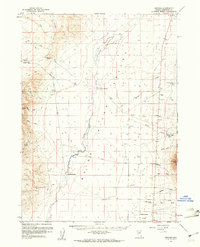
 1958 Rose Creek1960 Print · USGSThe Humboldt River corridor and the Sonoma Range meet here during the late 1950s, a period defined by rail traffic and high-desert mining. Researchers can trace the dual lines of the Southern Pacific and Western Pacific, find the Auburn Mine, and locate the old settlement of Rose Creek.2 unique versions available
 - 1958 Map of Paradise Valley, 1960 Print
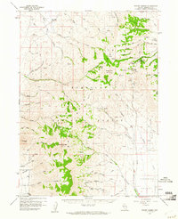
 1958 Paradise Valley1960 Print · USGSRanching and high-desert peaks define the Nevada landscape in the late fifties, where the high Humboldt National Forest meets the valley floor. Genealogists and historians can trace family properties like Grayson Ranch or locate historical transit markers including Willow Point and Paradise Well.2 unique versions available
 - 1958 Map of Awakening Peak, 1960 Print
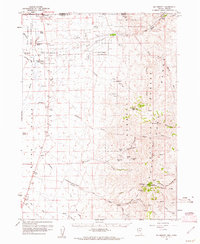
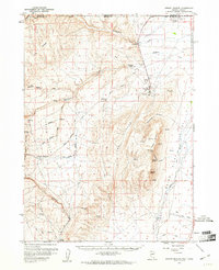
 1958 Awakening Peak1960 Print · USGSHumboldt County’s high desert mining history is preserved here during the late fifties, from the Slumbering Hills to the Silver State Valley. Researchers can trace the heritage of the Awakening Mining District through claims like the Jumbo Mine and the historic Amos (Old Stage Station).2 unique versions available
 - 1959 Map of Lovelock
 1959 Lovelock1959 Print · USGSNorthwestern Nevada in the late fifties is a study in vast desert basins and isolated rail outposts like Gerlach and Sulphur. You can trace the Humboldt River corridor through Lovelock, identify mid-century military zones, and locate the Mine Mill in the northern ranges.2 unique versions available
 - 1959 Map of McDermitt
 1959 McDermitt1959 Print · USGSThe high-desert borderlands of northern Nevada and southern Oregon are captured here in the late fifties. Researchers can trace historic mining operations at the Cordero Mine and Getchell Mine, or locate settlements like Paradise Valley and Tuscarora.2 unique versions available
 - 1959 Map of Bliss, 1960 Print
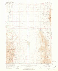
 1959 Bliss1960 Print · USGSHumboldt County ranching and rail transport are captured in the late fifties as the high desert landscape transitions from stagecoach history to modern infrastructure. Researchers can locate the Tollhouse (Old Stage Sta), the Basque Mine, and remote outposts like Eden Valley.2 unique versions available
 - 1959 Map of Orovada, 1961 Print
 1959 Orovada1961 Print · USGSHigh desert ranching life in the late fifties centered on the small hub of Orovada and the vital waters of the Quinn River. Genealogists and historians can trace the foundations of local agriculture through named homesteads like Rebel Creek Ranch and Buffalo Ranch.2 unique versions available
 - 1959 Map of McDermitt, 1961 Print
 1959 McDermitt1961 Print · USGSThe Nevada-Oregon borderlands come alive in this mid-century survey of the Quinn River valley. Genealogists and researchers can trace family ranching history at the Hoppin Ranch or Minor Ranch and locate remote mining sites like the National Mine and Cordero Mine.3 unique versions available
 - 1959 Map of Hinkey Summit, 1961 Print
 1959 Hinkey Summit1961 Print · USGSHumboldt County ranching and forestry are captured in the late fifties as the Santa Rosa Range was managed for mining and water. Researchers can trace land use at the Flat Creek Ranch, the Solid Silver Mine, and the Martin Creek Ranger Station.3 unique versions available
 - 1959 Map of Jordan Meadow, 1961 Print
 1959 Jordan Meadow1961 Print · USGSThe high desert along the Nevada-Oregon border comes alive in this late 1950s survey, showing the vital connection between water and settlement. Researchers can trace the industrial footprint of the Cordero Mine or locate the historic Ft Mc Dermitt Indian Res and Lucky Seven Ranch.2 unique versions available
End of results
Showing maps 1-20 of 20
Top cities of Humboldt County
- Winnemucca historical maps
- Grass Valley historical maps
- Fort McDermitt historical maps
- Golconda historical maps
- Paradise Valley historical maps
- Orovada historical maps
See more
Frequently asked questions
- What are the different types of historical maps available for Humboldt County?
- What is the oldest map of Humboldt County?
- Where can I purchase historical maps of Humboldt County for my home or office?
- Where can I download high-res historical maps of Humboldt County?
- Are there historical topographic maps available for Humboldt County?
- Is there historical aerial imagery available for Humboldt County?
- Where are historical maps of Humboldt County sourced from?