1970s Maps of Humboldt County, Nevada
Explore 23 historic maps of Humboldt County from the 1970s. These maps offer a rare glimpse into what life looked like during the 1970s — showing old roads, neighborhoods, homes, and landmarks that have changed or disappeared over time.
Whether you're researching your family's past, planning a metal detecting trip, or studying how Humboldt County's landscape evolved across the 1970s, these high-resolution maps are a powerful tool for exploring the history of this region.
- Focus on a specific era: All maps on this page are from the 1970s, giving you a focused view of this time period.
- See what’s changed: Compare century-old streets, trails, and buildings to today's modern landscape using overlays and satellite layers.
- Research with precision: Use these maps for genealogy, historical research, land use analysis, or educational projects.
- View, download, or print: Maps are fully viewable online in high resolution, and can be downloaded or printed for your own records.
Start exploring Humboldt County's history through authentic maps from the 1970s. This is your window into the past.
Humboldt County, NV maps
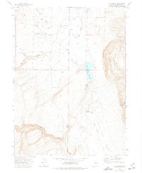
(23)- 1971 Map of Jungo, 1975 Print
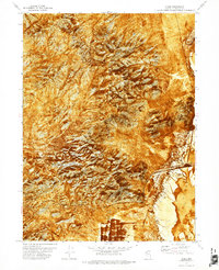 1971 Jungo1975 Print · USGSThe remote railroad siding at Jungo is captured during the early 1970s, nestled between the Antelope Range and the vast Alkali Flats. Genealogists and desert explorers can trace the Western Pacific line and locate isolated Prospects or the essential Water Tank.
 - 1971 Map of Jungo NE, 1977 Print
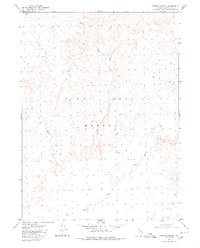
 1971 Jungo NE1977 Print · USGSThe Humboldt County desert at the start of the 1970s reveals a vast, unpopulated landscape defined by salt crusts and iron rails. Trace the path of the Western Pacific railroad as it skirts the Alkali Flats and the expansive Desert Flat.
 - 1971 Map of Alpha Mountain, 1977 Print
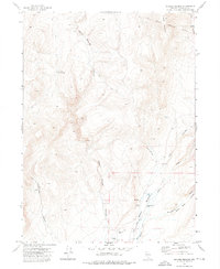
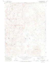
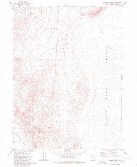
 1971 Alpha Mountain1977 Print · USGSThe high desert of Pershing County is captured during the early 1970s, revealing a landscape defined by mineral exploration and isolated range lands. Researchers can trace the paths of a Jeep Trail past mining Prospects on Alpha Mountain and a lone Corral.
 - 1971 Map of Long Canyon, 1977 Print
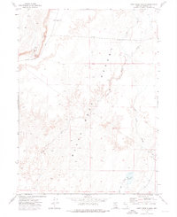
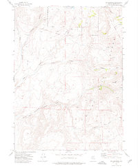
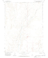
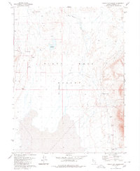
 1971 Long Canyon1977 Print · USGSThe eastern edges of the Antelope Range meet the Desert Valley in the early 1970s, revealing a landscape shaped by remote mining and high-desert terrain. Genealogists and researchers can trace access along numerous jeep trails to reach the Haystack Mine, localized prospects, and Box Canyon Spring No 2.
 - 1972 Map of Mud Meadow, 1976 Print
 1972 Mud Meadow1976 Print · USGSHumboldt County at the start of the seventies reveals a remote desert landscape defined by geothermal springs and water management. Trace the geography of the Black Rock Desert near Mud Meadow Reservoir and locate the Mine tucked in Copper Canyon.2 unique versions available
 - 1972 Map of Deer Creek Slough, 1976 Print
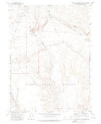
 1972 Deer Creek Slough1976 Print · USGSHumboldt County ranching and desert hydrology come into focus during the early 1970s. Researchers can trace land use through local landmarks like Deer Creek Ranch, the Quinn River, and water sources at Leonard Creek Well.
 - 1972 Map of Pinto Mountain, 1976 Print
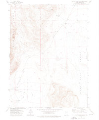
 1972 Pinto Mountain1976 Print · USGSHigh-desert terrain in early 1970s Nevada shows a remote landscape defined by the Black Rock Desert. Trace geothermal features like Pinto Hot Springs or follow the route of Leonard Creek Road.
 - 1972 Map of Hobo Canyon, 1976 Print
 1972 Hobo Canyon1976 Print · USGSHumboldt County in the early seventies shows the dramatic meeting of the alkali desert and the high Nevada peaks. Researchers can trace land use through the Jackson Creek Ranch, the Harrison Grove Mine, and many family-named landmarks like Mike O'Brian Canyon.
 - 1972 Map of Soldier Meadow, 1976 Print
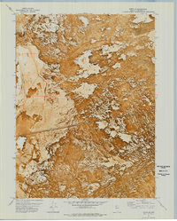
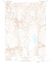
 1972 Soldier Meadow1976 Print · USGSHumboldt County, Nevada, in the early 1970s reveals a remote landscape of thermal springs and historic ranching outposts. Trace the cattle and military history of the region through the Soldier Meadow Ranch, the Historical Marker, and the Old Military Reservation Boundary.2 unique versions available
 - 1972 Map of High Rock Lake, 1976 Print
 1972 High Rock Lake1976 Print · USGSNorthwestern Nevada in the early 1970s is a landscape of desert canyons and vital springs along the Washoe and Humboldt county line. Researchers can trace remote campsites and geologic landmarks like Mahogany Creek Canyon Camp, The Potholes, and High Rock Lake.2 unique versions available
 - 1972 Map of Burnt Springs, 1976 Print
 1972 Burnt Springs1976 Print · USGSThe Humboldt County high desert in the early seventies remains a landscape of isolated cabins and frontier trails. Trace the path of the Old Military Road or locate remote landmarks like Basin Cabin and the secluded Burnt Springs.
 - 1972 Map of Big Mountain, 1976 Print
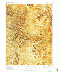
 1972 Big Mountain1976 Print · USGSHumboldt County was a landscape of remote ranching and mining prospects in the early seventies. Trace the vital water network through Mustang Springs and Bawling Calf Reservoir, or locate early mining sites like the Prospect in the Black Rock Range.
 - 1972 Map of Red Mountain, 1976 Print
 1972 Red Mountain1976 Print · USGSNorthern Nevada's high-desert ranching and reservation lands are captured here in the early 1970s. Researchers can trace historic pioneer routes like the Old Tollhouse Military Trail and find landmarks such as Summit Lake and the Black Range.
 - 1972 Map of Yellow Hills East, 1976 Print
 1972 Yellow Hills East1976 Print · USGSNorthern Nevada high-desert terrain is captured here in the early 1970s, straddling the Washoe and Humboldt county lines. Trace remote routes like the Jeep Trail past landmarks such as Black Buttes and reliable water at Mustang Spring.
 - 1972 Map of Leonard Cr. Slough North, 1976 Print
 1972 Leonard Cr. Slough North1976 Print · USGSHumboldt County in the early 1970s reveals a vast desert landscape where water and terrain dictate life. Trace family-named landmarks and essential water sources like Montero Reservoir, the Nera Well, and the seasonal Bartlett Creek.2 unique versions available
 - 1972 Map of Battle Creek Ranch, 1976 Print
 1972 Battle Creek Ranch1976 Print · USGSThe Black Rock Desert edge in the early 1970s was a landscape of remote ranches and remnant mining prospects. You can trace the footprint of Varyville, locate the Clarkfield Ranch, and find isolated Graves near Bartlett Creek.2 unique versions available
 - 1972 Map of Leonard Cr. Slough South, 1977 Print
 1972 Leonard Cr. Slough South1977 Print · USGSNorthern Nevada in the early seventies reveals a landscape dominated by the arid expanse of the High Desert. Hydrologists and local historians can trace the meandering path of the Quinn River as it interacts with the Leonard Creek Slough and Jackson Creek Slough.
 - 1972 Map of Paiute Meadows, 1977 Print
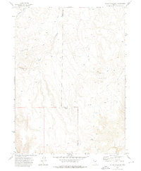
 1972 Paiute Meadows1977 Print · USGSHumboldt County ranching life in the early 1970s is centered around the vital water sources of the high desert basin. Researchers can trace the remote Paiute Meadows Ranch and find named landmarks like Elephant Mtn and Johnstone Springs.
 - 1975 Map of Winnemucca NW, 1980 Print
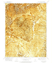
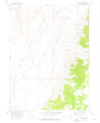
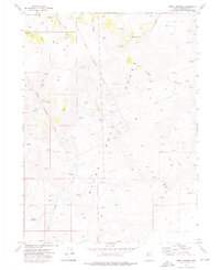
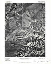 1975 Winnemucca NW1980 Print · USGSThe high desert landscape of Winnemucca during the mid-1970s comes to life in this aerial orthophotoquad. Researchers can examine the town's expansion toward the Sonoma Range and trace geographic landmarks like Water Canyon and Thomas Creek.
 - 1979 Map of Denio
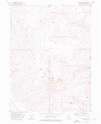
 1979 Denio1979 Print · USGSThe Nevada-Oregon borderlands in the late seventies are characterized by isolated mining camps and expansive wildlife refuges. Researchers can trace remote mineral sites like the Ashdown Mine and Moonlight Mine or locate desert water sources such as Bog Hot Spring.4 unique versions available
 - 1979 Map of Double Hot Springs, 1980 Print
 1979 Double Hot Springs1980 Print · USGSThe northern reaches of the Black Rock Desert are captured here in the late seventies, a landscape shaped by geothermal activity. Local historians can trace the sites of Hardin City and Wheeler Ranch alongside thermal features like Double Hot Springs.2 unique versions available
 - 1979 Map of Pidgeon Spring, 1980 Print
 1979 Pidgeon Spring1980 Print · USGSHumboldt County’s high-desert landscape is captured here in the late seventies, showing where the mountains meet the basin. Researchers can trace the path of the Jeep Trail and locate water sources like Pidgeon Spring and Indian Creek.
 - 1979 Map of Crowbar Spring, 1980 Print
 1979 Crowbar Spring1980 Print · USGSThe northern reaches of the Black Rock Desert are captured here in the late seventies, showing a landscape defined by seasonal hydrology. Geologists and researchers can trace the winding path of the Quinn River and locate vital water sources like Crowbar Spring.2 unique versions available
End of results
Showing maps 1-23 of 23
Top cities of Humboldt County
- Winnemucca historical maps
- Grass Valley historical maps
- Fort McDermitt historical maps
- Golconda historical maps
- Paradise Valley historical maps
- Orovada historical maps
See more
Frequently asked questions
- What are the different types of historical maps available for Humboldt County?
- What is the oldest map of Humboldt County?
- Where can I purchase historical maps of Humboldt County for my home or office?
- Where can I download high-res historical maps of Humboldt County?
- Are there historical topographic maps available for Humboldt County?
- Is there historical aerial imagery available for Humboldt County?
- Where are historical maps of Humboldt County sourced from?