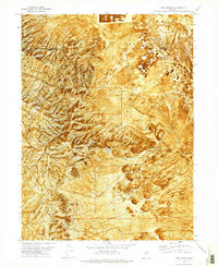
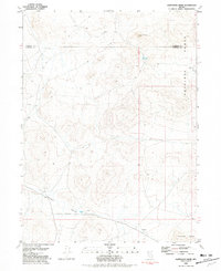
1971 Map of Long Canyon
USGS Topo · Published 1977About this map
Desert Valley dominates the northeastern landscape of this orthophotomap, where the terrain transitions into the stark expanses of Jungo Flat and Alkali Flats. This 1971 field-checked survey reveals a landscape defined by resource extraction and high-desert hydrology. The eastern slopes of the Antelope Range are marked by several mining operations, most notably the Haystack Mine and various prospects and borrow pits that follow the mountain contours. The mapping of Box Canyon Spring No 2 suggests the importance of localized water sources in this arid environment, while a network of jeep trails provides the only access through the winding Long Canyon and across the Humboldt and Pershing County line. The orthophoto base provides a rare, photographic view of the alluvial fans and drainage patterns that are often lost in traditional line-drawn topographic maps.
Find a feature on this map
15 named features on this map. Tap any name to fly to it.
Don’t see what you’re looking for? This feature index may not catch every label — zoom into the map to look around manually.
Map Details
Editions of this 1971 Long Canyon Map
This is the sole edition of this map. No revisions or reprints were ever made.
Other maps of this area

1931 · Lovelock
USGS Topo · 1:250,000

1935 · Lovelock
USGS Topo · 1:250,000

1955 · Lovelock
USGS Topo · 1:250,000

1959 · Lovelock
USGS Topo · 1:250,000

1971 · Majuba Mtn
USGS Topo · 1:24,000

1971 · Rye Patch Reservoir North
USGS Topo · 1:24,000
1971 · Jungo
USGS Topo · 1:24,000
1971 · Jungo NE
USGS Topo · 1:24,000
1971 · Alpha Mountain
USGS Topo · 1:24,000
1981 · Sawtooth Knob
USGS Topo · 1:24,000