1960s Maps of Pershing County, Nevada
Explore 22 historic maps of Pershing County from the 1960s. These maps offer a rare glimpse into what life looked like during the 1960s — showing old roads, neighborhoods, homes, and landmarks that have changed or disappeared over time.
Whether you're researching your family's past, planning a metal detecting trip, or studying how Pershing County's landscape evolved across the 1960s, these high-resolution maps are a powerful tool for exploring the history of this region.
- Focus on a specific era: All maps on this page are from the 1960s, giving you a focused view of this time period.
- See what’s changed: Compare century-old streets, trails, and buildings to today's modern landscape using overlays and satellite layers.
- Research with precision: Use these maps for genealogy, historical research, land use analysis, or educational projects.
- View, download, or print: Maps are fully viewable online in high resolution, and can be downloaded or printed for your own records.
Start exploring Pershing County's history through authentic maps from the 1960s. This is your window into the past.
Pershing County, NV maps
(22)- 1960 Map of Reno
 1960 Reno1960 Print · USGSThe high desert of western Nevada comes alive in this mid-century survey of the Reno-Tahoe region. Genealogists and historians can trace rail lines like the Southern Pacific RR and locate remote outposts such as Olinghouse, Nixon, and the Olinghouse Mine.2 unique versions available
 - 1961 Map of Kyle Hot Springs, 1963 Print
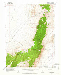
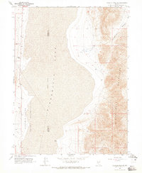
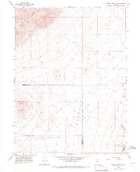
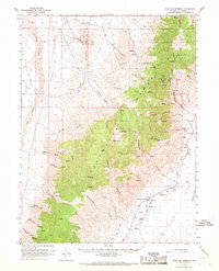
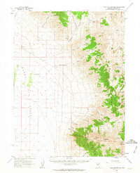 1961 Kyle Hot Springs1963 Print · USGSPershing County in the early sixties reveals a landscape of high-desert ranching and mining at the foot of the East Range. Researchers can trace the water sources and trails vital to the region, from Kyle Hot Springs and Sheppard Well to the high Star Point Mine.2 unique versions available
 - 1961 Map of Mt. Tobin, 1963 Print
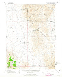
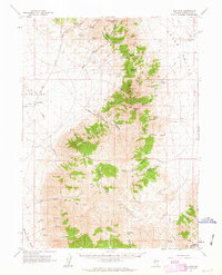
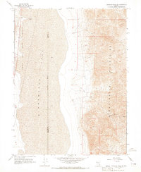
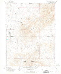
 1961 Mt. Tobin1963 Print · USGSPershing County's high-desert mining and ranching life is preserved here during the early sixties. Genealogists and historians can trace the former townsites of Goldbanks and Kennedy, alongside rural landmarks like Pearce Sch and the Eureka Mine.2 unique versions available
 - 1961 Map of Cain Mountain, 1963 Print
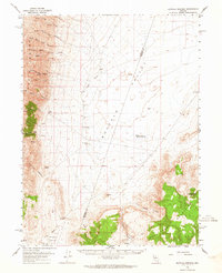
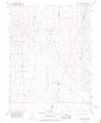
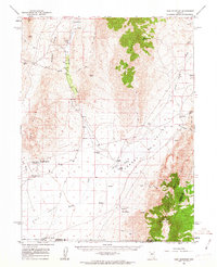 1961 Cain Mountain1963 Print · USGSPershing County's high-desert basins and rugged ranges are captured here in the early sixties, showing a landscape defined by thermal activity and remote cattle stations. Researchers can trace the heritage of isolated outposts like Seven Devils Ranch, McCoy Ranch, and the geothermal waters of Sou Hot Springs.2 unique versions available
 - 1961 Map of Leach Hot Springs, 1963 Print
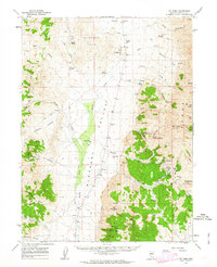
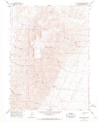
 1961 Leach Hot Springs1963 Print · USGSThe high desert of Pershing County comes into focus in the early sixties, showing the remote ranching and mining operations of the Great Basin. Genealogists and historians can trace isolated outposts like Grand Trunk Ranch and the industrial activity at Black Diablo Mine and Pronto Plata Mine.3 unique versions available
 - 1961 Map of Fencemaker, 1963 Print
 1961 Fencemaker1963 Print · USGSPershing and Churchill Counties are seen here in the early sixties, highlighting the high desert ridges and remote camps of central Nevada. Researchers can locate isolated outposts like Fencemaker Camp, the high-altitude Pleasant Valley Beacon, and the Gilberts Mine near the county line.3 unique versions available
 - 1961 Map of Dun Glen, 1963 Print
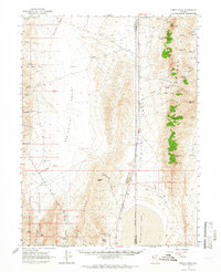
 1961 Dun Glen1963 Print · USGSPershing County's mining and ranching heritage is captured here in the early 1960s, showing the rugged East Range and its high-desert outposts. Researchers can trace historic workings at the Black Hole Mine or locate early settlements like Dun Glen and the Grass Valley Ranch.3 unique versions available
 - 1961 Map of Mt. Moses, 1963 Print
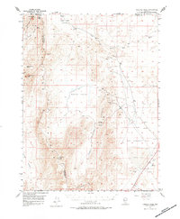
 1961 Mt. Moses1963 Print · USGSThe high-desert terrain of central Nevada is charted here during the early sixties, showing the remote borderlands between Pershing and Lander Counties. Researchers can locate isolated water sources and natural transit points like Hess Spring, Home Station Gap, and Cottonwood Pass.3 unique versions available
 - 1962 Map of Winnemucca
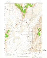
 1962 Winnemucca1962 Print · USGSNorthern Nevada's high desert comes alive in the mid-1950s as a vital transportation and mining corridor following the Humboldt River. Trace the early rail-and-ranch economy through stops like Palisade, find old workings at the Adelaide Mine, and see the layout of Winnemucca before the interstate era.
 - 1962 Map of Buffalo Springs, 1964 Print
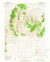
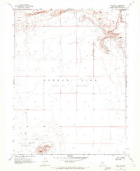
 1962 Buffalo Springs1964 Print · USGSPershing and Lander counties meet in this high-desert basin during the early 1960s, a time when remote ranching outposts defined the landscape. Genealogists and historians can trace the locations of the Buffalo Ranch, Anderson Homestead, and the geothermal Buffalo Valley Hot Springs.3 unique versions available
 - 1964 Map of Tohakum Peak NE, 1965 Print
 1964 Tohakum Peak NE1965 Print · USGSPershing and Washoe counties meet in this arid basin during the early 1960s, showing the intersection of tribal lands and rugged desert peaks. Researchers can locate remote sites like Goose Spring, the prominent Needle Rock, and several early mining Prospect markers.2 unique versions available
 - 1964 Map of Tohakum Peak SE, 1965 Print
 1964 Tohakum Peak SE1965 Print · USGSThe high desert basins and peaks of Pershing County are recorded here in the mid-1960s. Researchers can trace historical mining activity at the MGL Mines and follow the Pyramid Lake Indian Reservation boundary along the edge of Winnemucca Lake.2 unique versions available
 - 1964 Map of Gerlach, 1966 Print
 1964 Gerlach1966 Print · USGSWashoe and Pershing counties meet in the high desert during the mid-sixties, where the railroad and ranching life intersect. Genealogists and historians can locate remote sites like Deephole Ranch, the Gerlach Cem, and the industrial layout of Empire.2 unique versions available
 - 1964 Map of Kumiva Peak, 1966 Print
 1964 Kumiva Peak1966 Print · USGSWashoe and Pershing Counties are seen here in the mid-1960s, a period of remote ranching and desert resource exploration. Local historians can trace the geography of the Selenite Range, identifying sites like Obrien Ranch, the Indian Caves, and several seasonal springs.2 unique versions available
 - 1965 Map of Cherry Creek NE, 1967 Print
 1965 Cherry Creek NE1967 Print · USGSHumboldt County in the mid-sixties reveals a landscape of high-desert basins and remote mining activity. Researchers can locate early industrial sites like several prospects and gravel pits or trace the path of Trenton Creek near the county lines.2 unique versions available
 - 1965 Map of Smelser Pass, 1967 Print
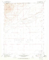
 1965 Smelser Pass1967 Print · USGSHumboldt and Pershing counties meet in this high-altitude 1960s survey of the Nevada desert. Researchers can locate the Tipton Ranch, trace the remote Jeep Trail through Smelser Pass, and identify water sources like Summit Spring.2 unique versions available
 - 1965 Map of Cherry Creek SE, 1967 Print
 1965 Cherry Creek SE1967 Print · USGSPershing and Humboldt counties meet in this mid-1960s survey of the high desert, centered on the wide expanse of Buffalo Valley. Researchers can trace the path of Cherry Creek and locate a solitary Prospect in the southeastern hills.2 unique versions available
 - 1965 Map of China Mountain, 1967 Print
 1965 China Mountain1967 Print · USGSThe high Nevada desert in the mid-1960s was a land of isolated ranches and steep canyon trails. Genealogists and historians can locate the Hoffman Ranch or trace the Jeep Trail through the high terrain near China Mountain.2 unique versions available
 - 1966 Map of Dixie Hot Springs, 1968 Print
 1966 Dixie Hot Springs1968 Print · USGSThe Stillwater Range and Dixie Valley meet in the mid-1960s, revealing a landscape of remote mining camps and vital desert water sources. Researchers can trace the footprints of early industry at Coppereid Ruins, the Buena Vista Mine, and the historic Dixie townsite.2 unique versions available
 - 1967 Map of Fireball Ridge, 1984 Print
 1967 Fireball Ridge1984 Print · USGSThe high desert of Churchill County in the late 1950s was a landscape of remote mining claims and thermal springs. Researchers can trace the era's mining footprint through the Jay Bird Mine, numerous prospects, and the arid expanses of Alkali Flat.
 - 1969 Map of Lone Rock, 1972 Print
 1969 Lone Rock1972 Print · USGSChurchill County’s desert landscape in the late sixties reveals a mix of natural depressions and Cold War military activity. Researchers can trace the perimeter of the Navy Bombing Target Area surrounding Lone Rock and the wide Alkali Flat.3 unique versions available
 - 1969 Map of Lone Rock NW, 1972 Print
 1969 Lone Rock NW1972 Print · USGSThe Nevada desert in the late sixties reveals a landscape of high ranges and expansive alkali basins. Trace early military footprints and infrastructure through the Navy Bombing Target Area and Communication Facility amidst the Sand Dunes.2 unique versions available
End of results
Showing maps 1-22 of 22
Top cities of Pershing County
- Lovelock historical maps
- Humboldt River Ranch historical maps
- Imlay historical maps
- Unionville historical maps
Frequently asked questions
- What are the different types of historical maps available for Pershing County?
- What is the oldest map of Pershing County?
- Where can I purchase historical maps of Pershing County for my home or office?
- Where can I download high-res historical maps of Pershing County?
- Are there historical topographic maps available for Pershing County?
- Is there historical aerial imagery available for Pershing County?
- Where are historical maps of Pershing County sourced from?