1970s Maps of Pershing County, Nevada
Explore 7 historic maps of Pershing County from the 1970s. These maps offer a rare glimpse into what life looked like during the 1970s — showing old roads, neighborhoods, homes, and landmarks that have changed or disappeared over time.
Whether you're researching your family's past, planning a metal detecting trip, or studying how Pershing County's landscape evolved across the 1970s, these high-resolution maps are a powerful tool for exploring the history of this region.
- Focus on a specific era: All maps on this page are from the 1970s, giving you a focused view of this time period.
- See what’s changed: Compare century-old streets, trails, and buildings to today's modern landscape using overlays and satellite layers.
- Research with precision: Use these maps for genealogy, historical research, land use analysis, or educational projects.
- View, download, or print: Maps are fully viewable online in high resolution, and can be downloaded or printed for your own records.
Start exploring Pershing County's history through authentic maps from the 1970s. This is your window into the past.
Pershing County, NV maps
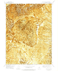
(7)- 1971 Map of Majuba Mtn, 1973 Print
 1971 Majuba Mtn1973 Print · USGSIn the early seventies, Pershing County remained a rugged landscape of mineral prospects and remote springs. Genealogists and historians can trace old mining sites like the Majuba Hill Mine and Last Chance Mine, or locate isolated landmarks such as Graves near Big Antelope Spring.
 - 1971 Map of Rye Patch Reservoir South, 1974 Print
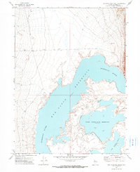
 1971 Rye Patch Reservoir South1974 Print · USGSPershing County's high desert landscape meets the engineering of the mid-twentieth century as the reservoir system manages the river's flow. Genealogists and historians can trace the Old Emigrant Road or locate the site of Humboldt House and Valery (Site).2 unique versions available
 - 1971 Map of Poker Brown, 1974 Print
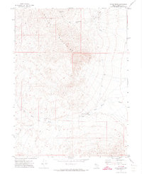 1971 Poker Brown1974 Print · USGSPershing County's high desert reaches and mining history are recorded here during the early 1970s. Researchers can locate remote mineral sites and vital water sources such as Majuba Placers, Cavanaugh Spring, and the namesake Poker Brown landmark.
 - 1971 Map of Rye Patch Reservoir North, 1974 Print
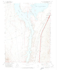
 1971 Rye Patch Reservoir North1974 Print · USGSPershing County's water infrastructure is on full display in the early 1970s, focused on the high-desert reach of the Humboldt River. Researchers can trace the exact shorelines of Rye Patch Reservoir and the Upper Pitt-Taylor Reservoir alongside remote sites like Nelson Well.2 unique versions available
 - 1971 Map of Alpha Mountain, 1977 Print
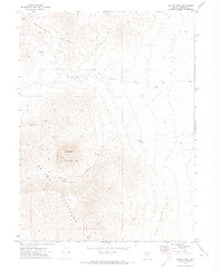
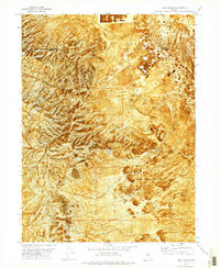
 1971 Alpha Mountain1977 Print · USGSThe high desert of Pershing County is captured during the early 1970s, revealing a landscape defined by mineral exploration and isolated range lands. Researchers can trace the paths of a Jeep Trail past mining Prospects on Alpha Mountain and a lone Corral.
 - 1971 Map of Long Canyon, 1977 Print
 1971 Long Canyon1977 Print · USGSThe eastern edges of the Antelope Range meet the Desert Valley in the early 1970s, revealing a landscape shaped by remote mining and high-desert terrain. Genealogists and researchers can trace access along numerous jeep trails to reach the Haystack Mine, localized prospects, and Box Canyon Spring No 2.
 - 1979 Map of Carson Sink
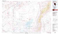 1979 Carson Sink1979 Print · USGSIn the late seventies, the Churchill County desert shows a landscape shaped by ancient lakebeds and Cold War military needs. Researchers can trace the Southern Pacific rail line past remote outposts like Jessup and historic sites such as the Lovelock Indian Caves.2 unique versions available
End of results
Showing maps 1-7 of 7
Top cities of Pershing County
- Lovelock historical maps
- Humboldt River Ranch historical maps
- Imlay historical maps
- Unionville historical maps
Frequently asked questions
- What are the different types of historical maps available for Pershing County?
- What is the oldest map of Pershing County?
- Where can I purchase historical maps of Pershing County for my home or office?
- Where can I download high-res historical maps of Pershing County?
- Are there historical topographic maps available for Pershing County?
- Is there historical aerial imagery available for Pershing County?
- Where are historical maps of Pershing County sourced from?