1930s Maps of New Jersey
Explore 18 historic maps of New Jersey from the 1930s. These maps offer a rare glimpse into what life looked like during the 1930s — showing old roads, neighborhoods, homes, and landmarks that have changed or disappeared over time.
Whether you're researching your family's past, planning a metal detecting trip, or studying how New Jersey's landscape evolved across the 1930s, these high-resolution maps are a powerful tool for exploring the history of this region.
- Focus on a specific era: All maps on this page are from the 1930s, giving you a focused view of this time period.
- See what’s changed: Compare century-old streets, trails, and buildings to today's modern landscape using overlays and satellite layers.
- Research with precision: Use these maps for genealogy, historical research, land use analysis, or educational projects.
- View, download, or print: Maps are fully viewable online in high resolution, and can be downloaded or printed for your own records.
Start exploring New Jersey's history through authentic maps from the 1930s. This is your window into the past.
New Jersey maps
(18)- 1931 Map of Ramapo
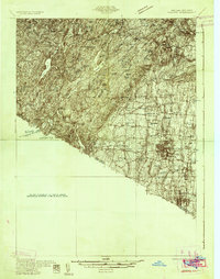 1931 Ramapo1931 Print · USGSRockland County in the late twenties and early thirties shows a unique mix of expanding suburban rail towns and state park wilderness. Genealogists and historians can trace Letchworth Village, the old Hogan Kamp Mine, and early schools like Bardonia Sch.3 unique versions available
 - 1931 Map of Bay Side
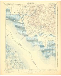 1931 Bay Side1931 Print · USGSThe tidal marshes of the lower Delaware River come alive in the early thirties, showcasing the maritime and agricultural roots of South Jersey. Genealogists and historians can trace family-named sites like Maskell Mill, the rail path of the Southern Jersey R R, and old bayfront landings at Sea Breeze.2 unique versions available
 - 1931 Map of Smyrna
 1931 Smyrna1931 Print · USGSCoastal Delaware in the late twenties and early thirties was a landscape of tidal landings and crossroads settlements linked by the new Dupont Highway. Genealogists can trace family names across Gums Corners, identify sites like St Anns Church, or locate the many landings along Blackbird Creek, including Blackbird Landing and Stave Landing.5 unique versions available
 - 1932 Map of Easton
 1932 Easton1932 Print · USGSThe Delaware River valley thrived as a corridor of industry and transport in the early 1930s, bridging Pennsylvania and New Jersey. Genealogists and historians can trace the legacy of early industry along the Morris Canal or locate local landmarks like St Josephs Ch and Mine Hill.5 unique versions available
 - 1934 Map of Bowers
 1934 Bowers1934 Print · USGSCoastal Kent County in the mid-1930s is a landscape of tidal marshes and tight-knit farming communities tied to the bay. Researchers can trace ancestral roots at Barratts Chapel, find rural schoolhouses like St Jones Sch, and locate old river settlements like Barkers Landing.
 - 1934 Map of Park Ridge
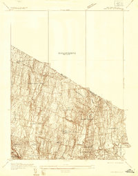 1934 Park Ridge1934 Print · USGSBergen County settlements were evolving into distinct residential hubs during the mid-1930s. Researchers can trace early infrastructure and local landmarks like Villa Maria Clare, the Western Reservoir, and the estates of Saddle River.
 - 1934 Map of Hackensack
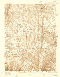 1934 Hackensack1934 Print · USGSBergen County suburban expansion is in full swing during the mid-thirties as rail lines and early state highways reshape the landscape. Trace family history through numerous burial grounds like Valleau Cemetery or locate landmarks such as the Radburn-Fairlawn Sta and Oradell Reservoir.
 - 1935 Map of Weehawken
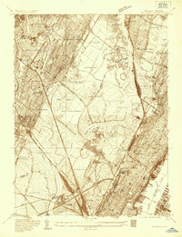 1935 Weehawken1935 Print · USGSBergen and Hudson counties in the mid-1930s show a dense grid of riverfront industry and rail lines interwoven with tidal marshes. Genealogists and historians can locate numerous cemeteries like Holy Cross Cem or trace institutional landmarks like the Hudson County Hospital.
 - 1936 Map of Ramsey
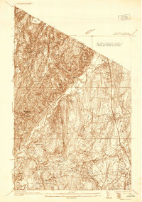 1936 Ramsey1936 Print · USGSNorthern New Jersey during the mid-1930s shows a landscape of highland camps and expanding rail towns along the Erie RR. Trace family roots and local landmarks from Ramsey to Mahwah, including the Don Bosco Institute and Macmillan Reservoir.
 - 1936 Map of Delaware Water Gap
 1936 Delaware Water Gap1936 Print · USGSThe Delaware River valley thrived in the mid-thirties as a critical junction for coal-hauling railroads and mountain tourism. Local historians can trace family roots through numerous rural landmarks like Spoke Factory Sch, Ross Cem, and Slateford Junction.4 unique versions available
 - 1936 Map of Bowers
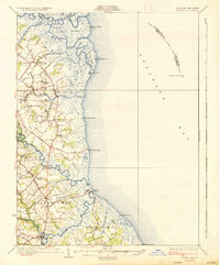 1936 Bowers1936 Print · USGSCoastal Kent County appears in the mid-1930s as a landscape of tidal marshes, small farming districts, and vital river landings. Genealogists can trace family footprints through sites like Barretts Chapel, Barkers Landing, and rural schools like Cowgill Sch.4 unique versions available
 - 1937 Map of Nyack
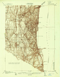 1937 Nyack1937 Print · USGSRockland County’s riverfront and wooded interior are shown here in the late 1930s as the rail-and-river economy remained in full swing. Genealogists and historians can trace family locations near the Rockland State Hospital, Piermont, and the St Catharines Cem.
 - 1937 Map of Tarrytown
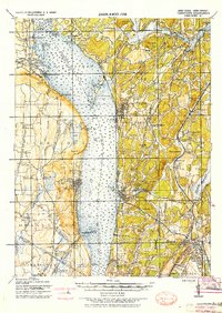 1937 Tarrytown1937 Print · USGSThe Hudson River valley during the 1930s serves as a busy corridor of rail, water, and infrastructure. Genealogists and local historians can trace the old landings at Waldberg Landing, the grounds of the State Prison in Ossining, and the rail lines through Nyack.
 - 1937 Map of Cape Henlopen
 1937 Cape Henlopen1937 Print · USGSThe Delaware coastline near Cape Henlopen comes alive in the early twentieth century, showing a landscape defined by maritime safety and rail transport. Trace the routes of the Pennsylvania RR to settlements like Lewes or locate landmarks such as the West Hill School and Cape Henlopen Light.2 unique versions available
 - 1938 Map of Paterson
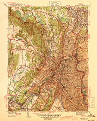 1938 Paterson1938 Print · USGSPaterson and the Passaic River valley are captured in the late thirties, showing the transition from dense industrial centers to the wooded ridges of the Watchung Mountains. Local historians can trace the foundations of St Michaels Orphanage, the early runways of Murchio Airport, and the grounds of Fairlawn Cem.2 unique versions available
 - 1938 Map of Goshen
 1938 Goshen1938 Print · USGSOrange County was a vital rail and agricultural corridor during the early twentieth century. Researchers can trace the path of the Erie RR through Middletown and explore long-standing farming communities like Florida and Orange Farm.
 - 1938 Map of Ramapo
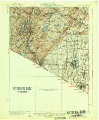 1938 Ramapo1938 Print · USGSRockland County in the late 1930s is revealed here as a landscape of institutional campuses, rail-side villages, and emerging parklands. Genealogists can trace family connections at Letchworth Village, St Agatha Home, and vanished hamlets like Sandyfield or Johnsontown.3 unique versions available
 - 1939 Map of Park Ridge
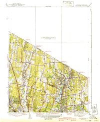 1939 Park Ridge1939 Print · USGSNorthwestern Bergen County and the New York state line are captured here during a period of steady suburban development along the rail lines. Trace the early layout of Montvale and Park Ridge or locate landmarks like Zion Tabernacle and Woodcliff Lake.2 unique versions available
End of results
Showing maps 1-18 of 18
Top cities of New Jersey
- Newark historical maps
- Jersey City historical maps
- Paterson historical maps
- Elizabeth historical maps
- Edison historical maps
- Woodbridge Township historical maps
See more
Top counties of New Jersey
- Bergen County historical maps
- Middlesex County historical maps
- Essex County historical maps
- Hudson County historical maps
- Monmouth County historical maps
- Ocean County historical maps
See more
Frequently asked questions
- What are the different types of historical maps available for New Jersey?
- What is the oldest map of New Jersey?
- Where can I purchase historical maps of New Jersey for my home or office?
- Where can I download high-res historical maps of New Jersey?
- Are there historical topographic maps available for New Jersey?
- Is there historical aerial imagery available for New Jersey?
- Where are historical maps of New Jersey sourced from?