1910s Maps of New Jersey
Explore 21 historic maps of New Jersey from the 1910s. These maps offer a rare glimpse into what life looked like during the 1910s — showing old roads, neighborhoods, homes, and landmarks that have changed or disappeared over time.
Whether you're researching your family's past, planning a metal detecting trip, or studying how New Jersey's landscape evolved across the 1910s, these high-resolution maps are a powerful tool for exploring the history of this region.
- Focus on a specific era: All maps on this page are from the 1910s, giving you a focused view of this time period.
- See what’s changed: Compare century-old streets, trails, and buildings to today's modern landscape using overlays and satellite layers.
- Research with precision: Use these maps for genealogy, historical research, land use analysis, or educational projects.
- View, download, or print: Maps are fully viewable online in high resolution, and can be downloaded or printed for your own records.
Start exploring New Jersey's history through authentic maps from the 1910s. This is your window into the past.
New Jersey maps
(21)- 1910 Map of Ramapo
 1910 Ramapo1910 Print · USGSThe Ramapo Valley at the turn of the century served as a vital transit corridor between New York and New Jersey, dominated by rail lines and river industry. Genealogists and local historians can trace the foundations of Sloatsburg, Suffern, and Pearl River, alongside landmarks like the Ramapo Cem. and the Powder Works.6 unique versions available
 - 1910 Map of Greenwood Lake
 1910 Greenwood Lake1910 Print · USGSThe Highlands of northern New Jersey and southern New York are shown here during a peak era of iron mining and rail expansion. Genealogists and industrial historians can trace the foundations of Sterling Furnace, Charlotteburg Mine, and the New Milford Sta. along the Erie Railroad.9 unique versions available
 - 1913 Map of Milford, 1958 Print
 1913 Milford1958 Print · USGSBefore the Tri-State area was suburbanized, this early twentieth-century survey captures the rugged river economy of the Delaware valley. Genealogists can trace family roots at McCartys Corner or locate vanished rural schoolhouses like the McCain School and Woodtown School.
 - 1915 Map of Milford
 1915 Milford1915 Print · USGSThe Delaware River valley at the tri-state border comes alive in this pre-war survey, capturing a world of riverside rail stations and remote mountain schoolhouses. Genealogists can locate family landmarks like McCarthys Corner or trace rural education at the Yale Forest School and Quicktown School.7 unique versions available
 - 1918 Map of Camp Dix
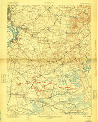 1918 Camp Dix1918 Print · USGSNew Jersey at the height of the Great War features the sprawling mobilization grounds of Camp Dix and its expansive Rifle Range. Genealogists and historians can trace defunct stops like Imlaystown Sta or locate family roots near New Egypt and Colliers Mill.2 unique versions available
 - 1918 Map of Cape Henlopen
 1918 Cape Henlopen1918 Print · USGSCoastal Sussex County is seen here at a pivotal maritime moment, as the bustling port at Lewes manages the traffic of the Delaware Bay. Researchers can trace early twentieth-century rail lines, the historic Cape Henlopen Light, and local landmarks like West Hill School.2 unique versions available
 - 1918 Map of Great Egg Harbor, 1921 Print
 1918 Great Egg Harbor1921 Print · USGSAtlantic County at the close of the Great War reveals a landscape of tidal marshes and pine forests connected by emerging rail lines. Genealogists can locate family-named sites such as Mc Keetown, Steelmans Landing, and the prominent Doughty Mill.
 - 1918 Map of Tuckahoe, 1921 Print
 1918 Tuckahoe1921 Print · USGSSouthern New Jersey’s pine barrens and river valleys are captured here during a period of transition between early industry and railroad expansion. Genealogists and researchers can trace the locations of Walker's Forge, the West Jersey Railroad, and forgotten milling sites like Bennett Mill.
 - 1918 Map of Cape May, 1921 Print
 1918 Cape May1921 Print · USGSCoastal New Jersey is shown here at the height of its early railroad era, before modern development transformed the shoreline. Genealogists and historians can trace rail lines to Cape May City, find old Life Saving Stations, and locate vanished spots like Schellinger's Landing or Bennet.
 - 1918 Map of Sandy Hook, 1921 Print
 1918 Sandy Hook1921 Print · USGSMonmouth County's coastline and interior settlements are captured during the final months of the First World War. Genealogists and historians can trace the early rail network through Little Silver Sta or locate old landmarks like Stone Church and Fort Hancock.
 - 1919 Map of Long Beach
 1919 Long Beach1919 Print · USGSThe New Jersey shore during the early twentieth century was a landscape of remote Life Saving Stations and emerging rail-side hamlets. Genealogists and historians can trace the early footprints of Beach Haven and Harvey Cedars along the Long Beach Railroad.
 - 1919 Map of Wilmington
 1919 Wilmington1919 Print · USGSNorthern Delaware and the river corridor are mapped at the close of the Great War, highlighting strategic coastal defenses and rail hubs. Genealogists can trace early landmarks like Coochs Bridge, Corner Ketch, and the defensive works at Fort Delaware.2 unique versions available
 - 1919 Map of Hammonton
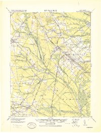 1919 Hammonton1919 Print · USGSThe Pine Barrens of the early twentieth century are defined here by a massive web of competing railroads and small mill settlements. Researchers can trace historic family landmarks and transit hubs like Winslow Junction, Iron Mills, and Pestletown during the region's peak agricultural era.
 - 1919 Map of Vineland, 1921 Print
 1919 Vineland1921 Print · USGSCumberland County’s coastal oyster ports and inland industrial centers are captured here during a period of peak maritime activity. Genealogists and historians can trace rail lines like the Central R. R. of New Jersey or locate vanished sites like Whitehall Ldg. and Sheppards Mill.
 - 1919 Map of Mount Holly, 1921 Print
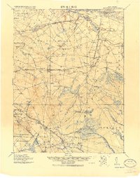 1919 Mount Holly1921 Print · USGSThe Burlington and Camden County interior appears here at a peak of rail-driven commerce during the early twentieth century. Genealogists and historians can trace family-named industrial sites like Kirby's Mill and old bog operations at the West Jersey Cranberry Meadow.
 - 1919 Map of New Brunswick, 1921 Print
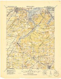 1919 New Brunswick1921 Print · USGSMiddlesex and Monmouth counties are depicted here in the years following the Great War, when rail lines and river commerce still drove the region’s growth. Researchers can trace the sprawling Pennsylvania Railroad network through industrial hubs like Jamesburg or visit the hallowed Monmouth Battle Ground.
 - 1919 Map of Sea Isle, 1921 Print
 1919 Sea Isle1921 Print · USGSCoastal Cape May at the end of the Great War reveals a landscape of tidal thoroughfares and early rail-connected resorts. Researchers can trace the tracks of the Penna. R.R. through Ocean View or locate old shore landmarks like L.S.S. Corson Inlet.
 - 1919 Map of Barnegat, 1921 Print
 1919 Barnegat1921 Print · USGSCoastal Ocean County comes alive in the years after the Great War, showing a landscape of barrier island settlements and mainland rail stops. Genealogists and historians can trace early shore life through the string of Life Saving Stations, the Barnegat Light, and old rail stops like Pinewald Sta. or Ostrom Sta.
 - 1919 Map of Mullica, 1921 Print
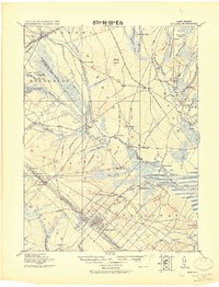 1919 Mullica1921 Print · USGSCoastal New Jersey's Pine Barrens and river landings are captured here in the early 1900s during a period of transition between water-based commerce and expanding rail lines. Researchers can trace the legacy of iron and agriculture through sites like Batsto, Harris Ville, and the Tranquility Bogs.
 - 1919 Map of Asbury Park, 1921 Print
 1919 Asbury Park1921 Print · USGSCoastal Monmouth and Ocean Counties come alive in the early twentieth century, showing the rapid growth of beach resorts alongside quiet pineland settlements. Researchers can trace the early rail corridors of the Pennsylvania Railroad and locate maritime landmarks like L.S. Station Manasquan Beach and Point Pleasant.
 - 1919 Map of Dennisville, 1921 Print
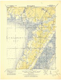 1919 Dennisville1921 Print · USGSCape May County's southern peninsula is documented here during the height of the coastal rail era, before modern development reshaped the shoreline. Genealogists and historians can trace the foundations of local commerce through sites like Bidwell Town Mill, Goshen Landing, and the many family-named stops along the Philadelphia & Reading R.R.
End of results
Showing maps 1-21 of 21
Top cities of New Jersey
- Newark historical maps
- Jersey City historical maps
- Paterson historical maps
- Elizabeth historical maps
- Edison historical maps
- Woodbridge Township historical maps
See more
Top counties of New Jersey
- Bergen County historical maps
- Middlesex County historical maps
- Essex County historical maps
- Hudson County historical maps
- Monmouth County historical maps
- Ocean County historical maps
See more
Frequently asked questions
- What are the different types of historical maps available for New Jersey?
- What is the oldest map of New Jersey?
- Where can I purchase historical maps of New Jersey for my home or office?
- Where can I download high-res historical maps of New Jersey?
- Are there historical topographic maps available for New Jersey?
- Is there historical aerial imagery available for New Jersey?
- Where are historical maps of New Jersey sourced from?