1980s Maps of New Jersey
Explore 34 historic maps of New Jersey from the 1980s. These maps offer a rare glimpse into what life looked like during the 1980s — showing old roads, neighborhoods, homes, and landmarks that have changed or disappeared over time.
Whether you're researching your family's past, planning a metal detecting trip, or studying how New Jersey's landscape evolved across the 1980s, these high-resolution maps are a powerful tool for exploring the history of this region.
- Focus on a specific era: All maps on this page are from the 1980s, giving you a focused view of this time period.
- See what’s changed: Compare century-old streets, trails, and buildings to today's modern landscape using overlays and satellite layers.
- Research with precision: Use these maps for genealogy, historical research, land use analysis, or educational projects.
- View, download, or print: Maps are fully viewable online in high resolution, and can be downloaded or printed for your own records.
Start exploring New Jersey's history through authentic maps from the 1980s. This is your window into the past.
New Jersey maps
(34)- 1980 Map of Cape Henlopen, 1982 Print
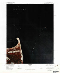 1980 Cape Henlopen1982 Print · USGSThe Sussex County coast comes alive in this 1980s color infrared survey, showing the transition from bay to ocean. Trace the shifting sands of Cape Henlopen and the early layout of Lewes during this era of coastal change.
 - 1981 Map of Cape May, 1982 Print
 1981 Cape May1982 Print · USGSThe Jersey Shore's southernmost reaches come into focus during the early eighties, showcasing the maritime infrastructure of the Cape. Researchers can trace the layout of coastal towns like Wildwood Crest and North Cape May or locate the sprawling U.S. Coast Guard Training Center.
 - 1982 Map of Trenton, 1983 Print
 1982 Trenton1983 Print · USGSCentral New Jersey and the Delaware River valley are captured in the early eighties during a time of major highway expansion and suburban maturation. Researchers can trace the grounds of Princeton University, the historic Monmouth Battlefield, and the sprawling Fort Dix.
 - 1983 Map of Long Branch, 1984 Print
 1983 Long Branch1984 Print · USGSThe Jersey Shore in the early 1980s is captured here, tracing the coastline from the tip of the peninsula to the bustling beachfronts. Researchers can locate coastal neighborhoods like Sea Bright and Low Moor, and trace the shorelines of Lake Takanassee and the Shrewsbury River.
 - 1984 Map of Cape Henlopen
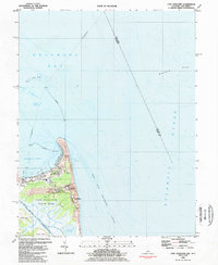 1984 Cape Henlopen1984 Print · USGSThe Delaware coastline in the mid-1980s reveals a strategic landscape of naval reservations and maritime heritage near the mouth of the bay. Researchers can trace the boundaries of Lewes and explore coastal features like Gordons Pond and the Harbor of Refuge.4 unique versions available
 - 1984 Map of Allentown, 1985 Print
 1984 Allentown1985 Print · USGSThe Lehigh Valley and southern Poconos are captured in the mid-eighties as industry and academic life converge along the river corridor. Trace the rail-and-water networks connecting Jim Thorpe and Bethlehem, or explore landmarks like Lehigh University and the Delaware Water Gap.3 unique versions available
 - 1984 Map of Atlantic City, 1985 Print
 1984 Atlantic City1985 Print · USGSThe Jersey Shore and Pine Barrens are captured here in the mid-eighties, showing the coastal transition from salt marsh to forest. Genealogists and historians can trace family locations from Estell Manor to North Wildwood or explore the vast bounds of the Belleplain State Forest.
 - 1984 Map of Newark, 1985 Print
 1984 Newark1985 Print · USGSNorthern New Jersey's massive industrial and transit network is on full display in the mid-eighties, showing the region just before modern redevelopment. Genealogists and historians can trace the dense urban grids of Newark, find historic landmarks like Ellis Island, and locate the sprawling Picatinny Arsenal in the western hills.
 - 1984 Map of Dover, 1985 Print
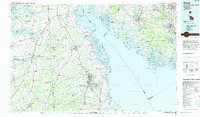 1984 Dover1985 Print · USGSThe Delaware Bay coastline and its surrounding communities are captured here in the mid-1980s. Genealogists and historians can trace the growth of Dover, locate rural landmarks like St Augustine, or study the rail networks of CONRAIL and the Dover Air Force Base.
 - 1984 Map of Wilmington, 1986 Print
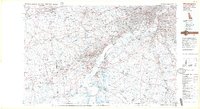 1984 Wilmington1986 Print · USGSThe Delaware Valley in the mid-eighties was a powerhouse of transit and industry where Delaware, New Jersey, Pennsylvania, and Maryland meet. Researchers can trace the sprawling rail networks of SEPTA and PATCO or locate historic sites like Fort Delaware State Park and Valley Forge State Forest.2 unique versions available
 - 1984 Map of Reading, 1986 Print
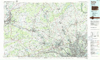 1984 Reading1986 Print · USGSSoutheastern Pennsylvania in the mid-eighties shows a landscape of established industrial hubs and rapid suburban expansion. Trace local history through landmarks like Valley Forge National Historical Park, the Willow Grove Naval Air Station, and Kutztown University.2 unique versions available
 - 1984 Map of Long Island West, 1986 Print
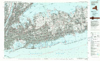 1984 Long Island West1986 Print · USGSWestern Long Island in the mid-eighties shows a mature suburban landscape defined by its famous expressways and historic rail lines. Researchers can trace the development of planned communities like Levittown or locate landmarks such as Fort Totten Mil Res and Stony Brook.2 unique versions available
 - 1984 Map of Seaford, 1986 Print
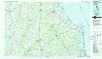 1984 Seaford1986 Print · USGSCoastal Delaware and the Maryland borderlands are captured here in the mid-eighties as modern tourism and traditional agriculture coexist. Researchers can trace the rail-and-river routes through Seaford, explore inland millponds like Chipman Pond, or study the shoreline at Cape Henlopen.2 unique versions available
 - 1984 Map of Hammonton, 1986 Print
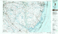 1984 Hammonton1986 Print · USGSSouthern New Jersey is captured in the mid-eighties as suburban growth pressed against the vast Pinelands. Researchers can trace the development of the Atlantic City Expressway corridor and locate landmarks like Ancora Psychiatric Hospital and the sprawling Wharton State Forest.3 unique versions available
 - 1986 Map of Middletown
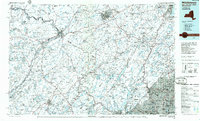 1986 Middletown1986 Print · USGSThe Tri-State region comes alive in the mid-1980s, documenting the corridor from the Hudson River to the Delaware Water Gap. Researchers can trace the sprawling grounds of West Point, the extensive Conrail rail network, and early suburban growth around Middletown and Suffern.2 unique versions available
 - 1986 Map of Bridgeport
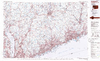 1986 Bridgeport1986 Print · USGSSpanning the New York and Connecticut border in the mid-eighties, this survey shows the dense rail and parkway network connecting the Hudson to the Sound. Researchers can trace the massive New Croton Reservoir system or locate landmarks like the West Point U.S. Military Academy.3 unique versions available
 - 1986 Map of Scranton
 1986 Scranton1986 Print · USGSNortheastern Pennsylvania in the mid-eighties shows an era of transition between its deep-rooted mining history and modern transit growth. Researchers can trace the industrial footprint of a Strip Mine, locate the Tobyhanna Army Depot, or find family sites near St Marys Cem and Wilkes College.2 unique versions available
 - 1986 Map of Newark, 1987 Print
 1986 Newark1987 Print · USGSNorthern New Jersey during the mid-eighties shows an incredible transition from the industrial harbor to the wooded Highlands. Researchers can trace the massive footprints of Picatinny Arsenal and Newark International Airport or explore protected lands like the Great Swamp National Wildlife Refuge.
 - 1986 Map of Trenton, 1987 Print
 1986 Trenton1987 Print · USGSCentral New Jersey and the Delaware River valley are shown here during the mid-eighties, a period of dense suburban growth and military activity. Researchers can trace the sprawling grounds of the Fort Dix Military Reservation and the historic corridors of the Delaware & Raritan Canal State Park.
 - 1989 Map of Point Pleasant
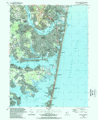 1989 Point Pleasant1989 Print · USGSCoastal New Jersey comes into sharp focus during the late eighties, documenting the dense development along the Barnegat Bay and the Atlantic. Traces of local life are everywhere, from the National Guard Training Center to landmarks like St Paul Ch and Lake of the Lilies.2 unique versions available
 - 1989 Map of Mays Landing
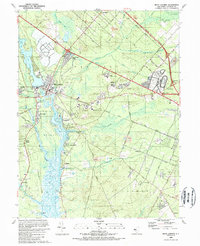 1989 Mays Landing1989 Print · USGSMays Landing and the Great Egg Harbor River valley are captured here in the late eighties as the region balanced its rural roots with modern infrastructure. Genealogists and local historians can trace family sites at Union Cem, explore the sprawling Atlantic City Racetrack, or follow the Old Railroad Grade.
 - 1989 Map of Ocean City
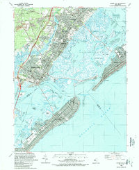 1989 Ocean City1989 Print · USGSThe New Jersey shoreline in the late eighties reveals the established resort grids of Ocean City alongside the growing mainland suburbs. Genealogists and historians can trace the development of Somers Point and locate landmarks like Friends Central Cem and the City Hall Museum.
 - 1989 Map of Marmora
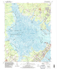 1989 Marmora1989 Print · USGSThe coastal marshes of Atlantic and Cape May counties are captured here in the late eighties as the region balanced conservation with growth. Genealogists and local historians can locate several rural landmarks including Asbury Ch, Seaside Cem, and the historic settlement at Beesleys Point.2 unique versions available
 - 1989 Map of Barnegat Light
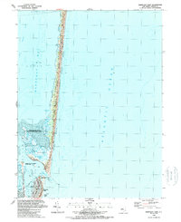 1989 Barnegat Light1989 Print · USGSThe Jersey Shore's barrier islands and bay ecosystems are captured here in the late eighties, just south of Berkeley. Researchers can trace maritime landmarks from the Barnegat Lighthouse to the marshes of the Sedge Islands.3 unique versions available
 - 1989 Map of Lakewood
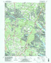 1989 Lakewood1989 Print · USGSCoastal New Jersey suburban life is in full bloom during the late eighties as residential developments spread across Ocean County. Researchers can trace the layout of Leisure Village, locate family plots in Evergreen Cem, or follow the industrial sites near Seven Stars.2 unique versions available
Showing maps 1-25 of 34
Top cities of New Jersey
- Newark historical maps
- Jersey City historical maps
- Paterson historical maps
- Elizabeth historical maps
- Edison historical maps
- Woodbridge Township historical maps
See more
Top counties of New Jersey
- Bergen County historical maps
- Middlesex County historical maps
- Essex County historical maps
- Hudson County historical maps
- Monmouth County historical maps
- Ocean County historical maps
See more
Frequently asked questions
- What are the different types of historical maps available for New Jersey?
- What is the oldest map of New Jersey?
- Where can I purchase historical maps of New Jersey for my home or office?
- Where can I download high-res historical maps of New Jersey?
- Are there historical topographic maps available for New Jersey?
- Is there historical aerial imagery available for New Jersey?
- Where are historical maps of New Jersey sourced from?