2020s Maps of East Amwell Township, New Jersey
Explore 3 historic maps of East Amwell Township from the 2020s. These maps offer a rare glimpse into what life looked like during the 2020s — showing old roads, neighborhoods, homes, and landmarks that have changed or disappeared over time.
Whether you're researching your family's past, planning a metal detecting trip, or studying how East Amwell Township's landscape evolved across the 2020s, these high-resolution maps are a powerful tool for exploring the history of this region.
- Focus on a specific era: All maps on this page are from the 2020s, giving you a focused view of this time period.
- See what’s changed: Compare century-old streets, trails, and buildings to today's modern landscape using overlays and satellite layers.
- Research with precision: Use these maps for genealogy, historical research, land use analysis, or educational projects.
- View, download, or print: Maps are fully viewable online in high resolution, and can be downloaded or printed for your own records.
Start exploring East Amwell Township's history through authentic maps from the 2020s. This is your window into the past.
East Amwell Township, NJ maps
(3)- 2023 Map of Hopewell, 2023 Print
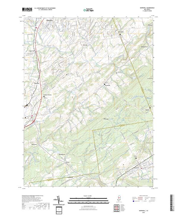 2023 Hopewell2023 Print · USGSThe crossroads and hamlets of Hunterdon and Mercer counties are documented here in detail. Genealogists can trace family names and local history through sites like Amwell Ridge Cem, Reaville, and the Union Cem of Wertsville.
 - 2023 Map of Stockton, 2023 Print
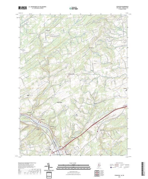 2023 Stockton2023 Print · USGSThe Delaware River corridor remains a centerpiece of local geography in the early twenty-first century, flanked by its historic canal systems. Genealogists and historians can locate family landmarks such as Rosemont Cem, Barber Cem, and the riverfront town of Stockton.
 - 2023 Map of Rocky Hill, 2023 Print
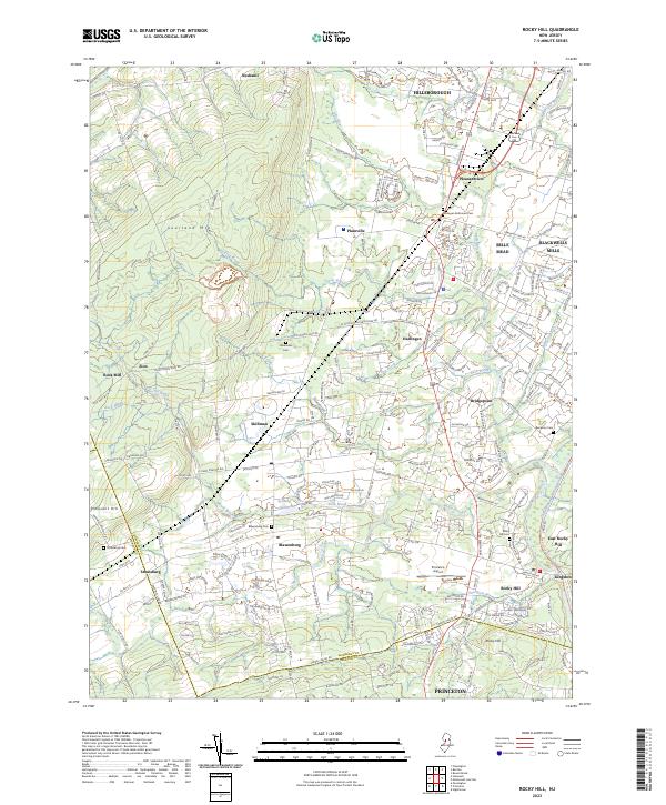 2023 Rocky Hill2023 Print · USGSThe transition from the slopes of Sourland Mtn to the Millstone River valley is captured here in the contemporary era. Researchers can trace historic burial sites like Unionville Cem and Stoutsburg Cem alongside landmarks like Princeton Airport.
End of results
Showing maps 1-3 of 3
Top cities near East Amwell Township
- Hamilton Township historical maps
- Trenton historical maps
- Franklin Township historical maps
- South Brunswick historical maps
- Middletown Township historical maps
- Bridgewater Township historical maps
See more
Top neighborhoods of East Amwell Township
- Linvale historical maps
- Larisons Corners historical maps
- Rileyville historical maps
- Snydertown historical maps
- Amwell historical maps
- Ringoes historical maps
See more
Frequently asked questions
- What are the different types of historical maps available for East Amwell Township?
- What is the oldest map of East Amwell Township?
- Where can I purchase historical maps of East Amwell Township for my home or office?
- Where can I download high-res historical maps of East Amwell Township?
- Are there historical topographic maps available for East Amwell Township?
- Is there historical aerial imagery available for East Amwell Township?
- Where are historical maps of East Amwell Township sourced from?