Old Maps of Eastern Navajo Agency, New Mexico for Hiking & Exploration
Hike through history with 877 historic maps of Eastern Navajo Agency. Explore old trails, ghost towns, and forgotten backroads — perfect for outdoor adventurers and local explorers.
- Rediscover forgotten places: Map out old mining camps, roads, and footpaths that no longer exist on modern maps.
- Layer with modern tools: Combine with LiDAR or satellite views to plan hikes through historical terrain.
- Made for exploration: Popular among hikers, overlanders, and local history lovers.
Use these maps to find adventure and explore the hidden past of Eastern Navajo Agency.
Eastern Navajo Agency, NM maps
(877)- 1883 Map of Mt. Taylor
 1883 Mt. Taylor1883 Print · USGSThe high-desert frontier of New Mexico comes to life in the 1880s, centered on the towering Mt Taylor. Researchers can trace the early path of the Atlantic and Pacific Railroad and locate settlements like Old Fort Wingate and Laguna.
 - 1886 Map of Wingate
 1886 Wingate1886 Print · USGSThe high deserts of western New Mexico are shown during the expansion of the rail era in the mid-1880s. Genealogists and historians can trace early settlements and vital water sources like Gallup, Old Zuñi, and the historic Fort Wingate along the Atlantic and Pacific Railroad.
 - 1886 Map of Mt. Taylor
 1886 Mt. Taylor1886 Print · USGSNorthwestern New Mexico in the mid-1880s reveals a high-desert territory where early rail commerce meets long-standing mountain settlements. Researchers can trace the path of the Atlantic and Pacific Railroad past Old Fort Wingate and the historic villages of Laguna and Cebolletta.
 - 1886 Map of Fort Defiance
 1886 Fort Defiance1886 Print · USGSTerritorial Arizona and the high plateaus of Apache County come to life in the 1880s, centered on the strategic outpost of Fort Defiance. Researchers can trace the path of the Atlantic and Pacific Railroad and locate early stops like Allantown and Navajo.
 - 1888 Map of Bernalillo, 1951 Print
 1888 Bernalillo1951 Print · USGSThe Middle Rio Grande valley appears here in the late nineteenth century, just as the railroad began to reshape the high desert. Genealogists and historians can trace the early footprints of Albuquerque, Bernalillo, and traditional communities like Atrisco and Santa Ana.
 - 1889 Map of Albuquerque
 1889 Albuquerque1889 Print · USGSAlbuquerque and the Rio Grande Valley appear here during the expansion of the territorial railroad system. Local historians can trace the early rail corridor of the Atchison Topeka and Santa Fe Railroad and find early river settlements like Bernalillo, Alameda, and Artisco.
 - 1889 Map of Largo
 1889 Largo1889 Print · USGSNorthwestern New Mexico in the late nineteenth century shows a vast network of desert canyons and river valleys before modern development. Genealogists and researchers can trace early settlements like Bloomfield and Largo or locate landmarks such as Angels Peak and the remote Stinking Lakes Sinks.
 - 1889 Map of Chaco
 1889 Chaco1889 Print · USGSNorthwestern New Mexico appears here in the late nineteenth century as a frontier of emerging river settlements and high-desert springs. Researchers can trace early footprints at Farmington and Aztec, or locate watering points like Sheep Spring and Seven Lakes.
 - 1892 Map of Fort Defiance
 1892 Fort Defiance1892 Print · USGSNorthern Arizona in the late nineteenth century remains a frontier of isolated outposts and high desert mesas. Trace the path of the A & P R R through Sanders or locate the remote station at Pueblo Colorado and the springs at Jacobs Well.6 unique versions available
 - 1892 Map of Wingate
 1892 Wingate1892 Print · USGSNorthwestern New Mexico territory comes to life during the expansion of the rail era, centered on the strategic military and trade routes of the high desert. Researchers can trace the path of the Atlantic and Pacific Railroad past Fort Wingate and through early settlements like Gallup and Old Zuni.4 unique versions available
 - 1892 Map of Chaco
 1892 Chaco1892 Print · USGSNorthwestern New Mexico in the late nineteenth century reveals the early river-side foundations of the Four Corners region. Genealogists and historians can trace the development of Farmington, Aztec, and Jewett along the San Juan River and the high desert outpost of Seven Lakes.5 unique versions available
 - 1892 Map of Mt. Taylor, 1896 Print
 1892 Mt. Taylor1896 Print · USGSNorthwestern New Mexico in the late nineteenth century was a territory of rail expansion and ancient volcanic landmarks. Researchers can trace the path of the Atlantic and Pacific Railroad past Old Fort Wingate and the pueblo at Laguna.
 - 1893 Map of Albuquerque
 1893 Albuquerque1893 Print · USGSThe Rio Grande valley in the late nineteenth century is a study in river-fronting settlements and the emerging rail economy. Genealogists can trace the early footprints of Albuquerque, Bernalillo, and the traditional community at Artisco.5 unique versions available
 - 1895 Map of Largo, 1897 Print
 1895 Largo1897 Print · USGSNorthwestern New Mexico appears as a rugged frontier of canyons and high peaks in the years before statehood. Researchers can trace early settlements at Bloomfield and Largo or locate iconic landmarks such as El Huerfano and the headwaters of Canon Largo.3 unique versions available
 - 1899 Map of Mt. Taylor
 1899 Mt. Taylor1899 Print · USGSNorthwestern New Mexico in the late nineteenth century is a landscape of vast mesas and early rail stops before modern highways arrived. Genealogists and historians can trace the foundations of Grant, San Mateo, and Old Fort Wingate along the Santa Fe Pacific Railroad.5 unique versions available
 - 1917 Map of Cerro Verde
 1917 Cerro Verde1917 Print · USGSNorthwestern New Mexico’s high desert landscape is captured here during the First World War era, showing a mix of ancient land grants and rail-side outposts. Genealogists and historians can trace family-named sites like Vigil, Baca, and the Correo Post Office along the Atchison Topeka and Santa Fe line.
 - 1917 Map of Broom Mountain
 1917 Broom Mountain1917 Print · USGSValencia County at the close of the First World War shows a landscape of high mesas and scattered homesteads. Genealogists and historians can trace early ranching outposts like Bodenheimer and Th Garcia or locate the former Miller Post Office.
 - 1927 Map of Sulphur Spring
 1927 Sulphur Spring1927 Print · USGSSan Juan County was a region of remote outposts and river crossings during the late 1920s. Researchers can trace the early desert road network including the Shiprock Gallup Highway and locate historic hubs like Wheeler Trading Post and Bisti Trading Post.
 - 1928 Map of Kirtland, 1955 Print
 1928 Kirtland1955 Print · USGSSan Juan County at the close of the 1920s shows a landscape of riverfront farming and remote desert commerce. Genealogists and historians can trace the network of isolated hubs like Wheeler Trading Post, Nava PO, and the early workings of a Coal Mine.
 - 1932 Map of Kirtland
 1932 Kirtland1932 Print · USGSThe Navajo Nation's high desert landscape and the San Juan River valley are documented here in the early thirties. Genealogists and historians can trace essential early hubs like the Wheeler Trading Post, the Oil Pumping Sta near Barber Peak, and the community at Fruitland.
 - 1954 Map of Shiprock
 1954 Shiprock1954 Print · USGSThe Four Corners region in the mid-fifties reveals a vast landscape of tribal lands and desert landmarks. Researchers can trace the mid-century footprints of the Navajo Indian Reservation, identifying remote Trading Posts, the early growth of Farmington, and the iconic spire of Ship Rock.5 unique versions available
 - 1954 Map of Herrera, 1955 Print
 1954 Herrera1955 Print · USGSTribal lands and early ranching infrastructure converge in this mid-fifties New Mexico survey of Bernalillo and Sandoval counties. Genealogists and historians can locate the Herrera settlement, the Capilla de San Ignacio, and the now-vacant CCC Camp (Aban'd).3 unique versions available
 - 1954 Map of Canoncito School, 1955 Print
 1954 Canoncito School1955 Print · USGSBernalillo and Valencia counties meet in the high desert during the mid-1950s, a landscape defined by Indigenous lands and mineral exploration. Researchers can trace historic locations such as the Canoncito Navajo Day School, Pueblo Ruins, and the Fern Mine.3 unique versions available
 - 1954 Map of La Mesita Negra, 1955 Print
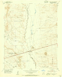 1954 La Mesita Negra1955 Print · USGSIn the mid-1950s, this area of Bernalillo County was defined by the intersection of tribal lands and the historic path of Mother Road travelers. You can trace the path of U.S. Route 66 past the Rio Puerco Trading Post and into the Town of Atrisco Grant.4 unique versions available
 - 1954 Map of Benavidez Ranch, 1955 Print
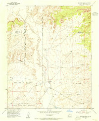 1954 Benavidez Ranch1955 Print · USGSThe Rio Puerco Valley in the mid-1950s was a landscape defined by expansive land grants and remote ranching outposts. Genealogists and researchers can trace the footprint of family holdings like Benavidez Ranch and Rio Puerco Ranch or locate the State Game and Fish Commission Bird Shelter.2 unique versions available
Showing maps 1-25 of 877
Top cities near Eastern Navajo Agency
Top neighborhoods of Eastern Navajo Agency
- Bisti historical maps
- Nahodishgish historical maps
- Tinaja historical maps
- El Morro historical maps
- El Morro historical maps
- Ramah historical maps
See more
Frequently asked questions
- What are the different types of historical maps available for Eastern Navajo Agency?
- What is the oldest map of Eastern Navajo Agency?
- Where can I purchase historical maps of Eastern Navajo Agency for my home or office?
- Where can I download high-res historical maps of Eastern Navajo Agency?
- Are there historical topographic maps available for Eastern Navajo Agency?
- Is there historical aerial imagery available for Eastern Navajo Agency?
- Where are historical maps of Eastern Navajo Agency sourced from?