1970s Maps of Eastern Navajo Agency, New Mexico
Explore 30 historic maps of Eastern Navajo Agency from the 1970s. These maps offer a rare glimpse into what life looked like during the 1970s — showing old roads, neighborhoods, homes, and landmarks that have changed or disappeared over time.
Whether you're researching your family's past, planning a metal detecting trip, or studying how Eastern Navajo Agency's landscape evolved across the 1970s, these high-resolution maps are a powerful tool for exploring the history of this region.
- Focus on a specific era: All maps on this page are from the 1970s, giving you a focused view of this time period.
- See what’s changed: Compare century-old streets, trails, and buildings to today's modern landscape using overlays and satellite layers.
- Research with precision: Use these maps for genealogy, historical research, land use analysis, or educational projects.
- View, download, or print: Maps are fully viewable online in high resolution, and can be downloaded or printed for your own records.
Start exploring Eastern Navajo Agency's history through authentic maps from the 1970s. This is your window into the past.
Eastern Navajo Agency, NM maps
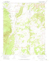
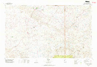
(30)- 1970 Map of Seven Lakes NW, 1973 Print
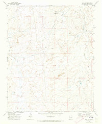
 1970 Seven Lakes NW1973 Print · USGSHigh desert rangeland in McKinley County is captured here in the early seventies, showing a landscape of resource exploration and ancient history. Researchers can trace ancestral sites at Indian Ruins or locate mid-century infrastructure like scattered Drill Holes and seasonal drainages including Fajada Wash.
 - 1970 Map of Standing Rock NW, 1973 Print
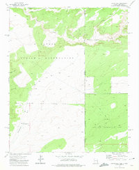
 1970 Standing Rock NW1973 Print · USGSMcKinley County, New Mexico, is captured in the early 1970s, showcasing the high-desert terrain within the Navajo Indian Reservation. Researchers can trace the courses of Standing Rock Wash and find the site of a lonely Well.
 - 1970 Map of Milk Lake, 1973 Print
 1970 Milk Lake1973 Print · USGSMcKinley County ranching and water resources are documented here during the early seventies. Genealogists and researchers can trace local landmarks like I K Ranch, the winding Kim-me-ni-oli Wash, and water sites such as Milk Lake.2 unique versions available
 - 1970 Map of Nose Rock, 1973 Print
 1970 Nose Rock1973 Print · USGSMcKinley County's high-desert landscape is captured here in the early 1970s, showing a region shaped by water management and mineral exploration. Genealogists and historians can trace the paths of Kin Klizhin Wash and locate specific landmarks like Nose Rock and Windmill No 6.
 - 1970 Map of Kin Nahzin Ruins, 1973 Print
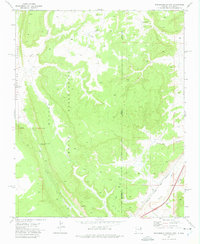
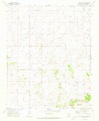 1970 Kin Nahzin Ruins1973 Print · USGSMcKinley County, New Mexico, appears in the early 1970s as a landscape of ancient ruins and modern resource exploration. Trace archaeological history at Kin Nahzin Ruins and Cliff Dwellings, or follow the path of the Continental Divide.3 unique versions available
 - 1970 Map of Toyee, 1973 Print
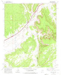
 1970 Toyee1973 Print · USGSMcKinley County, New Mexico, is shown here as it appeared in the early 1970s, focused on the high desert terrain of the Navajo Nation. Researchers can trace the layout of the settlement at Toyee, find remote water sources like Toyee Spring, and locate the Standing Rock Landing Strip.
 - 1970 Map of Red Lake Well, 1973 Print
 1970 Red Lake Well1973 Print · USGSThe Navajo Indian Reservation in the early seventies was a landscape of sparse water and cattle ranching. Trace the vital desert hydrology at Red Lake Well (Flowing) and the drainage of Indian Creek across this high-elevation terrain.
 - 1970 Map of Antelope Lookout Mesa, 1973 Print
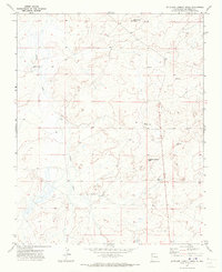 1970 Antelope Lookout Mesa1973 Print · USGSHigh-desert mesas and community centers define this part of McKinley County in the early seventies. Genealogists and historians can trace essential landmarks like the Becenti Chapter House and water sources such as the Flowing Well near Indian Creek.2 unique versions available
 - 1970 Map of Standing Rock, 1973 Print
 1970 Standing Rock1973 Print · USGSLife on the Navajo Reservation during the early seventies is documented here through its essential water sources and high-desert terrain. Researchers can locate the Standing Rock settlement, isolated Mine sites, and landmarks like Twin Peaks or Mulholland Well.
 - 1970 Map of Becenti Lake, 1974 Print
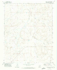 1970 Becenti Lake1974 Print · USGSMcKinley County's high-desert terrain is captured here in the early seventies, detailing the drainage of Kim-me-ni-oli Wash. Researchers can trace old Ruins, several Well sites, and the namesake Becenti Lake across this rural landscape.2 unique versions available
 - 1970 Map of Seven Lakes NE, 1974 Print
 1970 Seven Lakes NE1974 Print · USGSNorthwestern New Mexico’s high desert appears in the early 1970s as a land of ancient dwellings and modern energy extraction. Researchers can locate documented Indian Ruins and a Cliff Dwelling alongside the active Red Mountain Oil Field.
 - 1970 Map of Seven Lakes, 1983 Print
 1970 Seven Lakes1983 Print · USGSMcKinley County, New Mexico, appears in the early 1970s as a quiet expanse of high-desert ranching and resource exploration. Researchers can locate isolated landmarks like the Ruby Wells Ranch, ancient Ruins, and numerous Drill Holes along the Seven Lakes Wash.
 - 1971 Map of Hunters Point, 1975 Print
 1971 Hunters Point1975 Print · USGSThe Navajo Nation borderlands come into focus in the early seventies, detailing the valley around Black Creek. Genealogists and researchers can locate family-named landmarks like John Nez Well and Tabaha Well, alongside the Hunters Point Boarding Sch.
 - 1971 Map of Chafin Well, 1975 Print
 1971 Chafin Well1975 Print · USGSThe high-desert borderlands of Arizona and New Mexico are captured in the early seventies, marking the intersection of the Navajo Indian Reservation and Zuni Indian Reservation. Trace remote outposts and water sources like G H Begaye Well and Good Luck Spring.2 unique versions available
 - 1971 Map of Surrender Canyon, 1975 Print
 1971 Surrender Canyon1975 Print · USGSThe Arizona-New Mexico borderlands within the Navajo Indian Reservation are documented here in the early 1970s. Trace the path of the Atchison Topeka and Santa Fe railroad or locate remote landmarks like Tea Pot and Surrender Canyon.
 - 1971 Map of Lupton, 1975 Print
 1971 Lupton1975 Print · USGSIn the early 1970s, this borderland between Arizona and New Mexico was a critical transit point for the Atchison Topeka and Santa Fe railroad. Researchers can find deep-country water sources and Navajo landmarks such as Lupton Chapter House, Begay Well, and Keetsoel Spring.
 - 1972 Map of Pescado, 1976 Print
 1972 Pescado1976 Print · USGSMcKinley County tribal lands are captured in the early seventies, showing the village of Pescado and its vital water network. Trace the traditional landscape through Pescado Reservoir, the Rio Pescado, and numerous mapped ancient Ruins.
 - 1972 Map of Burned Timber Canyon, 1976 Print
 1972 Burned Timber Canyon1976 Print · USGSTribal lands and high-desert terrain define this corner of McKinley County in the early seventies. Geographers and historians can trace the paths of Nutria Road and the ridgeline of The Hogback as they pass through the Zuni Indian Reservation.
 - 1972 Map of Vanderwagen Draw, 1976 Print
 1972 Vanderwagen Draw1976 Print · USGSMcKinley County, New Mexico, appears in the early 1970s as a landscape of reservation lands and high desert drainages. Researchers can trace the Old Indian Reservation Bdy and locate landmarks such as Cousins, Gonzales Well, and Dubois Hill.
 - 1972 Map of Shoemaker Canyon SE, 1976 Print
 1972 Shoemaker Canyon SE1976 Print · USGSValencia County’s high-desert landscape in the early seventies reveals a remote world of small outposts and ancestral markers. Genealogists and historians can locate the Mares Cemetery, the Las Norias Store, and the site of Los Pinitos (Ruins).
 - 1972 Map of Horsehead Canyon NW, 1976 Print
 1972 Horsehead Canyon NW1976 Print · USGSThe Zuni Indian Reservation in the early 1970s reveals a specialized system of water management along the Rio Nutria. Researchers can trace the Old Indian Reservation Boundary and locate landmarks like Nutria Reservoir No 2 and the Nutria Campground.
 - 1972 Map of Shoemaker Canyon, 1976 Print
 1972 Shoemaker Canyon1976 Print · USGSThe Zuni and Ramah lands are captured here in the early 1970s, showing a high-desert landscape shaped by deep canyons and tribal boundaries. Researchers can locate archaeological sites like Ojo Pueblo (Ruins) and remote water features such as Miller Well.
 - 1973 Map of Chi Chil Tah, 1976 Print
 1973 Chi Chil Tah1976 Print · USGSThe Zuni Indian Reservation landscape is captured here in the early 1970s, showing a region defined by remote water sources and tribal lands. Researchers can trace land use through features like Stinkwater Well, the settlement at Chi Chil Tah, and the Arroyo drainages.
 - 1976 Map of Chaco Canyon, 1978 Print
 1976 Chaco Canyon1978 Print · USGSNorthwestern New Mexico in the mid-seventies is a landscape of ancient ruins, high desert mesas, and remote outposts. Researchers can trace the legacy of the regional economy through sites like the Huerfano Trading Post and Nageezi, or locate early industrial infrastructure within the Escrito Oil Field.
 - 1977 Map of Chaco Mesa, 1978 Print
 1977 Chaco Mesa1978 Print · USGSNorthwestern New Mexico in the late seventies remained a landscape of remote trading outposts and high-altitude mesas. Researchers can trace the location of historic commerce hubs like Star Lake Trading Post and Pueblo Pintado alongside the Continental Divide.2 unique versions available
Showing maps 1-25 of 30
Top cities near Eastern Navajo Agency
Top neighborhoods of Eastern Navajo Agency
- Bisti historical maps
- Nahodishgish historical maps
- Tinaja historical maps
- El Morro historical maps
- El Morro historical maps
- Ramah historical maps
See more
Frequently asked questions
- What are the different types of historical maps available for Eastern Navajo Agency?
- What is the oldest map of Eastern Navajo Agency?
- Where can I purchase historical maps of Eastern Navajo Agency for my home or office?
- Where can I download high-res historical maps of Eastern Navajo Agency?
- Are there historical topographic maps available for Eastern Navajo Agency?
- Is there historical aerial imagery available for Eastern Navajo Agency?
- Where are historical maps of Eastern Navajo Agency sourced from?