1990s Maps of Harding County, New Mexico
Explore 10 historic maps of Harding County from the 1990s. These maps offer a rare glimpse into what life looked like during the 1990s — showing old roads, neighborhoods, homes, and landmarks that have changed or disappeared over time.
Whether you're researching your family's past, planning a metal detecting trip, or studying how Harding County's landscape evolved across the 1990s, these high-resolution maps are a powerful tool for exploring the history of this region.
- Focus on a specific era: All maps on this page are from the 1990s, giving you a focused view of this time period.
- See what’s changed: Compare century-old streets, trails, and buildings to today's modern landscape using overlays and satellite layers.
- Research with precision: Use these maps for genealogy, historical research, land use analysis, or educational projects.
- View, download, or print: Maps are fully viewable online in high resolution, and can be downloaded or printed for your own records.
Start exploring Harding County's history through authentic maps from the 1990s. This is your window into the past.
Harding County, NM maps
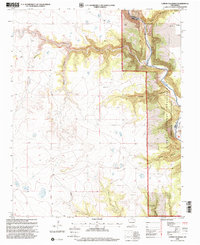
(10)- 1998 Map of Divine Lake, 2001 Print
 1998 Divine Lake2001 Print · USGSNortheastern New Mexico's high plateau country is recorded here in the late nineties where Colfax and Harding counties meet. Genealogists and researchers can trace local landmarks like Mofax Cem, the Sugarloaf Ranch, and numerous family-named sites such as Sanders East Well.
 - 1998 Map of Valencia Spring, 2001 Print
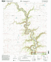
 1998 Valencia Spring2001 Print · USGSHarding County ranching country and the breaks of the canyonlands are captured here in the late nineties. Researchers can trace the cattle-working history of the area via landmarks like Carrizo Camp Windmills, the Carrizo Ch Cem, and Branding Corral Windmill.
 - 1998 Map of Canon Colorado, 2001 Print
 1998 Canon Colorado2001 Print · USGSThe high plains and deep canyonlands of Mora County are captured in the late nineties, showcasing the remote terrain of the Kiowa National Grassland. Researchers can locate the Paises Cem and the settlement of Adobe while tracing the winding path of the Canadian River.
 - 1998 Map of Jaritas Ranch, 2001 Print
 1998 Jaritas Ranch2001 Print · USGSThe high plains of Mora County met the deep breaks of the Canadian River at the end of the twentieth century. Genealogists and historians can trace family land ties near Jaritas Ranch or explore the drainage networks of Dog Canyon and Lodge Canyon.
 - 1998 Map of Kansas Valley, 2001 Print
 1998 Kansas Valley2001 Print · USGSHarding County ranching country and federal grazing lands are captured here in the late nineties, showcasing the vital water infrastructure of the high plains. You can locate remote landmarks like West Spear Windmill, the Gravel Pit, and the levees lining the Kansas Valley.
 - 1998 Map of Abbott Lake, 2001 Print
 1998 Abbott Lake2001 Print · USGSThe high plains of Harding and Colfax counties are captured here in the late twentieth century as cattle ranching and grassland conservation define the land. Genealogists can locate family landmarks like Johnson Cem, Johnson Ranch, and Case Ranch along the banks of Sauz Creek.
 - 1998 Map of Mills East, 2001 Print
 1998 Mills East2001 Print · USGSHarding County ranching country and the high plains of the Kiowa National Grassland are documented here at the close of the twentieth century. Genealogists and local historians can locate the Mills Cem, Chicosa Lake State Park, and the Rigoni Landing Strips.
 - 1998 Map of Beaver Canyon, 2001 Print
 1998 Beaver Canyon2001 Print · USGSThe Canadian River gorge cuts through the high plains of Harding and Mora counties in the late nineties. Genealogists and local historians can trace isolated landmarks like a riverside Cem and the rugged drainage systems of Beaver Canyon and Cañon Blanco.
 - 1998 Map of Spear Hills, 2001 Print
 1998 Spear Hills2001 Print · USGSNortheastern New Mexico rangelands are documented here during the late nineties, showing the managed terrain of the Kiowa National Grassland. Researchers can trace the essential water network of the high plains through named landmarks like Franks Place Well, Chateau Hill, and Carrizo Creek.
 - 1998 Map of Mills West, 2001 Print
 1998 Mills West2001 Print · USGSHarding County’s high plains and deep canyons are documented here in the late nineties, showcasing a remote ranching landscape. You can locate the Mesteñito Cem and trace the settlement at Mills alongside the dramatic breaks of the Canadian River.
End of results
Showing maps 1-10 of 10
Top cities of Harding County
Frequently asked questions
- What are the different types of historical maps available for Harding County?
- What is the oldest map of Harding County?
- Where can I purchase historical maps of Harding County for my home or office?
- Where can I download high-res historical maps of Harding County?
- Are there historical topographic maps available for Harding County?
- Is there historical aerial imagery available for Harding County?
- Where are historical maps of Harding County sourced from?