Old Maps of Harding County, New Mexico for Metal Detecting
Plan your next treasure hunt with 324 historic maps of Harding County. Find old homesites, ghost towns, trails, and gathering spots that may be lost to time — perfect for identifying promising metal detecting locations.
- Locate forgotten sites: Uncover places like long-lost settlements, abandoned rail lines, or gathering spots.
- Plan better hunts: Use map overlays combined with LiDAR or satellite views to narrow in on historically rich areas.
- Made for detectorists: Thousands of hobbyists use these maps to discover relics, coins, and hidden history.
Use these historic maps to boost your research and find new opportunities beneath the surface of Harding County.
Harding County, NM maps
(324)- 1930 Map of Tucumcari
 1930 Tucumcari1930 Print · USGSTucumcari and the surrounding ranch lands of eastern New Mexico are captured here during the peak of the steam rail era. Genealogists and historians can trace family-named sites like the Elliott Ranch, remote schools such as Bryantine Sch, and the winding Canadian River corridor.2 unique versions available
 - 1954 Map of Santa Fe, 1963 Print
 1954 Santa Fe1963 Print · USGSNew Mexico's high mountains and eastern plains meet in the mid-fifties, showing a landscape defined by the Sangre de Cristo Mountains and the Pecos River. Trace family roots and local history through San Christobal Church, Sena School, and the historic Las Vegas rail corridor.4 unique versions available
 - 1954 Map of Raton, 1963 Print
 1954 Raton1963 Print · USGSNorthern New Mexico's high-country and plains are documented here in the early sixties, showing the region's ranching and mining infrastructure. Trace the legacy of the Maxwell Land Grant, locate remote rural sites like Tafoya School, and follow the Atchison Topeka and Santa Fe Railway through the heart of Raton.3 unique versions available
 - 1954 Map of Tucumcari, 1965 Print
 1954 Tucumcari1965 Print · USGSThe high plains along the New Mexico and Texas border come alive in this mid-century survey, just as the regional highway network was maturing. Trace the historic route of U.S. 66 through Glenrio and San Jon or locate remote rail sidings like Rehm Station and Obar.2 unique versions available
 - 1954 Map of Dalhart, 1967 Print
 1954 Dalhart1967 Print · USGSThe High Plains at the junction of four states come alive in the mid-fifties, showing a landscape of rail-hub towns and cattle country. Trace the Old Santa Fe Trail or locate mid-century industrial sites like the Dry ice plant and Carbon Dioxide Works.2 unique versions available
 - 1958 Map of Raton
 1958 Raton1958 Print · USGSNorthern New Mexico and the Colorado borderlands are mapped here in the late fifties, showcasing a landscape of high peaks and historic land grants. Genealogists and historians can trace families across Picuris Pueblo, find old schoolhouses like Piedra Lumbre School, or follow the Atchison Topeka and Santa Fe rail line.3 unique versions available
 - 1958 Map of Santa Fe
 1958 Santa Fe1958 Print · USGSThe Sangre De Cristo Mountains meet the high plains in the late 1950s, showing a landscape defined by rail corridors and ranching. Genealogists can trace family-named sites like Upton Ranch or visit the Fort Union (Ruins) and Tuloso School.
 - 1958 Map of Tucumcari
 1958 Tucumcari1958 Print · USGSEastern New Mexico and the Texas Panhandle meet in this mid-century survey of the high plains ranching and rail corridor. Researchers can trace the path of Mother Road travelers through Tucumcari and Glenrio or locate remote rail stops like Nara Visa Station and Hartley Station.
 - 1958 Map of Dalhart
 1958 Dalhart1958 Print · USGSThe High Plains of the tri-state border region come alive in this mid-century survey of the ranching and rail territory around the Texas Panhandle. Genealogists and historians can trace the paths of the Atchison Topeka & Santa Fe Ry, military outposts like Dalhart Air Force No 1, and early settlements such as Pasamonte and Texline.2 unique versions available
 - 1962 Map of Dalhart
 1962 Dalhart1962 Print · USGSThe High Plains and volcanic peaks of the tri-state area are shown in detail during the early sixties. Genealogists and historians can trace the rail corridors of the Fort Worth and Denver and find industrial sites like the Cactus Ordnance Works or the Beaver Meade & Englewood Grain Elevator.
 - 1962 Map of Logan, 1966 Print
 1962 Logan1966 Print · USGSQuay County ranching and rail life are documented here in the early sixties, centered on the Logan river crossing. Researchers can trace historic family holdings like Pyle Ranch and Martinez Springs or locate the Anniston Cem near the southern plains.
 - 1966 Map of Skull Mesa, 1968 Print
 1966 Skull Mesa1968 Print · USGSNortheastern New Mexico ranching country is captured here in the mid-1960s as it straddles the Union and Harding county lines. Researchers can find old property landmarks like Zurick Ranch, the winding Shaw Brakes, and reliable water sources such as Dripping Springs.
 - 1966 Map of Pedernal Creek, 1968 Print
 1966 Pedernal Creek1968 Print · USGSHarding and Union Counties in the mid-1960s reveal a landscape shaped by water and ranching along the Tramperos Creek drainage. Researchers can locate family-named landmarks and historical sites like Pedernal Cem, Franks Dam, and North Gallegos Well.
 - 1966 Map of Rosebud, 1968 Print
 1966 Rosebud1968 Print · USGSHarding County ranching country is captured here in the mid-sixties, showing the vital water and livestock infrastructure of the high plains. Genealogists and historians can locate the Rosebud Cemetery and trace family-named sites like Matis Lake or the Brune School Section Well.
 - 1966 Map of Ione, 1968 Print
 1966 Ione1968 Print · USGSNortheastern New Mexico ranching country is captured here during the mid-sixties, showing the high-plains landscape of the Harding and Union County line. Family and local historians can trace isolated landmarks and water sources like Ione, Entrania Spring, and Mitchil.
 - 1966 Map of Hayden, 1968 Print
 1966 Hayden1968 Print · USGSNortheastern New Mexico ranching country is captured here during the mid-sixties along the Union and Harding County line. Genealogists and local historians can trace family operations at Heimann Ranch and Jacobs Ranch or locate the community Cem and Rodeo Ground near Hayden.
 - 1966 Map of Cherokee Valley, 1969 Print
 1966 Cherokee Valley1969 Print · USGSQuay County ranching and water management are frozen in time on this mid-century survey of the New Mexico high plains. Family researchers can locate early homesteads like Kaufman Ranch or trace the Cherokee Valley Cemetery and numerous family-named landmarks.
 - 1966 Map of Cottonwood Springs, 1969 Print
 1966 Cottonwood Springs1969 Print · USGSHarding County ranching lands are captured here in the mid-1960s, showing a landscape defined by water rights and cattle ranges. Researchers can locate the Maytum Cem, the remains at Cone (Ruins), and family-named landmarks like Ellis Well.
 - 1966 Map of Mc Carty Ranch, 1969 Print
 1966 Mc Carty Ranch1969 Print · USGSThe high plains of the Harding and Quay county border are captured here in the mid-1960s, showing a landscape defined by ranching and water. Genealogists and local historians can trace family-named landmarks like Tom Young Well, Casados Well, and the McCarty Ranch.
 - 1966 Map of Mc Cloy Ranch, 1969 Print
 1966 Mc Cloy Ranch1969 Print · USGSHarding and Quay counties are depicted in the mid-1960s as a specialized landscape of cattle ranching and water management. Researchers can trace historic water sources and property boundaries through labels like the Old Church Well, McCloy Ranch, and Whorial Blanca Well.2 unique versions available
 - 1968 Map of Hampton Ranch, 1971 Print
 1968 Hampton Ranch1971 Print · USGSThe high plains ranchlands of San Miguel County come into focus during the late 1960s, a landscape defined by expansive land grants and seasonal water. Researchers can trace historical ranching outposts and family landmarks like Hampton Ranch, McCuistion Camp, and the remote Bryantine Cem.
 - 1968 Map of Montesito Creek, 1971 Print
 1968 Montesito Creek1971 Print · USGSHarding and Quay Counties come to life in this late-sixties survey of the High Plains as it transitions toward the Ute Reservoir. Genealogists and historians can trace family-named landmarks like Martinez Windmill and rural sites including Montesito Sch and Alamosa Cem.2 unique versions available
 - 1968 Map of Medina Mesa, 1971 Print
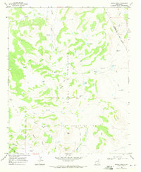 1968 Medina Mesa1971 Print · USGSSan Miguel County ranch lands and the high plateaus of the late sixties are detailed here during a period of remote southwestern surveying. You can trace the path of the Old Railroad Grade and locate isolated landmarks like Trigg Ranch and Atarque Corrals.
 - 1969 Map of Gallegos, 1972 Print
 1969 Gallegos1972 Print · USGSHarding County ranching life is preserved here in the late sixties, centered on the high plains near the Gallegos settlement. Researchers can trace family ranch boundaries and water infrastructure through labels like Gallegos Ranch, Osborn Ranch, and the local Cem.
 - 1969 Map of Gallegos NE, 1972 Print
 1969 Gallegos NE1972 Print · USGSHarding County ranching life is preserved here during the late sixties, showing a landscape defined by its vital water infrastructure. Researchers can trace historic grazing boundaries and remote outposts like Cooper Ranch, Gallegos Well, and the Twin Honeycutt Windmills.
Showing maps 1-25 of 324
Top cities of Harding County
Frequently asked questions
- What are the different types of historical maps available for Harding County?
- What is the oldest map of Harding County?
- Where can I purchase historical maps of Harding County for my home or office?
- Where can I download high-res historical maps of Harding County?
- Are there historical topographic maps available for Harding County?
- Is there historical aerial imagery available for Harding County?
- Where are historical maps of Harding County sourced from?