Old Maps of High Lonesome Wells, New Mexico for Hiking & Exploration
Hike through history with 13 historic maps of High Lonesome Wells. Explore old trails, ghost towns, and forgotten backroads — perfect for outdoor adventurers and local explorers.
- Rediscover forgotten places: Map out old mining camps, roads, and footpaths that no longer exist on modern maps.
- Layer with modern tools: Combine with LiDAR or satellite views to plan hikes through historical terrain.
- Made for exploration: Popular among hikers, overlanders, and local history lovers.
Use these maps to find adventure and explore the hidden past of High Lonesome Wells.
High Lonesome Wells, NM maps
(13)- 1917 Map of Antelope Wells, 1970 Print
 1917 Antelope Wells1970 Print · USGSThe New Mexico and Mexico border region comes alive in this 1917 survey of ranching outposts and mountain passes. Researchers can trace family-named sites like Culberson's Ranch and Lynch Ranch, alongside vital desert water sources including Antelope Wells.2 unique versions available
 - 1919 Map of Antelope Wells
 1919 Antelope Wells1919 Print · USGSThe New Mexico borderlands come into focus at the end of the Great War, showing a landscape of remote cattle ranches and vital desert water sources. Researchers can trace historic family-named sites like Culbersons Ranch and W.H.Sims Ranch or follow the old Packers Trail.2 unique versions available
 - 1955 Map of Douglas
 1955 Douglas1955 Print · USGSThe Arizona and New Mexico borderlands come into focus in the mid-1950s, highlighting the mining and ranching hubs of the Desert Southwest. Genealogists and historians can trace the foundations of Bisbee, the operations at Hachita Mine, and rural landmarks like the Double Adobe School.2 unique versions available
 - 1959 Map of Douglas, 1968 Print
 1959 Douglas1968 Print · USGSSoutheast Arizona and southwest New Mexico meet at the border in the late fifties, showcasing a high-desert landscape defined by industrial copper mining and ranching. Genealogists and historians can trace the foundations of Bisbee, locate the Lavender Pit, and follow the Southern Pacific line through Douglas.4 unique versions available
 - 1961 Map of Douglas
 1961 Douglas1961 Print · USGSThe Arizona-Mexico borderlands come into focus at mid-century, detailing the vital mining and ranching hubs of Cochise County and southwest New Mexico. Genealogists and historians can trace the Southern Pacific Railroad through Bisbee and Douglas, or locate early sites like the Old Hachita Mine and Rucker School.
 - 1964 Map of Douglas
 1964 Douglas1964 Print · USGSThe Arizona-New Mexico borderlands in the early sixties reveal a landscape of deep-rooted copper mining and high-desert ranching. Genealogists and researchers can trace the legacy of settlements like Pirtleville, the industrial site of the Copper Smelter, and remnants of the Cochise Mines.
 - 1982 Map of Hilo Peak
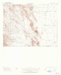
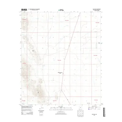
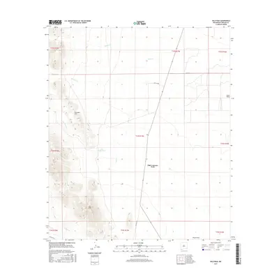
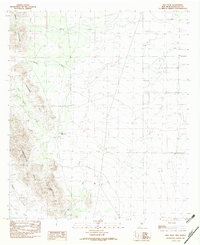 1982 Hilo Peak1982 Print · USGSHidalgo County is captured in the early eighties, showcasing a high-desert terrain dominated by the Animas Mountains. Researchers can trace old stock routes through Granite Pass or locate remote water features like Little Brushy Tank and South Tank.
 - 1983 Map of Alamo Hueco Mountains
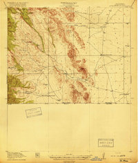
 1983 Alamo Hueco Mountains1983 Print · USGSThe New Mexico-Mexico borderlands in the early eighties reveal a landscape of remote ranching outposts and rugged mountain ranges. Researchers can trace the path of the Continental Divide and locate isolated settlements like Fitzpatricks, San Luis, and the Antelope Wells crossing.
 - 2010 Map of Hilo Peak, 2010 Print
 2010 Hilo Peak2010 Print · USGSCovers High Lonesome Wells, including Hidalgo County, United States, and other nearby areas
 - 2013 Map of Hilo Peak, 2013 Print
 2013 Hilo Peak2013 Print · USGSCovers High Lonesome Wells, including Hidalgo County, United States, and other nearby areas
 - 2017 Map of Hilo Peak, 2017 Print
 2017 Hilo Peak2017 Print · USGSCovers High Lonesome Wells, including Hidalgo County, United States, and other nearby areas
 - 2020 Map of Hilo Peak, 2020 Print
 2020 Hilo Peak2020 Print · USGSCovers High Lonesome Wells, including Hidalgo County, United States, and other nearby areas
 - 2023 Map of Hilo Peak, 2023 Print
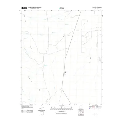
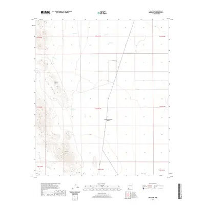
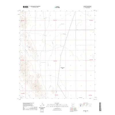 2023 Hilo Peak2023 Print · USGSHidalgo County's high desert landscape is documented here in recent detail, showing the intricate drainage systems and peaks of southwest New Mexico. Genealogists and researchers can trace the ranching corridors near High Lonesome Wells, Hilo Peak, and the Chinaman Hills.
End of results
Showing maps 1-13 of 13
Frequently asked questions
- What are the different types of historical maps available for High Lonesome Wells?
- What is the oldest map of High Lonesome Wells?
- Where can I purchase historical maps of High Lonesome Wells for my home or office?
- Where can I download high-res historical maps of High Lonesome Wells?
- Are there historical topographic maps available for High Lonesome Wells?
- Is there historical aerial imagery available for High Lonesome Wells?
- Where are historical maps of High Lonesome Wells sourced from?