1970s Maps of Luna County, New Mexico
Explore 8 historic maps of Luna County from the 1970s. These maps offer a rare glimpse into what life looked like during the 1970s — showing old roads, neighborhoods, homes, and landmarks that have changed or disappeared over time.
Whether you're researching your family's past, planning a metal detecting trip, or studying how Luna County's landscape evolved across the 1970s, these high-resolution maps are a powerful tool for exploring the history of this region.
- Focus on a specific era: All maps on this page are from the 1970s, giving you a focused view of this time period.
- See what’s changed: Compare century-old streets, trails, and buildings to today's modern landscape using overlays and satellite layers.
- Research with precision: Use these maps for genealogy, historical research, land use analysis, or educational projects.
- View, download, or print: Maps are fully viewable online in high resolution, and can be downloaded or printed for your own records.
Start exploring Luna County's history through authentic maps from the 1970s. This is your window into the past.
Luna County, NM maps
(8)- 1972 Map of Myndus, 1974 Print
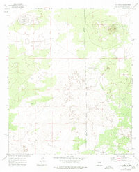
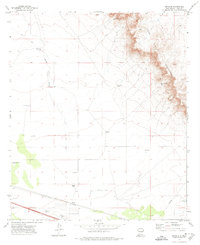 1972 Myndus1974 Print · USGSThe high desert of Luna County is seen here in the early 1970s, where the railroad dictates the layout of local life. Researchers can trace the water sources essential to this arid region, from Hannigan Well to the Simpson Ranch and the tracks of the Southern Pacific.
 - 1972 Map of Cambray, 1975 Print
 1972 Cambray1975 Print · USGSThe high desert of southern New Mexico is captured here in the early seventies along the border of Luna and Doña Ana counties. Trace the rail-and-road corridor through Cambray and find isolated landmarks like Providence Cone and Geronimo Ranch.
 - 1972 Map of Good Sight Peak NE, 1975 Print
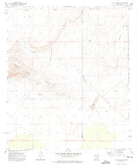
 1972 Good Sight Peak NE1975 Print · USGSIn the early 1970s, the high desert of the New Mexico borderlands remained a land of remote ranching and historic passage. Researchers can trace the legendary Butterfield Trail as it crosses the Uvas Valley near Pole M Ranch and Massacre Peak.
 - 1972 Map of Good Sight Peak, 1975 Print
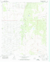
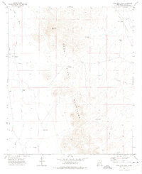 1972 Good Sight Peak1975 Print · USGSLuna County ranching and historic transit routes come alive in this mid-seventies survey of the high desert. Genealogists and historians can trace the path of the Butterfield Trail past landmarks like Good Sight Peak and the Nunn Ranch.
 - 1972 Map of X-7 Ranch, 1975 Print
 1972 X-7 Ranch1975 Print · USGSHigh-desert ranching life in the early seventies is recorded here along the Luna and Doña Ana county line. Researchers can trace the infrastructure of remote outposts like the X-7 Ranch, located near San Luis Lake and Malpais Ridge.
 - 1972 Map of Lazy E Ranch, 1975 Print
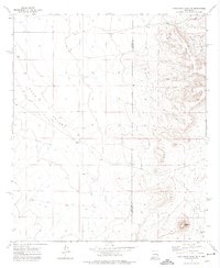
 1972 Lazy E Ranch1975 Print · USGSThe high desert of the New Mexico borderlands comes to life in this early 1970s survey of the Good Sight Mountains. Genealogists and historians can trace the vital ranching infrastructure of the era, from the Lazy E Ranch to remote water sources like Dog Town Windmill and Suman Windmill.
 - 1972 Map of Akela, 1975 Print
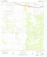 1972 Akela1975 Print · USGSIn the Chihuahuan Desert of the 1970s, this area shows a high-plains landscape shaped by transit and infrastructure. Researchers can trace the legacy of the Southern Pacific railroad alongside landmarks like the Matamoros Windmill and Akela Flats.
 - 1972 Map of Sibley Hole, 1976 Print
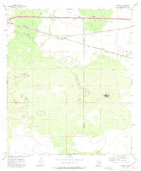
 1972 Sibley Hole1976 Print · USGSLuna County ranching country is captured here in the early 1970s, showing a landscape of remote outposts and vital water sources. Researchers can trace the layout of the White House Ranch and locate functional desert landmarks like High Lonesome Windmill and Sibley Hole.
End of results
Showing maps 1-8 of 8
Top cities of Luna County
Frequently asked questions
- What are the different types of historical maps available for Luna County?
- What is the oldest map of Luna County?
- Where can I purchase historical maps of Luna County for my home or office?
- Where can I download high-res historical maps of Luna County?
- Are there historical topographic maps available for Luna County?
- Is there historical aerial imagery available for Luna County?
- Where are historical maps of Luna County sourced from?