1990s Maps of Deming, New Mexico
Explore 4 historic maps of Deming from the 1990s. These maps offer a rare glimpse into what life looked like during the 1990s — showing old roads, neighborhoods, homes, and landmarks that have changed or disappeared over time.
Whether you're researching your family's past, planning a metal detecting trip, or studying how Deming's landscape evolved across the 1990s, these high-resolution maps are a powerful tool for exploring the history of this region.
- Focus on a specific era: All maps on this page are from the 1990s, giving you a focused view of this time period.
- See what’s changed: Compare century-old streets, trails, and buildings to today's modern landscape using overlays and satellite layers.
- Research with precision: Use these maps for genealogy, historical research, land use analysis, or educational projects.
- View, download, or print: Maps are fully viewable online in high resolution, and can be downloaded or printed for your own records.
Start exploring Deming's history through authentic maps from the 1990s. This is your window into the past.
Deming, NM maps
(4)- 1996 Map of Bowlin Ranch, 2003 Print
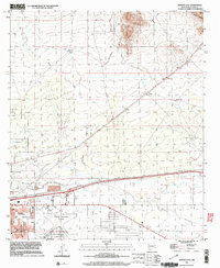
 1996 Bowlin Ranch2003 Print · USGSThe southern outskirts of Deming and the surrounding high desert are captured here in the mid-1990s. Researchers can trace rural infrastructure including the Sunshine Sch, the namesake Bowlin Ranch, and the Hermanas Grade.
 - 1996 Map of Deming West, 2003 Print
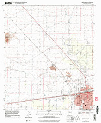 1996 Deming West2003 Print · USGSDeming stood as a bustling rail and industrial crossroads in the late nineties, where the high desert meets a growing urban grid. Genealogists and historians can trace local landmarks like Holy Cross Cem, the Asarco Mill, and the settlement at Peruhill.
 - 1996 Map of Capitol Dome, 2003 Print
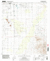 1996 Capitol Dome2003 Print · USGSIn the mid-1990s, the desert basin of Luna County met the high peaks of the Florida Mountains in a landscape of ranching and mining. Trace family land at Spanish Stirrup Ranch or explore the mountain terrain of Rock Hound State Park and the Copper Queen Mine.
 - 1996 Map of Deming East, 2003 Print
 1996 Deming East2003 Print · USGSDeming and the surrounding high desert are captured in the late twentieth century as the city expanded along the river and rail lines. Genealogists and historians can trace local landmarks like Mountain View Cemetery, the Bell School, and the path of the Southern Pacific railroad.
End of results
Showing maps 1-4 of 4
Top neighborhoods of Deming
Frequently asked questions
- What are the different types of historical maps available for Deming?
- What is the oldest map of Deming?
- Where can I purchase historical maps of Deming for my home or office?
- Where can I download high-res historical maps of Deming?
- Are there historical topographic maps available for Deming?
- Is there historical aerial imagery available for Deming?
- Where are historical maps of Deming sourced from?