1960s Maps of San Juan County, New Mexico
Explore 82 historic maps of San Juan County from the 1960s. These maps offer a rare glimpse into what life looked like during the 1960s — showing old roads, neighborhoods, homes, and landmarks that have changed or disappeared over time.
Whether you're researching your family's past, planning a metal detecting trip, or studying how San Juan County's landscape evolved across the 1960s, these high-resolution maps are a powerful tool for exploring the history of this region.
- Focus on a specific era: All maps on this page are from the 1960s, giving you a focused view of this time period.
- See what’s changed: Compare century-old streets, trails, and buildings to today's modern landscape using overlays and satellite layers.
- Research with precision: Use these maps for genealogy, historical research, land use analysis, or educational projects.
- View, download, or print: Maps are fully viewable online in high resolution, and can be downloaded or printed for your own records.
Start exploring San Juan County's history through authentic maps from the 1960s. This is your window into the past.
San Juan County, NM maps
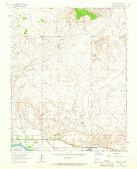
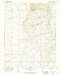
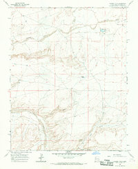
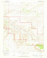
(82)- 1960 Map of Bloomfield, 1963 Print
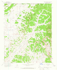
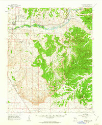 1960 Bloomfield1963 Print · USGSSan Juan County in the early sixties was a landscape of rapid industrial growth meeting traditional river valley life. Genealogists and researchers can trace the community footprints of Bloomfield and Blanco, finding local landmarks like St Marys Ch and the Hammond Cem.3 unique versions available
 - 1961 Map of Durango
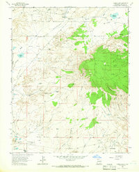
 1961 Durango1961 Print · USGSThe high San Juan country in the early sixties is shown here as a network of historic mining towns and early reservoir projects. Genealogists and researchers can trace the Denver & Rio Grande Western RR as it connects Durango, Silverton, and Arboles.
 - 1962 Map of Aztec
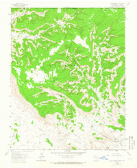
 1962 Aztec1962 Print · USGSNorthwestern New Mexico in the early sixties showcases a landscape defined by the arrival of the Navajo Reservoir and the high-altitude timber of the Carson National Forest. Trace the path of the Denver & Rio Grande Western RR or locate historic settlements like Tierra Amarilla and Gobernador.
 - 1962 Map of Cortez
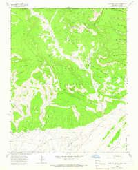
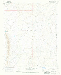
 1962 Cortez1962 Print · USGSThe Four Corners region comes alive in the early sixties, showing a landscape defined by reservation lands and federal forests. Trace the route of the Rio Grande Southern RR or locate the Uranium and vanadium mines near Monticello.
 - 1963 Map of Durango
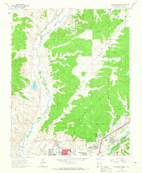
 1963 Durango1963 Print · USGSThe San Juan Mountains and San Luis Valley are captured here in the early 1950s as mining, rail, and tribal lands shaped the region. Researchers can trace the Denver & Rio Grande Western RR through high-country towns like Telluride and Silverton, or locate landmarks such as the Asiatic Mine.
 - 1963 Map of Farmington North, 1965 Print
 1963 Farmington North1965 Print · USGSFarmington's northern expansion during the early sixties shows the city pushing toward the mesas as the local energy economy took shape. Genealogists and local historians can trace school sites like Ladera del Norte Sch and the Denver and Rio Grande Western rail corridor.2 unique versions available
 - 1963 Map of La Plata, 1965 Print
 1963 La Plata1965 Print · USGSThe high desert of San Juan County meets the Colorado border in the early sixties, where river irrigation transforms the arid valley. Genealogists and historians can locate family sites at Two Cross Ranch, the La Plata Cem, and the old Morgan Mines.3 unique versions available
 - 1963 Map of Flora Vista, 1965 Print
 1963 Flora Vista1965 Print · USGSSan Juan County saw significant growth in the early sixties as the Animas River valley balanced agriculture and industry. Genealogists and historians can trace family locations near Flora Vista Cem, Elledge Mill, and the Aztec Ruins.4 unique versions available
 - 1963 Map of Adobe Downs Ranch, 1965 Print
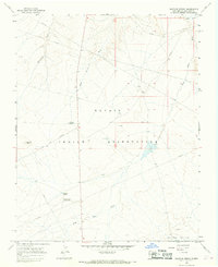
 1963 Adobe Downs Ranch1965 Print · USGSThe high desert along the New Mexico-Colorado border comes into focus in the early sixties as energy exploration began to dot the mesas. Researchers can trace ranching and water history through the Wilson Ranch and various earthen works like Pee Wee Dam and Oliver Dam.2 unique versions available
 - 1963 Map of Youngs Lake, 1966 Print
 1963 Youngs Lake1966 Print · USGSThe high desert of San Juan County was an active energy frontier in the early 1960s, where industrial development met traditional reservation lands. Trace the footprint of the oil and gas industry at Flare Hill and the Refinery, or locate early recreation spots like Macu Racetrack.3 unique versions available
 - 1963 Map of Heifer Point, 1966 Print
 1963 Heifer Point1966 Print · USGSThe Colorado and New Mexico borderlands come alive in the early sixties, showing a landscape defined by ancestral tribal lands and modern energy exploration. Researchers can find Ruins near Picket Canyon and trace water sources like Navajo Spring.2 unique versions available
 - 1963 Map of Purgatory Canyon, 1966 Print
 1963 Purgatory Canyon1966 Print · USGSThe high desert canyons of the New Mexico-Colorado border are captured here in the early sixties, as the energy industry transformed the plateau. Researchers can trace the development of the Verde Oil Field and Barker Dome across the Ute Mountain Indian Reservation.3 unique versions available
 - 1963 Map of Waterflow, 1966 Print
 1963 Waterflow1966 Print · USGSJewett Valley and Waterflow sit along the San Juan River in the early sixties, caught between traditional irrigation and a growing energy economy. Researchers can trace local coal history at the Adamson Mines or locate family sites like the Jewett Valley Cem and Sacred Heart Academy.3 unique versions available
 - 1965 Map of Aztec
 1965 Aztec1965 Print · USGSNorthern New Mexico and southern Colorado come alive in the mid-sixties, from the San Juan Basin to the high Jemez Mountains. Trace the narrow-gauge Denver & Rio Grande Western RR through Monero or locate old outposts like Blanco Trading Post.
 - 1965 Map of Farmington South, 1969 Print
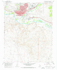 1965 Farmington South1969 Print · USGSMid-century Farmington is shown at a pivotal moment of growth along the Animas River and San Juan River in the 1960s. Researchers can locate local landmarks like Greenlawn Cem, the San Juan Mission, and the Denver and Rio Grande Western rail lines.3 unique versions available
 - 1965 Map of Gallegos Trading Post, 1969 Print
 1965 Gallegos Trading Post1969 Print · USGSSan Juan County saw a surge in energy exploration during the mid-sixties as pipelines began to crisscross the high desert. Genealogists and historians can trace local landmarks like Gallegos Trading Post and family-named features like McKay Windmill.2 unique versions available
 - 1965 Map of Horn Canyon, 1970 Print
 1965 Horn Canyon1970 Print · USGSBloomfield and the San Juan River valley are captured here in the mid-sixties during a period of expanding energy development and water management. Researchers can trace the growth of Desert Hills, locate the Riverside Ch, and find family landmarks like Gallegos Spring.2 unique versions available
 - 1965 Map of Hugh Lake, 1970 Print
 1965 Hugh Lake1970 Print · USGSSan Juan County in the mid-sixties exhibits a high-desert landscape being reshaped by the energy industry. Genealogists and historians can trace old ranching landmarks like English Well and Coppinger Well alongside an expanding grid of Oil Well sites and the West Fork Gallegos Canyon.2 unique versions available
 - 1966 Map of Cortez
 1966 Cortez1966 Print · USGSThe Four Corners region in the mid-sixties reveals a landscape of high mesas, tribal lands, and archaeological preserves. Researchers can trace the ancient sites at Hovenweep National Monument, follow the Denver & Rio Grande Western Railroad, or locate old settlements like Ginger Hill and Yellow Jacket.
 - 1966 Map of Durango
 1966 Durango1966 Print · USGSSouthwestern Colorado and the New Mexico borderlands are shown here in the mid-1960s, a time when the narrow-gauge rail network still tied the high peaks to the valley floor. Researchers can trace the Denver & Rio Grande Western Railroad between settlements like Silverton, Antonito, and Pagosa Springs.2 unique versions available
 - 1966 Map of Yellow Hill, 1968 Print
 1966 Yellow Hill1968 Print · USGSThe Navajo Nation in the mid-1960s reveals a high-desert landscape shaped by geology and water management. Trace the pathways of Dead Mans Wash and Pajarito Creek or locate landmarks like Yellow Hill and Big Gap Reservoir.3 unique versions available
 - 1966 Map of The Hogback North, 1968 Print
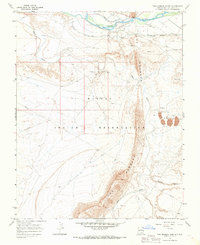 1966 The Hogback North1968 Print · USGSThe Navajo Nation in the mid-1960s was defined by its industrial resources and the towering ridge of The Hogback. Researchers can trace the legacy of energy extraction at the Hogback Oil Field or locate historic waterworks like the Fruitland Irrigation Canal.3 unique versions available
 - 1966 Map of Sulphur Spring, 1968 Print
 1966 Sulphur Spring1968 Print · USGSThe Navajo Nation in the mid-1960s reveals an environment shaped by both traditional landmarks and modern energy extraction. Researchers can trace early infrastructure like pipelines and oil wells near Sulphur Spring and the Chaco River.3 unique versions available
 - 1966 Map of Tanner Lake, 1969 Print
 1966 Tanner Lake1969 Print · USGSIn the mid-1960s, this San Juan County landscape was a rugged terrain of high-desert washes and seasonal waters. Researchers can trace remote desert landmarks and water sources like Tsaya Spring, Dog Eye Pond, and the wide course of the Chaco River.
 - 1966 Map of Pueblo Bonito, 1969 Print
 1966 Pueblo Bonito1969 Print · USGSThe San Juan Basin in the mid-sixties reveals a landscape of massive archaeological significance within Chaco Canyon National Monument. Researchers and historians can trace the proximity of the Chaco Canyon Trading Post to ancient Great Houses like Pueblo Bonito Ruins and Chetro Ketl Ruins.
Showing maps 1-25 of 82
Top cities of San Juan County
Frequently asked questions
- What are the different types of historical maps available for San Juan County?
- What is the oldest map of San Juan County?
- Where can I purchase historical maps of San Juan County for my home or office?
- Where can I download high-res historical maps of San Juan County?
- Are there historical topographic maps available for San Juan County?
- Is there historical aerial imagery available for San Juan County?
- Where are historical maps of San Juan County sourced from?