1950s Maps of San Juan County, New Mexico
Explore 31 historic maps of San Juan County from the 1950s. These maps offer a rare glimpse into what life looked like during the 1950s — showing old roads, neighborhoods, homes, and landmarks that have changed or disappeared over time.
Whether you're researching your family's past, planning a metal detecting trip, or studying how San Juan County's landscape evolved across the 1950s, these high-resolution maps are a powerful tool for exploring the history of this region.
- Focus on a specific era: All maps on this page are from the 1950s, giving you a focused view of this time period.
- See what’s changed: Compare century-old streets, trails, and buildings to today's modern landscape using overlays and satellite layers.
- Research with precision: Use these maps for genealogy, historical research, land use analysis, or educational projects.
- View, download, or print: Maps are fully viewable online in high resolution, and can be downloaded or printed for your own records.
Start exploring San Juan County's history through authentic maps from the 1950s. This is your window into the past.
San Juan County, NM maps
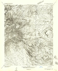
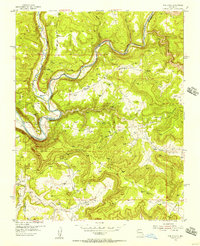
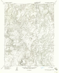
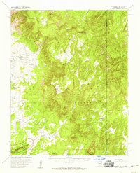
(31)- 1953 Map of Sanostee, 1954 Print
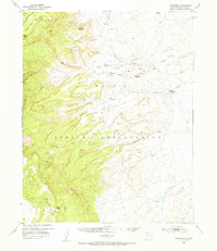 1953 Sanostee1954 Print · USGSThe high desert of northwestern New Mexico is captured here in the mid-fifties, featuring the eastern slopes of the Chuska Mountains. Genealogists and historians can locate early centers of commerce like the Sanostee Trading Post and trace the complex network of irrigation ditches along Pena Blanca Creek.
 - 1953 Map of Redrock Valley NE, 1954 Print
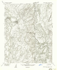
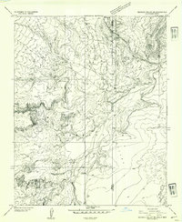 1953 Redrock Valley NE1954 Print · USGSThe high desert of the Navajo Indian Reservation comes alive in this early 1950s survey of the Four Corners borderlands. Researchers can trace the path of Red Rock Creek or locate isolated landmarks like the Emergency Landing Strip and Oak Spring.
 - 1953 Map of Redrock Valley SE, 1954 Print
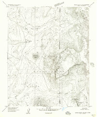
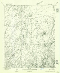 1953 Redrock Valley SE1954 Print · USGSThe Navajo Nation high desert comes into focus during the early fifties, documenting a landscape shaped by geological landmarks and traditional trade. Researchers can locate remote centers like the Red Rock Trading Post, Red Rock School, and the distinctive The Thumb peak.
 - 1953 Map of Pastora Peak NE, 1954 Print
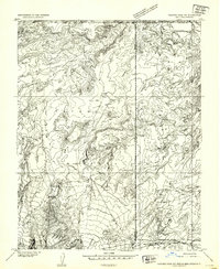 1953 Pastora Peak NE1954 Print · USGSThe Four Corners region in the early fifties shows a landscape of remote trading posts and vital water sources at the intersection of four states. Researchers can locate the Teec Nos Pos Trading Post, trace the San Juan River, and identify the early Emergency Landing Strip.
 - 1953 Map of Pastora Peak SE, 1954 Print
 1953 Pastora Peak SE1954 Print · USGSThe high-desert borderlands of Arizona and New Mexico appear in the early 1950s as a landscape of deep canyons and isolated outposts. Researchers can trace the rugged topography of Cottonwood Canyon and locate local landmarks like the Beclabito Trading Post.
 - 1953 Map of Pastora Peak, 1956 Print
 1953 Pastora Peak1956 Print · USGSThe Navajo Nation high country is captured here during the mid-fifties, centered on the towering heights of the Carrizo Mountains. Researchers can locate early outposts and community hubs like Teec Nos Pos, the Carrizo Mission Sch, and Foutz Trading Post.2 unique versions available
 - 1953 Map of Redrock Valley, 1956 Print
 1953 Redrock Valley1956 Print · USGSThe Navajo Nation's high-desert country comes into focus in the early fifties, where the Arizona and New Mexico borders meet. Geologists and local historians can trace the foundations of Red Rock and Black Rock, or locate early Mines and the remote Cove Sch.2 unique versions available
 - 1953 Map of Durango, 1963 Print
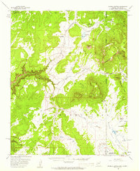
 1953 Durango1963 Print · USGSThe high peaks of the San Juan Mountains and the Colorado mining country are shown here as they appeared in the early fifties. Genealogists and local historians can trace the rail lines of the D & R G W RR and locate historic mining camps like Silverton, Ouray, and Old Ophir.
 - 1954 Map of Durango
 1954 Durango1954 Print · USGSSouthern Colorado in the mid-1950s was defined by high-altitude mining towns and the expansion of water storage in the San Luis Valley. Trace the narrow-gauge Denver & Rio Grande Western RR as it connects Durango to mountain outposts like Silverton and Creede.2 unique versions available
 - 1954 Map of Shiprock
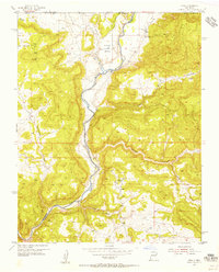
 1954 Shiprock1954 Print · USGSThe Four Corners region in the mid-fifties reveals a vast landscape of tribal lands and desert landmarks. Researchers can trace the mid-century footprints of the Navajo Indian Reservation, identifying remote Trading Posts, the early growth of Farmington, and the iconic spire of Ship Rock.5 unique versions available
 - 1954 Map of Allison, 1955 Print
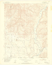 1954 Allison1955 Print · USGSSettlements along the New Mexico border were defined by the railroad and river in the mid-1950s. You can trace the historic Denver and Rio Grande Western line through Allison and Arboles or locate the Cem and irrigation works like the Pine River Canal.7 unique versions available
 - 1954 Map of Pine River, 1956 Print
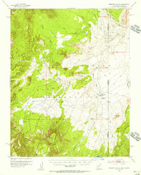
 1954 Pine River1956 Print · USGSThe San Juan Basin in the mid-1950s was a landscape defined by both deep canyons and an emerging energy industry. Researchers can trace early infrastructure like the pipeline network and gas wells set against landmarks like Smith Pass and Pine River.4 unique versions available
 - 1954 Map of Burnt Mesa, 1956 Print
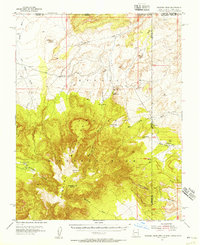
 1954 Burnt Mesa1956 Print · USGSThe high mesas of San Juan County are documented here in the mid-1950s, showing a landscape of family ranching outposts and deep river canyons. Genealogists can locate named homesteads like the Lucero Place and Mullen Place or the site of the Benito Sch.3 unique versions available
 - 1954 Map of Rosa, 1956 Print
 1954 Rosa1956 Print · USGSThe San Juan River valley of the mid-1950s shows the community of Rosa and its outlying ranching infrastructure just before major landscape shifts. Researchers can locate the Santa Rosa Ch, the local Cem, and early energy developments like the Pipe Line.5 unique versions available
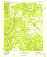
 - 1954 Map of Aztec, 1975 Print
 1954 Aztec1975 Print · USGSNorthern New Mexico and southern Colorado come alive in the mid-1950s, showing the high-country settlements and tribal lands of the San Juan Basin. Genealogists and historians can trace the path of the Denver & Rio Grande Western RR and locate communities like Abiquiu, Park View, and Lumberton.4 unique versions available
 - 1955 Map of Sonsala Butte 4 SE, 1958 Print
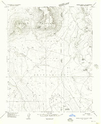 1955 Sonsala Butte 4 SE1958 Print · USGSThe high-desert terrain of the Arizona-New Mexico border is captured here in the mid-fifties within the Navajo Indian Reservation. Genealogists and historians can locate Graves, remote water sources like Black Salt Spring, and landmarks such as the Sonsela Buttes.
 - 1955 Map of Sonsala Butte 1 SE, 1958 Print
 1955 Sonsala Butte 1 SE1958 Print · USGSThe high Lukachukai Mountains are captured in the mid-1950s at the intersection of the Arizona and New Mexico state lines. Researchers can trace the rugged topography of the Navajo Indian Reservation including Tsaile Peak, local Ruins, and the headwaters of Tsaile Creek.
 - 1955 Map of Sonsala Butte 1 NE, 1958 Print
 1955 Sonsala Butte 1 NE1958 Print · USGSHigh in the Tunitcha Mountains during the mid-1950s, this survey captures a rugged borderland within the Navajo Indian Reservation. Researchers can trace the drainage of Tsaile Creek and locate high-altitude landmarks like the Lookout on Roof Butte.
 - 1955 Map of Sonsala Butte 4 NE, 1958 Print
 1955 Sonsala Butte 4 NE1958 Print · USGSThe high borderlands of the Arizona-New Mexico line are captured here in the mid-1950s, centered on the Navajo Indian Reservation. Researchers can trace early water infrastructure and landforms from Upper Wheatfields to the heights of White Cone and the Beshlaht hdas Cliffs.
 - 1955 Map of Sonsela Buttes, 1959 Print
 1955 Sonsela Buttes1959 Print · USGSThe high plateau of the Navajo Nation comes to life in the mid-fifties, spanning the border between Arizona and New Mexico. Researchers can trace land use at Chee Dodge Ranch and follow old routes through Lower Wheatfields or the Beshthalthaa Cliffs.3 unique versions available
 - 1955 Map of Lukachukai, 1959 Print
 1955 Lukachukai1959 Print · USGSThe Navajo Indian Reservation in the mid-1950s is captured here, centering on the communities of Lukachukai and Tsaile. Local historians can trace the foundations of these settlements through landmarks like St Isabel Mission, St Ann Church, and the Lukachukai Trading Post.2 unique versions available
 - 1956 Map of Cortez, 1972 Print
 1956 Cortez1972 Print · USGSThe Four Corners region comes alive in this mid-century study of the high plateaus and deep canyons surrounding Cortez. Trace the development of desert outposts like Towaoc or follow the historic Laramie Trail across a landscape dotted with ancient sites at Mesa Verde National Park.2 unique versions available
 - 1958 Map of Cortez
 1958 Cortez1958 Print · USGSThe Four Corners region comes alive in the late fifties, showing the interplay between expanding mountain settlements and ancient archeological sites. Trace the layout of Cortez, Monticello, and Blanding alongside landmarks like Mesa Verde National Park and Fort Lewis A&M College.
 - 1958 Map of Shiprock
 1958 Shiprock1958 Print · USGSThe Four Corners region in the mid-fifties shows a vast network of remote outposts and river settlements. You can locate numerous historic sites like the Emmanuel Mission and several commercial hubs such as Burnham Trading Post and Bisti Trading Post.
 - 1958 Map of Aztec
 1958 Aztec1958 Print · USGSNorthern New Mexico and the southern Colorado border are captured here during the mid-fifties, showing the rugged intersection of national forests and tribal lands. Researchers can trace the Denver and Rio Grande Western rail line and locate remote outposts like Blanco Trading Post or Sargent Ranch.
Showing maps 1-25 of 31
Top cities of San Juan County
Frequently asked questions
- What are the different types of historical maps available for San Juan County?
- What is the oldest map of San Juan County?
- Where can I purchase historical maps of San Juan County for my home or office?
- Where can I download high-res historical maps of San Juan County?
- Are there historical topographic maps available for San Juan County?
- Is there historical aerial imagery available for San Juan County?
- Where are historical maps of San Juan County sourced from?