Old Maps of San Juan County, New Mexico for Academic Research
Study the evolution of San Juan County with 736 high-resolution historic maps. Whether you're teaching, researching, or modeling changes in land use, these maps provide essential visual documentation of urban, environmental, and geographic change.
- Analyze long-term change: Track patterns in development, transportation, and natural features.
- Ideal for environmental or urban studies: Support academic projects with primary historical map data.
- Use in the classroom or lab: Educators and researchers rely on these maps to bring historical context to life.
These maps are a powerful tool for teaching, research, and visualizing how San Juan County has changed over the decades.
San Juan County, NM maps
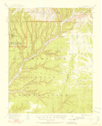
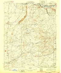
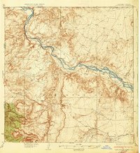
(736)- 1889 Map of Largo
 1889 Largo1889 Print · USGSNorthwestern New Mexico in the late nineteenth century shows a vast network of desert canyons and river valleys before modern development. Genealogists and researchers can trace early settlements like Bloomfield and Largo or locate landmarks such as Angels Peak and the remote Stinking Lakes Sinks.
 - 1889 Map of Chaco
 1889 Chaco1889 Print · USGSNorthwestern New Mexico appears here in the late nineteenth century as a frontier of emerging river settlements and high-desert springs. Researchers can trace early footprints at Farmington and Aztec, or locate watering points like Sheep Spring and Seven Lakes.
 - 1892 Map of Chaco
 1892 Chaco1892 Print · USGSNorthwestern New Mexico in the late nineteenth century reveals the early river-side foundations of the Four Corners region. Genealogists and historians can trace the development of Farmington, Aztec, and Jewett along the San Juan River and the high desert outpost of Seven Lakes.5 unique versions available
 - 1892 Map of Canyon De Chelly
 1892 Canyon De Chelly1892 Print · USGSApache County's high desert and deep sandstone canyons are documented here in the early 1890s, shortly after the initial 1883 survey. Modern researchers can trace the intricate drainages of Canyon De Chelly and find early water sources like Hospitito Spring and Tatezaka Tank.5 unique versions available
 - 1895 Map of Largo, 1897 Print
 1895 Largo1897 Print · USGSNorthwestern New Mexico appears as a rugged frontier of canyons and high peaks in the years before statehood. Researchers can trace early settlements at Bloomfield and Largo or locate iconic landmarks such as El Huerfano and the headwaters of Canon Largo.3 unique versions available
 - 1908 Map of Ignacio
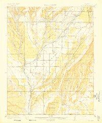
 1908 Ignacio1908 Print · USGSLa Plata County and the Southern Ute lands are captured here in the first decade of the twentieth century. Genealogists and rail historians can trace the early growth of Durango and locate rural landmarks such as the Ute Indian Agency, Pinkerton Hot Springs, and the Oxford PO.3 unique versions available
 - 1912 Map of Soda Canyon
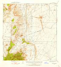
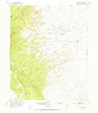
 1912 Soda Canyon1912 Print · USGSMontezuma County at the dawn of modern archaeology reveals a landscape dotted with ancestral dwellings. Researchers can trace the early documentation of Cliff Palace, Sprucetree House, and Balcony House alongside the winding course of the Mancos River.7 unique versions available
 - 1913 Map of Red Mesa
 1913 Red Mesa1913 Print · USGSLa Plata County's high mesa country is captured here shortly after the turn of the century, showing a landscape of early homesteads and irrigation ditches. Researchers can locate the Mormon Church, several early schools like Rockville School, and the tracks of the Rio Grande Southern RR.4 unique versions available
 - 1915 Map of Soda Canyon
 1915 Soda Canyon1915 Print · USGSSouthwestern Colorado at the onset of the Great War reveals a landscape defined by deep canyons and ancient ruins. Archaeologists and historians can trace the early locations of Cliff Palace, the Double Walled Tower, and Waters Ranch.7 unique versions available
 - 1924 Map of Ignacio, 1939 Print
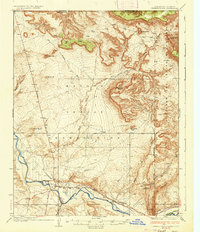
 1924 Ignacio1939 Print · USGSLa Plata County during the mid-1920s reveals a landscape shaped by the Denver and Rio Grande Railroad and the carving of the Animas River. Researchers can trace the early layout of DURANGO, locate remote mountain schoolhouses like Little Red Sch, and identify historic boundaries such as the South Boundary Ceded Ute Land.4 unique versions available
 - 1924 Map of Pagosa Springs, 1958 Print
 1924 Pagosa Springs1958 Print · USGSArchuleta County comes into focus in the 1920s as a vital mountain corridor defined by the San Juan and Piedra rivers. Genealogists and historians can trace the Denver and Rio Grande Western rail line and discover remote schoolhouses like Stollsteimer School and O'Neal Park School.2 unique versions available
 - 1927 Map of Pagosa Springs
 1927 Pagosa Springs1927 Print · USGSThe high country of the San Juan Mountains comes into focus in the 1920s as ranching and rail reach into the river valleys. Genealogists and historians can trace the Denver and Rio Grande Western line through Pagosa Junction and locate old rural hubs like Yellowjacket School.3 unique versions available
 - 1927 Map of Sulphur Spring
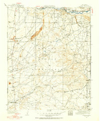
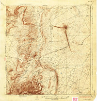
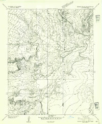
 1927 Sulphur Spring1927 Print · USGSSan Juan County was a region of remote outposts and river crossings during the late 1920s. Researchers can trace the early desert road network including the Shiprock Gallup Highway and locate historic hubs like Wheeler Trading Post and Bisti Trading Post.
 - 1928 Map of Kirtland, 1955 Print
 1928 Kirtland1955 Print · USGSSan Juan County at the close of the 1920s shows a landscape of riverfront farming and remote desert commerce. Genealogists and historians can trace the network of isolated hubs like Wheeler Trading Post, Nava PO, and the early workings of a Coal Mine.
 - 1932 Map of Kirtland
 1932 Kirtland1932 Print · USGSThe Navajo Nation's high desert landscape and the San Juan River valley are documented here in the early thirties. Genealogists and historians can trace essential early hubs like the Wheeler Trading Post, the Oil Pumping Sta near Barber Peak, and the community at Fruitland.
 - 1934 Map of Ship Rock, 1955 Print
 1934 Ship Rock1955 Print · USGSThe high desert of San Juan County during the mid-1930s is revealed through this detailed topographic survey of the Navajo Nation. Geologists and local historians can trace the paths of the Red Rock Highway or locate water sources like Sheep Spring and Mud Spring.4 unique versions available
 - 1934 Map of Chimney Rock, 1967 Print
 1934 Chimney Rock1967 Print · USGSThe Navajo and Southern Ute borders met along the San Juan River in the mid-1930s, creating a crossroads of tribal administration and desert agriculture. Genealogists and historians can locate the Shiprock Indian Agency, the Agency Coal Mine, and the path of the Old Mormon Trail.
 - 1934 Map of Rattlesnake, 1971 Print
 1934 Rattlesnake1971 Print · USGSThe San Juan River basin and the Four Corners intersection are captured here in the mid-1930s. Researchers can trace the early road networks and small settlements of the Navajo Indian Reservation, including Rattlesnake, Cudai, and Bitlabito.
 - 1936 Map of Chimney Rock
 1936 Chimney Rock1936 Print · USGSThe Navajo and Southern Ute borders met along the San Juan River in the mid-1930s, showing a landscape defined by both geologic wonders and early industry. Trace the path of the Old Mormon Trail or locate early coal operations at the Agency Coal Mine.2 unique versions available
 - 1937 Map of Ship Rock
 1937 Ship Rock1937 Print · USGSThe Navajo Nation territory comes into focus in the mid-1930s, centered on the towering geological monadnock and the high-plateau borderlands. Trace early travel routes like the Red Rock Highway past isolated landmarks including Mitten Rock and Mud Spring.4 unique versions available
 - 1937 Map of Rattlesnake
 1937 Rattlesnake1937 Print · USGSThe high desert borderlands where New Mexico meets Colorado and Arizona are captured here in the mid-1930s. Researchers can trace early reservation life near the San Juan River and locate historic points like Bitlabito, Cudai, and Rattlesnake.3 unique versions available
 - 1945 Map of Durango
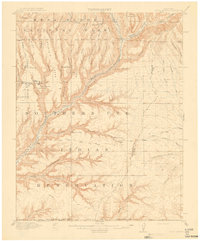
 1945 Durango1945 Print · USGSSouthwest Colorado and Northern New Mexico at mid-century are defined by the high peaks of the San Juan Range and the tribal lands of the Southern Ute. Genealogists and historians can trace the paths of the D & R G W RR and locate local landmarks like Animas City and the Blanco Basin School.3 unique versions available
 - 1953 Map of Sanostee, 1954 Print
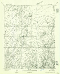
 1953 Sanostee1954 Print · USGSThe high desert of northwestern New Mexico is captured here in the mid-fifties, featuring the eastern slopes of the Chuska Mountains. Genealogists and historians can locate early centers of commerce like the Sanostee Trading Post and trace the complex network of irrigation ditches along Pena Blanca Creek.
 - 1953 Map of Redrock Valley NE, 1954 Print
 1953 Redrock Valley NE1954 Print · USGSThe high desert of the Navajo Indian Reservation comes alive in this early 1950s survey of the Four Corners borderlands. Researchers can trace the path of Red Rock Creek or locate isolated landmarks like the Emergency Landing Strip and Oak Spring.
 - 1953 Map of Redrock Valley SE, 1954 Print
 1953 Redrock Valley SE1954 Print · USGSThe Navajo Nation high desert comes into focus during the early fifties, documenting a landscape shaped by geological landmarks and traditional trade. Researchers can locate remote centers like the Red Rock Trading Post, Red Rock School, and the distinctive The Thumb peak.
Showing maps 1-25 of 736
Top cities of San Juan County
Frequently asked questions
- What are the different types of historical maps available for San Juan County?
- What is the oldest map of San Juan County?
- Where can I purchase historical maps of San Juan County for my home or office?
- Where can I download high-res historical maps of San Juan County?
- Are there historical topographic maps available for San Juan County?
- Is there historical aerial imagery available for San Juan County?
- Where are historical maps of San Juan County sourced from?