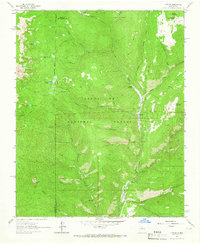
1960s Maps of Santa Fe County, New Mexico
Explore 20 historic maps of Santa Fe County from the 1960s. These maps offer a rare glimpse into what life looked like during the 1960s — showing old roads, neighborhoods, homes, and landmarks that have changed or disappeared over time.
Whether you're researching your family's past, planning a metal detecting trip, or studying how Santa Fe County's landscape evolved across the 1960s, these high-resolution maps are a powerful tool for exploring the history of this region.
- Focus on a specific era: All maps on this page are from the 1960s, giving you a focused view of this time period.
- See what’s changed: Compare century-old streets, trails, and buildings to today's modern landscape using overlays and satellite layers.
- Research with precision: Use these maps for genealogy, historical research, land use analysis, or educational projects.
- View, download, or print: Maps are fully viewable online in high resolution, and can be downloaded or printed for your own records.
Start exploring Santa Fe County's history through authentic maps from the 1960s. This is your window into the past.
Santa Fe County, NM maps
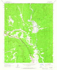
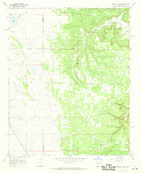
(20)- 1960 Map of Stanley, 1963 Print
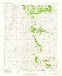 1960 Stanley1963 Print · USGSRanching life in Santa Fe County during the early 1960s is defined here by isolated homesteads and high-altitude water holes. Genealogists can trace family legacies through sites like Mitchell Ranch, Montaño Ranch, and the Stanley Cem.3 unique versions available
 - 1961 Map of Santa Fe, 1962 Print
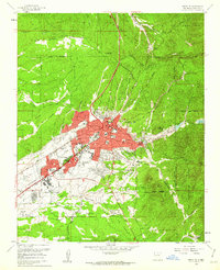 1961 Santa Fe1962 Print · USGSSanta Fe's mid-century landscape is captured here just as the city began its modern expansion beyond its traditional colonial footprint. Researchers can trace historic landmarks like The Plaza, the US Indian School, and the path of the Old Santa Fe Trail.6 unique versions available
 - 1961 Map of Madrid, 1964 Print
 1961 Madrid1964 Print · USGSThe high-desert mining country of New Mexico is captured here in the early sixties, showing the intersection of large land grants and mineral extraction. Trace the rail lines of the Atchison Topeka and Santa Fe or locate landmarks like the Ortiz Mine and San Francisco Ch.4 unique versions available
 - 1961 Map of Rosilla Peak, 1966 Print
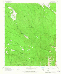
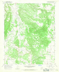
 1961 Rosilla Peak1966 Print · USGSSan Miguel County high country is documented here in the early sixties as the mountain economy balanced ranching and mining. Researchers can locate the Jones Mine, the site at El Macho, and old riverside settlements like Terrero and Tres Lagunas.3 unique versions available
 - 1961 Map of Pecos, 1966 Print
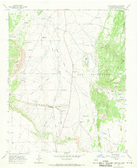
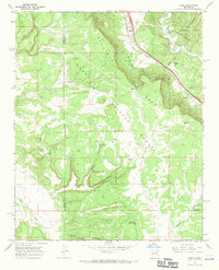
 1961 Pecos1966 Print · USGSNorthern New Mexico's cultural and natural geography is meticulously documented here in the early sixties. Genealogists and historians can trace family locations in Pecos or East Pecos while identifying landmarks like the Benedictine Monastery and Pecos State Monument Ruins.2 unique versions available
 - 1961 Map of Cowles, 1966 Print
 1961 Cowles1966 Print · USGSThe Sangre de Cristo foothills near the San Miguel and Santa Fe county lines appear here in the early sixties, centered on the Pecos River. You can trace alpine trails to Spirit Lake or locate the historic Panchuela Ranger Station and Cowles settlement.4 unique versions available
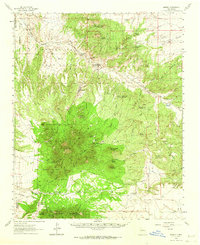
 - 1962 Map of Aztec
 1962 Aztec1962 Print · USGSNorthwestern New Mexico in the early sixties showcases a landscape defined by the arrival of the Navajo Reservoir and the high-altitude timber of the Carson National Forest. Trace the path of the Denver & Rio Grande Western RR or locate historic settlements like Tierra Amarilla and Gobernador.
 - 1962 Map of Albuquerque
 1962 Albuquerque1962 Print · USGSAlbuquerque and the surrounding high desert are captured here in the early 1960s during a period of intense mineral and military growth. Genealogists and historians can locate early schools like the Pueblo Pintado School, major industrial sites like the Jackpile Mine, and the sprawling Kirtland Air Force Base.
 - 1963 Map of Albuquerque, 1965 Print
 1963 Albuquerque1965 Print · USGSMid-century New Mexico unfolds across this map, showcasing the intersection of ancient pueblos, modern military bases, and historic mining districts. Trace family roots and local history through the Ortiz Mine, Seven Lakes Trading Post, and Alameda.3 unique versions available
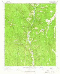
 - 1963 Map of Truchas Peak, 1965 Print
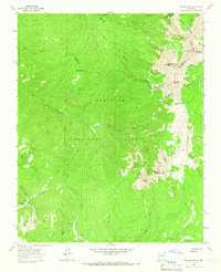 1963 Truchas Peak1965 Print · USGSThe Sangre de Cristo high country is surveyed here in the early sixties, showing the intersection of three counties among alpine peaks and glacial lakes. Hikers and historians can trace old routes to Brazas Cabin, Jose Vigil Lake, and the remote Horsethief Meadow.2 unique versions available
 - 1964 Map of El Valle, 1967 Print
 1964 El Valle1967 Print · USGSNorthern New Mexico during the mid-1960s reveals a high-altitude landscape defined by ancient land grants and traditional irrigation. Genealogists and researchers can trace the historic Las Trampas Grant Boundary and find local landmarks like the El Valle settlement, Vallecitos, and the Cem.3 unique versions available
 - 1965 Map of Aztec
 1965 Aztec1965 Print · USGSNorthern New Mexico and southern Colorado come alive in the mid-sixties, from the San Juan Basin to the high Jemez Mountains. Trace the narrow-gauge Denver & Rio Grande Western RR through Monero or locate old outposts like Blanco Trading Post.
 - 1966 Map of Mesa El Toro, 1970 Print
 1966 Mesa El Toro1970 Print · USGSNorthern New Mexico's high-mesa country is captured here during the mid-1960s, documenting a remote landscape of canyons and cattle ranching. Researchers can trace the rugged topography of Mesa el Toro and locate vital water sources like Mesa Well and Turkey Tank.2 unique versions available
 - 1966 Map of Clines Corners, 1970 Print
 1966 Clines Corners1970 Print · USGSThe high plains of central New Mexico during the mid-sixties reveal a landscape of remote ranching outposts and vital highway junctions. Genealogists and local historians can locate family landmarks like Tapia Cem, Los Norios Ranch, and the San Antonio Ch near the historic Clines Corners crossroads.
 - 1966 Map of Ojo Hedionda, 1970 Print
 1966 Ojo Hedionda1970 Print · USGSSettled ranchland and ancient archaeological sites define this New Mexico landscape in the mid-1960s. Genealogists and historians can trace the Anaya Ranch, follow the Old Railroad Grade, and locate the Pueblo Blanco Ruins and Pueblo Chey Ruins.2 unique versions available
 - 1966 Map of Galisteo, 1970 Print
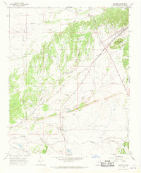 1966 Galisteo1970 Print · USGSThe high-desert basin of Santa Fe County is captured here in the mid-1960s, highlighting the rail corridor and ranching outposts of the period. Researchers can trace historical sites like the Pueblo los Tanos Ruins, the junction at Kennedy, and local landmarks like Thornton Ranch.2 unique versions available
 - 1966 Map of Rencona, 1971 Print
 1966 Rencona1971 Print · USGSSan Miguel County ranching life is preserved here in the mid-1960s, showing a landscape defined by remote homesteads and vital water sources. Genealogists can trace family landmarks like Witte Ranch, Children Place, and the Rencona Cem.
 - 1966 Map of Bull Canyon, 1971 Print
 1966 Bull Canyon1971 Print · USGSSanta Fe County’s high mesa country comes into focus in the mid-1960s, a landscape defined by ancestral sites and modern ranching. Genealogists and historians can locate the Pueblo San Cristobal (Ruins), the San Miguelito Cem, and the historic Bar S Ranch.2 unique versions available
 - 1966 Map of Wildhorse Mesa, 1971 Print
 1966 Wildhorse Mesa1971 Print · USGSSanta Fe County ranching culture is frozen in time during the 1960s, showing a landscape of mesas and vital water infrastructure. Trace the locations of historic homesteads and outposts like Dyer Ranch, Estracada House Well, and the Young Place.
 - 1966 Map of Rowe, 1971 Print
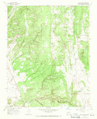
 1966 Rowe1971 Print · USGSThe Pecos River valley and Glorieta Mesa in the mid-1960s reveal a landscape of high-country ranching and vital rail transport. Genealogists and local historians can trace family-named sites like the Archuleta Ranch or follow the Atchison Topeka and Santa Fe railroad past Rowe.2 unique versions available
End of results
Showing maps 1-20 of 20
Top cities of Santa Fe County
- Santa Fe historical maps
- Edgewood historical maps
- Santa Cruz historical maps
- Madrid historical maps
- Lamy historical maps
Frequently asked questions
- What are the different types of historical maps available for Santa Fe County?
- What is the oldest map of Santa Fe County?
- Where can I purchase historical maps of Santa Fe County for my home or office?
- Where can I download high-res historical maps of Santa Fe County?
- Are there historical topographic maps available for Santa Fe County?
- Is there historical aerial imagery available for Santa Fe County?
- Where are historical maps of Santa Fe County sourced from?