1980s Maps of Sierra County, New Mexico
Explore 60 historic maps of Sierra County from the 1980s. These maps offer a rare glimpse into what life looked like during the 1980s — showing old roads, neighborhoods, homes, and landmarks that have changed or disappeared over time.
Whether you're researching your family's past, planning a metal detecting trip, or studying how Sierra County's landscape evolved across the 1980s, these high-resolution maps are a powerful tool for exploring the history of this region.
- Focus on a specific era: All maps on this page are from the 1980s, giving you a focused view of this time period.
- See what’s changed: Compare century-old streets, trails, and buildings to today's modern landscape using overlays and satellite layers.
- Research with precision: Use these maps for genealogy, historical research, land use analysis, or educational projects.
- View, download, or print: Maps are fully viewable online in high resolution, and can be downloaded or printed for your own records.
Start exploring Sierra County's history through authentic maps from the 1980s. This is your window into the past.
Sierra County, NM maps
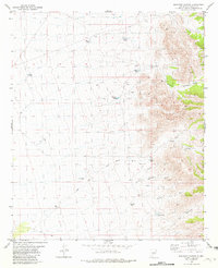
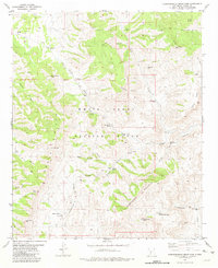
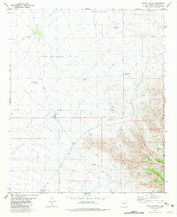
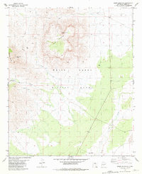
(60)- 1981 Map of Gilmore Draw
 1981 Gilmore Draw1981 Print · USGSThe high desert of Doña Ana County in the early eighties reveals a landscape of cattle ranching and military research. Genealogists and historians can trace the water infrastructure of Hills Ranch and the isolated House Pasture Windmill near the White Sands Missile Range.
 - 1981 Map of Big Gyp Mountain
 1981 Big Gyp Mountain1981 Print · USGSSierra County's high desert landscape was firmly established as a military testing ground by the early eighties. Researchers can trace historic water sources like Gyp Spring and Smith Springs alongside the geography of Big Gyp Mountain and the Gyp Hills.
 - 1981 Map of Taylor Peak
 1981 Taylor Peak1981 Print · USGSThe high Gila backcountry in the early 1980s was a landscape of remote mines and vital water tanks. Trace old mining operations at the Strip Mine or prospects near Boiler Peak, and follow the watershed from Alexander Cienaga to Taylor Creek.
 - 1981 Map of Shannon Canyon
 1981 Shannon Canyon1981 Print · USGSRanching and military boundaries intersect in this Sierra County landscape during the early eighties. Researchers can trace historic water sources and rugged transit routes like the Jeep Trail, Rabbit Well, and the remote Adobe House Tank.
 - 1981 Map of Fairview Mountain
 1981 Fairview Mountain1981 Print · USGSSierra and Socorro counties are shown during the early eighties, largely dominated by the restricted White Sands Missile Range. Researchers can trace old desert improvements and land use through Martin Well, multiple prospect sites, and unidentified Ruins.
 - 1981 Map of Baily Points
 1981 Baily Points1981 Print · USGSThe Black Range borderlands of Sierra and Catron counties are shown here as they appeared in the early 1980s. Local researchers can trace old Pack Trails through the Gila National Forest and locate seasonal water sources like Corral Spring and Well.
 - 1981 Map of Prisor Hill
 1981 Prisor Hill1981 Print · USGSSierra County ranching country is documented here in the early eighties, showing the vital water network of the high desert. Researchers can trace the layout of the Aleman Ranch and find specific water points like Santa Fe East Well and Badger Tank.
 - 1981 Map of Polecat Tank
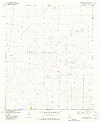
 1981 Polecat Tank1981 Print · USGSSierra County's arid rangeland is captured here in the early 1980s, centered on the essential water management of the desert floor. You can trace the geography of the Rainwater Ranch and remote landmarks like Polecat Tank or the New Mexico Principal Meridian.
 - 1981 Map of Hardscrabble Mountains
 1981 Hardscrabble Mountains1981 Print · USGSThe high desert of Sierra County is captured in the early eighties as a landscape of military range and remote mountain gaps. Genealogists and historians can locate isolated sites like the Black Bear Mine, a lonely Grave, and numerous water sources including Rhodes Spring.
 - 1981 Map of Salinas Peak
 1981 Salinas Peak1981 Print · USGSThe high desert of Sierra County appears here in the early 1980s, documenting a landscape primarily contained within the White Sands Missile Range. Researchers can locate specialized sites like the Salinas Mine, the Heliport atop Salinas Peak, and numerous remote water sources like Sweetwater Spring.
 - 1981 Map of Dugout Canyon
 1981 Dugout Canyon1981 Print · USGSSierra County's arid rangelands were carefully managed for water and military operations in the early eighties. Researchers can trace land use through remote landmarks like Mountain Well, Rabbit Tank, and the bordering White Sands Missile Range.
 - 1981 Map of Shannon Canyon NW
 1981 Shannon Canyon NW1981 Print · USGSSierra County ranch lands in the early eighties reveal the vital infrastructure of high-desert life. Trace family-named landmarks and water sources like Cain Ranch, Sunshine Well, and Homestead Tank across this arid landscape.
 - 1981 Map of Fence Canyon
 1981 Fence Canyon1981 Print · USGSSierra County ranching and military lands meet in this early 1980s landscape, just west of the missile range. Researchers can trace land grant boundaries at Pedro Armendaris No 33 and locate remote outposts like Graham Ranch or Bull Pasture Tank.
 - 1981 Map of Fairview Well
 1981 Fairview Well1981 Print · USGSSierra County ranching and surveying infrastructure are captured here in the early 1980s. Researchers can trace the water sources essential to the high desert, from Fairview Well and Hayfield Tank to the New Mexico Principal Meridian.
 - 1981 Map of Sawmill Peak
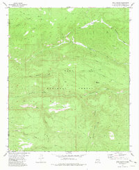
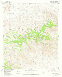
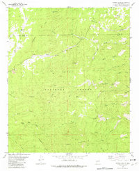 1981 Sawmill Peak1981 Print · USGSNew Mexico's high timberlands and mineral veins are captured here in the early 1980s as the Continental Divide crosses the Gila National Forest. Researchers can trace old mining claims like the Webber Mine and Ivanhoe Mine or locate isolated water sources such as Whiskey Spring.2 unique versions available
 - 1981 Map of Prisor Well
 1981 Prisor Well1981 Print · USGSSierra and Dona Ana counties are seen in the early eighties as a landscape of remote ranching outposts and military restricted zones. Researchers can trace historic water sources and backcountry routes through Prisor Well, the CCC Tank, and Lyons Draw.
 - 1981 Map of Tularosa
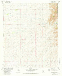
 1981 Tularosa1981 Print · USGSThe high-desert basin around Tularosa is captured here in the early eighties as a hub of military and rail activity. Trace the Southern Pacific line past Three Rivers or explore the vast White Sands Missile Range.2 unique versions available
 - 1981 Map of Sulphur Pass
 1981 Sulphur Pass1981 Print · USGSSierra County’s high-desert terrain is captured here in the early eighties, showcasing the intersection of military boundaries and remote ranching outposts. Researchers can trace the Pack Trail and locate isolated water sources like Rock House Well and Loma Vista.
 - 1981 Map of Hembrillo Basin
 1981 Hembrillo Basin1981 Print · USGSThe high desert of Sierra and Doña Ana Counties is captured here in the early eighties, showcasing the intersection of ranching history and military activity. Researchers can trace land use through Blackshire, Upper Hembrillo Spring, and the landmark Victorio Peak.
 - 1981 Map of Strawberry Peak
 1981 Strawberry Peak1981 Print · USGSSierra County's high-desert landscape is documented in the early eighties as it served as part of the White Sands Missile Range. Researchers can trace remote water sources and landmarks like Bat Ranch Spring, Gunsight Peak, and various Prospect sites.
 - 1981 Map of Lookout Mountain
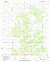
 1981 Lookout Mountain1981 Print · USGSSierra County's high country is captured here during the early 1980s, where the Continental Divide meets a history of silver and mineral extraction. Trace the paths of early prospectors and foresters through sites like the Silver Monument Mine, Sawmill Cabin, and the Monument Park Guard Station.2 unique versions available
 - 1981 Map of Tip Top Canyon
 1981 Tip Top Canyon1981 Print · USGSSierra County's high desert and mountain frontier are captured in the early eighties as the White Sands Missile Range met traditional ranching lands. Trace remote water sources like White Rock Well and historic mining traces near Lone Star Peak.
 - 1981 Map of Salinas Peak NW, 1982 Print
 1981 Salinas Peak NW1982 Print · USGSSierra and Socorro counties are captured during the early eighties within the restricted boundary of the White Sands Missile Range. Researchers can trace the desert's infrastructure through ranching remnants and sites like the Marcial Site, School Site, and Baca Well.
 - 1981 Map of Hembrillo Canyon, 1982 Print
 1981 Hembrillo Canyon1982 Print · USGSThe high San Andres Mountains meet the military frontier in the early 1980s, revealing a landscape of remote mines and vital springs. Researchers can trace the old workings of the Pioneer Mine, locate Hospital Spring, and follow the boundary of the White Sands Missile Range.
 - 1981 Map of Sheep Mountain, 1982 Print
 1981 Sheep Mountain1982 Print · USGSSierra County's high-desert landscape is recorded here in the early eighties, centered on the restricted White Sands Missile Range. Researchers can trace old mineral prospects and vital water sources like Mexican Hat Spring, South Well, and Sly Canyon.
Showing maps 1-25 of 60
Top cities of Sierra County
Frequently asked questions
- What are the different types of historical maps available for Sierra County?
- What is the oldest map of Sierra County?
- Where can I purchase historical maps of Sierra County for my home or office?
- Where can I download high-res historical maps of Sierra County?
- Are there historical topographic maps available for Sierra County?
- Is there historical aerial imagery available for Sierra County?
- Where are historical maps of Sierra County sourced from?