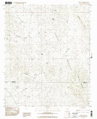
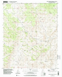
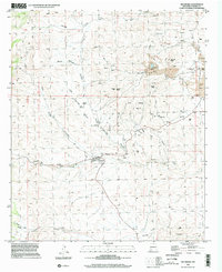
1990s Maps of Sierra County, New Mexico
Explore 48 historic maps of Sierra County from the 1990s. These maps offer a rare glimpse into what life looked like during the 1990s — showing old roads, neighborhoods, homes, and landmarks that have changed or disappeared over time.
Whether you're researching your family's past, planning a metal detecting trip, or studying how Sierra County's landscape evolved across the 1990s, these high-resolution maps are a powerful tool for exploring the history of this region.
- Focus on a specific era: All maps on this page are from the 1990s, giving you a focused view of this time period.
- See what’s changed: Compare century-old streets, trails, and buildings to today's modern landscape using overlays and satellite layers.
- Research with precision: Use these maps for genealogy, historical research, land use analysis, or educational projects.
- View, download, or print: Maps are fully viewable online in high resolution, and can be downloaded or printed for your own records.
Start exploring Sierra County's history through authentic maps from the 1990s. This is your window into the past.
Sierra County, NM maps
(48)- 1995 Map of Sierra Fijardo, 1998 Print
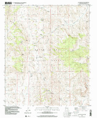
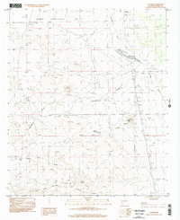
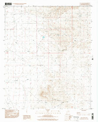
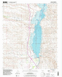
 1995 Sierra Fijardo1998 Print · USGSSouthern New Mexico’s high-desert terrain is meticulously documented in the 1990s as it transitions between ranch lands and national forest. Researchers can locate remote landmarks like the Flying X Ranch, the solitary Grave near the forest boundary, and Peñasco Peak.
 - 1995 Map of Monticello, 1998 Print
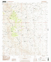
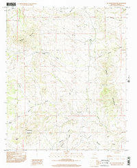
 1995 Monticello1998 Print · USGSSierra County ranchlands and high desert canyons are documented here in the mid-nineties, capturing the remote settlements of Monticello and Placitas. Researchers can trace local landmarks like St Ignatius Church, the Community Ditch, and Red Rock Ranch.
 - 1995 Map of Jaralosa Mountain, 1998 Print
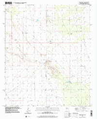
 1995 Jaralosa Mountain1998 Print · USGSThe Sierra Cuchillo high country during the late twentieth century reveals a landscape of isolated mines and ranching outposts. Researchers can trace land use through Serna Mine, the H V L Ranch, and historic water works like the Monticello Community Ditch.
 - 1996 Map of Sulphur Pass, 2001 Print
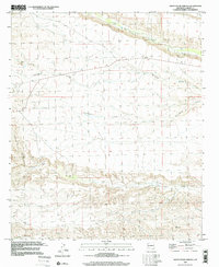
 1996 Sulphur Pass2001 Print · USGSSierra County in the late twentieth century is shown here as a landscape of military restricted zones and remote desert ranching. Researchers can locate essential water improvements and land markers like Rock House Well, Sulphur Pass, and the White Sands Missile Range.
 - 1996 Map of Upham Hills, 2001 Print
 1996 Upham Hills2001 Print · USGSSierra and Dona Ana counties appear in the 1990s as a high-desert landscape centered on cattle ranching and rugged landforms. Local historians can trace water infrastructure and remote outposts like Flat Lake Ranch, Chicken Well, and Pot Hole Tank.
 - 1996 Map of Alivio, 2001 Print
 1996 Alivio2001 Print · USGSSouthern New Mexico’s high desert landscape is documented here in the mid-1990s, where the Sierra and Doña Ana county line crosses rugged terrain. Researchers can locate remote water sources like Upside Down Tank and trace the rail corridor through Alivio near the prominent Point of Rocks.
 - 1996 Map of Prisor Well, 2001 Print
 1996 Prisor Well2001 Print · USGSSierra and Dona Ana counties appear in the late 1990s as a landscape defined by water scarcity and federal land boundaries. Researchers can locate remote ranching outposts and infrastructure like Renick Well, Martin Tank, and Blackshire Draw.
 - 1996 Map of Upham, 2001 Print
 1996 Upham2001 Print · USGSSierra County's arid high-desert landscape is captured in the late twentieth century, showing the isolated settlements of Aleman and Upham. Genealogists and researchers can trace local water infrastructure through sites like Rabbit Tank, Miller Tank, and Wetback Tank.
 - 1996 Map of Apache Gap, 2001 Print
 1996 Apache Gap2001 Print · USGSThe high Sierra County desert comes into focus in the mid-nineties, showing the rugged ranching and mining land of the Caballo Mountains. Trace the locations of historic livestock water sources like Ghost Tank and Slater Red Tanks, or follow the 4WD routes past remote prospects.
 - 1996 Map of Hockett, 2002 Print
 1996 Hockett2002 Print · USGSArid grazing lands and high-desert ranges define this mid-1990s region at the intersection of three counties. Genealogists and historians can trace the remote settlement of Hockett or locate infrastructure like the Sub Sta and the Gravel Pit near Horse Canyon.
 - 1996 Map of Cutter, 2002 Print
 1996 Cutter2002 Print · USGSThe high-desert terrain of Sierra County is revealed in the mid-1990s, centering on the small settlement of Cutter. Researchers can trace the path of the Old RR Grade, locate the local Cem, and identify extraction sites like Graves.
 - 1996 Map of Shannon Canyon, 2002 Print
 1996 Shannon Canyon2002 Print · USGSSierra County's arid canyons and water-management networks are captured here in the mid-1990s. Researchers and land historians can trace the vital placement of remote water sources like Adobe House Tank, Rabbit Well, and Shannon Well.
 - 1996 Map of Garfield, 2002 Print
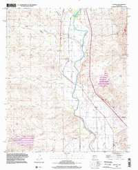 1996 Garfield2002 Print · USGSThe Rio Grande valley in the late twentieth century reveals a complex irrigation system supporting the riverside towns of Arrey, Derry, and Garfield. Genealogists and historians can trace local landmarks like the San Isidro Sch and Church of God.
 - 1996 Map of Hembrillo Basin, 2002 Print
 1996 Hembrillo Basin2002 Print · USGSThe high-desert terrain of the San Andres Mountains appears here in the late twentieth century, largely enclosed within military boundaries. Researchers can trace remote landmarks and water sources like Victoria Peak, Hembrillo Pass, and the Green Valley Windmill.
 - 1996 Map of Jug Canyon, 2002 Print
 1996 Jug Canyon2002 Print · USGSSierra County's high-desert terrain is captured here in the mid-1990s, showcasing a network of deep arroyos and essential water sources. Genealogists and researchers can locate the small Cem and trace the paths of Outlaw Canyon and Arroyo Jaralosa.
 - 1996 Map of Lake Valley, 2002 Print
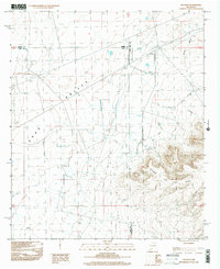
 1996 Lake Valley2002 Print · USGSThe Lake Valley mining district is preserved here in the late twentieth century, showing a landscape defined by silver-mining history and ranching. Genealogists and historians can trace the Old Railroad Grade and locate family landmarks like the Bridal Chamber Mine and Nunn Ranch.
 - 1996 Map of Mc Clede Mountain, 2002 Print
 1996 Mc Clede Mountain2002 Print · USGSSierra County's high-desert landscape comes into focus during the late twentieth century, showing a region defined by its vital springs and peaks. Genealogists and historians can trace ranching heritage through landmarks like O Bar O Peak, Mc Clede Spring, and Sibley Gap.
 - 1996 Map of Prisor Hill, 2002 Print
 1996 Prisor Hill2002 Print · USGSSierra County ranching and desert hydrology are captured here in the mid-nineties. Researchers can locate the Aleman Ranch and trace vital water sources like Santa Fe East Well and Jody Tank across the local draws.
 - 1996 Map of Skute Stone Arroyo, 2002 Print
 1996 Skute Stone Arroyo2002 Print · USGSSierra County ranching and mining country are captured here in the late twentieth century, showing a landscape shaped by both water and mineral wealth. Genealogists and historians can locate family landmarks such as Coalson Ranch or trace old workings at the Strip Mines and Wicks Gulch.
 - 1996 Map of Caballo, 2002 Print
 1996 Caballo2002 Print · USGSThe Sierra County desert in the mid-1990s reveals a landscape shaped by water management and the impounded Rio Grande. Researchers can locate a local Cem and Community Hall near Caballo, or trace the intricate network of arroyos like Greenhorn Arroyo.
 - 1996 Map of McLeod Tank, 2002 Print
 1996 McLeod Tank2002 Print · USGSArid ranching lands and desert peaks define this New Mexico landscape near the turn of the millennium. Researchers can trace historic water catchments and mountain passes like Broken House Tank, McLeod Tank, and the rugged slopes of Redhouse Mountain.
 - 1996 Map of Hardscrabble Mountains, 2002 Print
 1996 Hardscrabble Mountains2002 Print · USGSSierra County's high desert and military landscape are captured here in the late nineties, where the Hardscrabble Mountains meet the White Sands Missile Range. Trace early industry and water sources like the Black Bear Mine and Red House Well.
 - 1996 Map of Palomas Gap, 2002 Print
 1996 Palomas Gap2002 Print · USGSThe Caballo Mountains are captured here in the mid-nineties, showing a landscape defined by mining history and high desert terrain. Researchers can trace the path to the Lead Mine or locate vital water sources like Mescal Spring and Little Ohney Tank.
 - 1996 Map of Hillsboro, 2002 Print
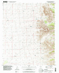
 1996 Hillsboro2002 Print · USGSSierra County mining territory comes into focus in the mid-1990s as the town of Hillsboro sits nestled among dry gulches and prominent peaks. Metal detectorists and researchers can locate old Mines, a Cem, and the steep terrain of Copper Flat.
 - 1996 Map of Engle, 2002 Print
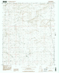
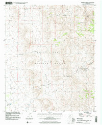
 1996 Engle2002 Print · USGSSierra County's arid basin and range topography is captured here during the late twentieth century. Genealogists and historians can locate the community of Engle, trace the Old RR Grade, and find individual markers like a Cem or a lone Grave.
Showing maps 1-25 of 48
Top cities of Sierra County
Frequently asked questions
- What are the different types of historical maps available for Sierra County?
- What is the oldest map of Sierra County?
- Where can I purchase historical maps of Sierra County for my home or office?
- Where can I download high-res historical maps of Sierra County?
- Are there historical topographic maps available for Sierra County?
- Is there historical aerial imagery available for Sierra County?
- Where are historical maps of Sierra County sourced from?