1980s Maps of Torrance County, New Mexico
Explore 25 historic maps of Torrance County from the 1980s. These maps offer a rare glimpse into what life looked like during the 1980s — showing old roads, neighborhoods, homes, and landmarks that have changed or disappeared over time.
Whether you're researching your family's past, planning a metal detecting trip, or studying how Torrance County's landscape evolved across the 1980s, these high-resolution maps are a powerful tool for exploring the history of this region.
- Focus on a specific era: All maps on this page are from the 1980s, giving you a focused view of this time period.
- See what’s changed: Compare century-old streets, trails, and buildings to today's modern landscape using overlays and satellite layers.
- Research with precision: Use these maps for genealogy, historical research, land use analysis, or educational projects.
- View, download, or print: Maps are fully viewable online in high resolution, and can be downloaded or printed for your own records.
Start exploring Torrance County's history through authentic maps from the 1980s. This is your window into the past.
Torrance County, NM maps
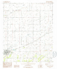
(25)- 1980 Map of Corona, 1981 Print
 1980 Corona1981 Print · USGSThe high-desert ranching and rail country of Lincoln County is documented here during the early eighties. Genealogists and local historians can trace the Southern Pacific line through Corona, locate the Old Railroad Grade, and find remote outposts like Claunch and Gallinas.
 - 1981 Map of Progresso NE
 1981 Progresso NE1981 Print · USGSTorrance County was a landscape of sparse ranching infrastructure and forest boundaries in the early eighties. Researchers can locate specific water sources like the Beedle Windmill and trace the northern edge of the Cibola National Forest.
 - 1981 Map of Pino Mountain
 1981 Pino Mountain1981 Print · USGSTorrance County high plains life in the early eighties centers on the prominent Pino Mountain and the settlement of Pinos Wells. Researchers can locate family sites and local landmarks like Cedarvale Cemetery and Pinos Wells Cem.
 - 1981 Map of Progresso SW
 1981 Progresso SW1981 Print · USGSHigh desert ranching in Torrance County comes into focus during the early eighties as the borders of three counties meet. Genealogists and historians can locate isolated ranching outposts like Atkinson Ranch and essential water features such as Wire Lake or Three Way Well.
 - 1981 Map of Camaleon Draw West
 1981 Camaleon Draw West1981 Print · USGSIn the early 1980s, the border between Torrance and Lincoln counties was a landscape of high mesas and isolated water wells. Trace the remote history of this desert region through landmarks like Trinchera Mesa, Little Five Wire Well, and Cola.
 - 1981 Map of Duran
 1981 Duran1981 Print · USGSDuran sat at a vital high-desert crossroads in the early 1980s, where the Southern Pacific line met the massive plateaus of the Estancia Basin. Researchers can trace historic water infrastructure like Railroad Well and explore the complex terrain around Duran Mesa and Serape Pass.
 - 1981 Map of Progresso
 1981 Progresso1981 Print · USGSThe high plains of Torrance County are captured here in the early eighties as ranching life centered around the Cibola National Forest. Researchers can trace old family holdings through named water sources like the Houston Windmill, Jew Windmill, and Garcia Windmill.
 - 1981 Map of Camaleon Draw East
 1981 Camaleon Draw East1981 Print · USGSRanching life in central New Mexico is documented here in the early 1980s, centered on the tri-county intersection and vital water sources. Trace historical livestock infrastructure through sites like Telephone Lake, Old Five Wire Well, and Rivera Well.
 - 1981 Map of Duran NE
 1981 Duran NE1981 Print · USGSEastern Torrance County ranching life is preserved here during the early eighties, where water meant survival for livestock and settlers. Trace the Southern Pacific rail line or locate family-named landmarks like Hindi Ranch and Duran Cem.
 - 1981 Map of Progresso SE
 1981 Progresso SE1981 Print · USGSThe northern slopes of the Gallinas Mountains meet the New Mexico plains in this early 1980s survey of the high-country ranching landscape. Researchers can locate remote water sources and landmarks such as Sawmill Tank, Pistola Tank, and Round Top.
 - 1981 Map of Cedarvale NE
 1981 Cedarvale NE1981 Print · USGSTorrance County, New Mexico, is shown in the early eighties as a high-desert landscape of salt flats and isolated ranching. Researchers can trace the local water sources and land use at the Going Thing Ranch or locate a Drill Hole and Springs among the salt basins.
 - 1981 Map of Corona North
 1981 Corona North1981 Print · USGSCentral New Mexico rail and ranching country comes into focus in the early 1980s, documenting the corridor between the settlements of Torrance and Corona. Genealogists and researchers can trace the Southern Pacific line, the Old Railroad Grade, and local landmarks like the Rodeo Ground.
 - 1981 Map of Cedarvale, 1982 Print
 1981 Cedarvale1982 Print · USGSThe settlement of Cedarvale is mapped here in the early 1980s, where high-desert ranching meets the edge of the Cibola National Forest. Researchers can trace the Old Railroad Grade and locate water infrastructure like Herring Windmill or Lobo Tank.
 - 1983 Map of Albuquerque, 1984 Print
 1983 Albuquerque1984 Print · USGSCentral New Mexico in the early eighties shows a landscape where ancient pueblos and modern aerospace hubs meet. Trace the routes of the Atchison Topeka and Santa Fe RR or locate landmarks like Kirtland Air Force Base, Madrid, and the Sandia Mountains.
 - 1983 Map of Villanueva, 1984 Print
 1983 Villanueva1984 Print · USGSThe Pecos River valley and its high mesa surroundings are captured here in the early eighties. Researchers can trace historic river settlements like Villanueva and Sena, the route of the Atchison Topeka and Santa Fe railroad, and the high-desert terrain of Glorieta Mesa.
 - 1984 Map of Vaughn, 1992 Print
 1984 Vaughn1992 Print · USGSCentral New Mexico’s high plains are captured here in the mid-1980s, revealing a landscape shaped by transcontinental rail and highway travel. Trace the paths of the Atchison Topeka and Santa Fe through settlements like Encino, Vaughn, and Milagro.
 - 1986 Map of Punta De Agua
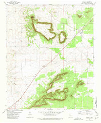
 1986 Punta De Agua1986 Print · USGSTorrance County during the mid-1980s reveals a landscape defined by traditional land grants and historical monuments. Researchers can trace the layout of Punta de Agua, locate the Quarai Division of the Salinas National Monument, and identify old family-named sites like Montaño.
 - 1986 Map of Mountainair NE
 1986 Mountainair NE1986 Print · USGSThe Estancia Basin of central New Mexico is captured here in the mid-1980s as a landscape of arid ranching and old infrastructure. Genealogists and historians can trace an Old R.R. Grade, locate a small local Cem., and follow the seasonal path of Torreon Draw.
 - 1986 Map of Willard
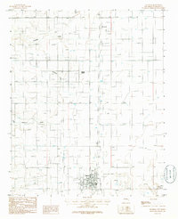
 1986 Willard1986 Print · USGSWillard was a critical high-plains rail junction in the 1980s, situated at the foot of the southern mesas. Genealogists and historians can trace the town's footprint including the Cem, the Atchison Topeka and Santa Fe Railway, and an Old R.R. Grade.
 - 1986 Map of Mountainair
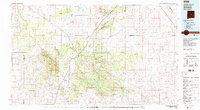
 1986 Mountainair1986 Print · USGSMountainair and the surrounding Torrance County ranching country are documented here in the mid-1980s. Local researchers can trace community landmarks like the Rodeo Ground, the local Landing Strip, and regional drainage features such as Arroyo de Manzano.
 - 1986 Map of Ewing
 1986 Ewing1986 Print · USGSNew Mexico's high desert landscape comes into focus during the early 1980s as rural settlements and arid drainages are meticulously recorded. Researchers can trace the boundaries of the Town of Torreon and locate local landmarks like the Landing Strip and Ewing.
 - 1986 Map of Manzano Peak
 1986 Manzano Peak1986 Print · USGSThe high peaks of the Manzano Mountains come alive in the mid-1980s, revealing a landscape of remote canyons and vital water sources. Researchers can trace the Pack Trail past Manzano Peak or locate named sites like Ojo Barreras and Wild Cow Spring.
 - 1986 Map of Estancia
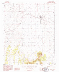
 1986 Estancia1986 Print · USGSThe Estancia Valley in the mid-1980s reveals a high-desert landscape defined by its ranching water-works and early rail infrastructure. Researchers can trace the path of the Railroad Grade through Mc Intosh or locate the rural Cem and the historic Antelope Springs.
 - 1986 Map of Moriarty North
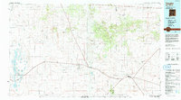
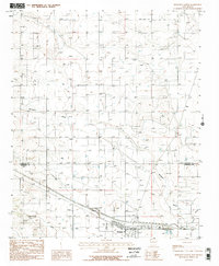 1986 Moriarty North1986 Print · USGSThe high plains of Santa Fe and Torrance counties come into focus during the mid-1980s. Genealogists and historians can trace the development of Moriarty, locate the Old Railroad Grade, and find smaller outposts like Otto amidst the network of ranch roads.2 unique versions available
 - 1986 Map of Moriarty South
 1986 Moriarty South1986 Print · USGSThe Estancia Valley's high-desert landscape is captured in the mid-1980s, centered on the growing community of Moriarty. Researchers can locate specific local landmarks like the Cem, the town Landing Strip, and natural drainage at Buffalo Draw.
End of results
Showing maps 1-25 of 25
Top cities of Torrance County
- Moriarty historical maps
- Estancia historical maps
- Mountainair historical maps
- Willard historical maps
- Encino historical maps
- Johnny's Place historical maps
Frequently asked questions
- What are the different types of historical maps available for Torrance County?
- What is the oldest map of Torrance County?
- Where can I purchase historical maps of Torrance County for my home or office?
- Where can I download high-res historical maps of Torrance County?
- Are there historical topographic maps available for Torrance County?
- Is there historical aerial imagery available for Torrance County?
- Where are historical maps of Torrance County sourced from?