1990s Maps of Torrance County, New Mexico
Explore 25 historic maps of Torrance County from the 1990s. These maps offer a rare glimpse into what life looked like during the 1990s — showing old roads, neighborhoods, homes, and landmarks that have changed or disappeared over time.
Whether you're researching your family's past, planning a metal detecting trip, or studying how Torrance County's landscape evolved across the 1990s, these high-resolution maps are a powerful tool for exploring the history of this region.
- Focus on a specific era: All maps on this page are from the 1990s, giving you a focused view of this time period.
- See what’s changed: Compare century-old streets, trails, and buildings to today's modern landscape using overlays and satellite layers.
- Research with precision: Use these maps for genealogy, historical research, land use analysis, or educational projects.
- View, download, or print: Maps are fully viewable online in high resolution, and can be downloaded or printed for your own records.
Start exploring Torrance County's history through authentic maps from the 1990s. This is your window into the past.
Torrance County, NM maps
(25)- 1990 Map of Longhorn Reservoir
 1990 Longhorn Reservoir1990 Print · USGSThe border of Santa Fe and Torrance counties is captured here in the final decade of the century, showing a landscape shaped by water management and ranching. Researchers can locate the Longhorn Ranch, trace the winding Armijo Draw, and find local landmarks like Stinking Spring and a solitary Grave.
 - 1990 Map of El Cuervo Butte
 1990 El Cuervo Butte1990 Print · USGSHigh desert ranching and water management define the landscape along the Santa Fe and Torrance County line in the late twentieth century. Genealogists and local historians can trace the settlement of Osita and natural features like El Cuervo Butte or Dinosaur Tank.
 - 1990 Map of Lobo Hill
 1990 Lobo Hill1990 Print · USGSThe high plains of Torrance County are revealed in the early nineties, showing a landscape shaped by water rights and energy infrastructure. Trace the routes of the PIPELINE across the Cañada de la Puerta and locate rural landmarks like Cottonwood Well and Lobo Hill.
 - 1990 Map of Lobo Hill SE
 1990 Lobo Hill SE1990 Print · USGSTorrance County ranching and water infrastructure are documented here during the late twentieth century as the region balanced traditional land use with modern utilities. Researchers can trace family-named sites and industrial markers including Dean Ranch, Allan Well, and local Gravel Pits.
 - 1990 Map of Lobo Hill NE
 1990 Lobo Hill NE1990 Print · USGSTorrance County ranching and rugged terrain are captured in this late twentieth-century survey of the New Mexico landscape. Researchers can trace the infrastructure of rural life through family-named landmarks like Red Canyon Ranch, Antelope Well, and Chavez Draw.
 - 1990 Map of Lobo Hill SW
 1990 Lobo Hill SW1990 Print · USGSTorrance County ranching and water management are at the forefront of this late-century survey of the New Mexico basin. Researchers can trace land use through named landmarks like Sprule Windmill, Childress Well, and the shores of Laguna del Perro.
 - 1990 Map of Tajique, 1996 Print
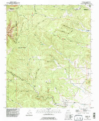 1990 Tajique1996 Print · USGSThe foothills of the Manzano Mountains are captured here in the 1990s, where traditional land grants meet national forest land. Researchers can trace local homesteads and family sites like Riley Place, Sun Valley Ranch, and the village Cemetery.
 - 1990 Map of Edgewood, 1996 Print
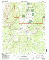
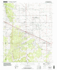 1990 Edgewood1996 Print · USGSEdgewood and the surrounding high plains were transitioning from ranching to residential use in the 1990s. Researchers can trace family-named sites like Blackwell Place, visit the Mountain Valley Cemetery, or follow the Old Railroad Grade.
 - 1991 Map of Torreon, 1995 Print
 1991 Torreon1995 Print · USGSThe foothills of the Manzano Mountains in the early 1990s reveal a landscape of ancestral land grants and high-desert ranching. Researchers can trace specific family homesteads like Bermudez Place and Chaves Place near the settlements of Torreon and Manzano.
 - 1991 Map of Chilili, 1996 Print
 1991 Chilili1996 Print · USGSNew Mexico's high-elevation ranching country is shown here in the 1990s as it straddles the Chilili Grant and county boundaries. Genealogists can locate family-named sites like Ballinger Ranch and Martinez or trace the early settlement of Old Chilili.
 - 1991 Map of Bosque Peak, 1996 Print
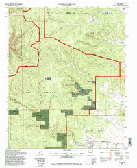
 1991 Bosque Peak1996 Print · USGSThe high peaks of Torrance County are captured here in the early 1990s as the wilderness boundary meets ancient land grants. Researchers can trace historic access routes like the Sandia Trail and locate isolated water sources such as Fourth Of July Spring and Lolito Spring.
 - 1991 Map of Milbourn Ranch, 1996 Print
 1991 Milbourn Ranch1996 Print · USGSThe ranching country of the Bernalillo and Torrance county line is captured here during the 1990s, showcasing the high-elevation terrain of the Chilili Grant. Genealogists and historians can locate remote burial sites at Garland Cemetery and trace family-named landmarks like Milbourn Ranch.
 - 1995 Map of Capilla Peak, 1998 Print
 1995 Capilla Peak1998 Print · USGSThe high Manzano Mountains of Torrance County are captured here in the mid-1990s, revealing a landscape of remote peaks and protected wilderness. Researchers can trace historical land grants and high-altitude water sources like Ojo la Casa, the Capilla Peak Observatory, and the settlement at Aguayo.
 - 1995 Map of Manzano Peak, 1998 Print
 1995 Manzano Peak1998 Print · USGSThe Manzano Mountains and the high desert of the 1990s are defined here by old land grants and isolated water sources. Genealogists and historians can trace boundaries of the Tome Grant or locate landmarks like Kayser Mill and Rattlesnake Spring.
 - 1995 Map of Cedarvale, 1998 Print
 1995 Cedarvale1998 Print · USGSCentral New Mexico ranching and forest lands are captured in the mid-nineties, showing the intersection of Cedarvale and the Cibola National Forest. Trace family-named sites and water infrastructure like Miller Ranch, Herring Windmill, and Lobo Tank.
 - 1995 Map of Progresso SE, 1998 Print
 1995 Progresso SE1998 Print · USGSThe high desert range and northern Gallinas Mountains are captured here in the mid-1990s as this remote corner of New Mexico remained defined by ranching life. Researchers can trace land use through named water improvements like Bates Ranch, Pruett Well, and Lockey Tank.
 - 1995 Map of Progresso NE, 1998 Print
 1995 Progresso NE1998 Print · USGSThe high-desert ranchlands of Torrance County are captured here in the mid-1990s, showing a sparsely settled landscape centered on cattle and water. Local researchers can trace family-held lands like Gustins Ranch and Pound Ranch or locate remote landmarks such as Beedle Windmill.
 - 1995 Map of Progresso SW, 1998 Print
 1995 Progresso SW1998 Print · USGSHigh desert ranching in Torrance County during the mid-nineties is defined by isolated outposts and vital water improvements. Researchers can locate remote family landmarks like the Atkinson Ranch and trace a network of named wells including Axtell Well and Middle Well.
 - 1995 Map of Punta De Agua, 1998 Print
 1995 Punta De Agua1998 Print · USGSTorrance County in the mid-1990s showcases a landscape of historic land grants and ancient ruins at the edge of the Cibola National Forest. Researchers can locate family landmarks like D Candelaria Ranch and La Cienega, or trace the grounds of the Salinas Ruin National Monument.
 - 1995 Map of Progresso, 1998 Print
 1995 Progresso1998 Print · USGSThe high desert of Torrance County is captured here in the mid-nineties, showing a land of remote ranching and forest conservation. Researchers can trace family sites like Piggott Ranch and find historical markers like Pueblo Blanco and Ruins Tank.
 - 1995 Map of Corona North, 1998 Print
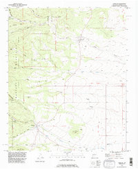
 1995 Corona North1998 Print · USGSHigh-desert ranching and rail history converge in central New Mexico during the 1990s. Researchers can trace family ranching sites like Brunson Ranch and follow the Southern Pacific tracks through Torrance and Corona.
 - 1995 Map of Scholle, 1998 Print
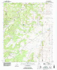
 1995 Scholle1998 Print · USGSSocorro County and the tri-county borderlands come to life in the mid-1990s as a high-desert ranching and mining hub. Genealogists and historians can trace the local economy through Scholle Siding, the Abo Mine, and family landmarks like the Casa Colorada Grant.
 - 1995 Map of Abo, 1998 Print
 1995 Abo1998 Print · USGSTorrance County in the mid-1990s showcases a landscape of high-desert canyons and historic monument lands. Researchers can trace land use through stock tanks like Chilton Tank, the ruins at Salinas National Monument, and the winding Abo Arroyo.
 - 1995 Map of Bosque Peak, 1998 Print
 1995 Bosque Peak1998 Print · USGSThe high country of Torrance County is captured here in the mid-1990s, where traditional land grants meet protected wilderness. Trace the intersection of the Isleta Pueblo Grant and Tome Grant or locate mountain water sources like Lolito Spring and Garcia Spring.
 - 1995 Map of Tajique, 1998 Print
 1995 Tajique1998 Print · USGSTorrance County at the eastern edge of the Manzano Mountains shows a landscape of historic land grants and high-elevation forest. Genealogists and local historians can locate family landmarks such as Nelson Place, La Jara Ranch, and the Cemetery near Tajique.
End of results
Showing maps 1-25 of 25
Top cities of Torrance County
- Moriarty historical maps
- Estancia historical maps
- Mountainair historical maps
- Willard historical maps
- Encino historical maps
- Johnny's Place historical maps
Frequently asked questions
- What are the different types of historical maps available for Torrance County?
- What is the oldest map of Torrance County?
- Where can I purchase historical maps of Torrance County for my home or office?
- Where can I download high-res historical maps of Torrance County?
- Are there historical topographic maps available for Torrance County?
- Is there historical aerial imagery available for Torrance County?
- Where are historical maps of Torrance County sourced from?