2020s Maps of Chenango County, New York
Explore 25 historic maps of Chenango County from the 2020s. These maps offer a rare glimpse into what life looked like during the 2020s — showing old roads, neighborhoods, homes, and landmarks that have changed or disappeared over time.
Whether you're researching your family's past, planning a metal detecting trip, or studying how Chenango County's landscape evolved across the 2020s, these high-resolution maps are a powerful tool for exploring the history of this region.
- Focus on a specific era: All maps on this page are from the 2020s, giving you a focused view of this time period.
- See what’s changed: Compare century-old streets, trails, and buildings to today's modern landscape using overlays and satellite layers.
- Research with precision: Use these maps for genealogy, historical research, land use analysis, or educational projects.
- View, download, or print: Maps are fully viewable online in high resolution, and can be downloaded or printed for your own records.
Start exploring Chenango County's history through authentic maps from the 2020s. This is your window into the past.
Chenango County, NY maps
(25)- 2023 Map of Sherburne, 2023 Print
 2023 Sherburne2023 Print · USGSChenango County hill country and river valleys are captured here in the early twenty-first century. Genealogists can locate numerous burial grounds like Tillotson Cem and Palmer Cem or trace the waters of Mad Brook through Sherburne.
 - 2023 Map of Earlville, 2023 Print
 2023 Earlville2023 Print · USGSThe upland ridges and river valleys of Chenango County are captured here in the early twenty-first century, showing the rural character of Earlville and Smyrna. Researchers can trace local heritage through numerous burial grounds like Smyrna East Cem and Sherburne West Hill Cem, or explore family landmarks such as Steam Sawmill Hill.
 - 2023 Map of Cincinnatus, 2023 Print
 2023 Cincinnatus2023 Print · USGSThe Otselic River valley in central New York is home to several historic hamlets and upland ridges. Genealogists can trace family roots at Holland Cem or Cincinnatus Cem, while hikers can follow the North Country National Scenic Trail through the heights of Mount Roderick.
 - 2023 Map of Otselic, 2023 Print
 2023 Otselic2023 Print · USGSChenango County's northern highlands are documented in this recent survey, showing the enduring hamlets and high hills of the Otselic valley. Genealogists and hikers can trace the geography around Otselic, Beaver Meadow, and several family burial sites like Cole Hill Cem.
 - 2023 Map of South Otselic, 2023 Print
 2023 South Otselic2023 Print · USGSSettled along the upper valley of the Otselic River, this rural New York landscape features a high concentration of family-named hills and historic cemeteries. Researchers can trace local lineage at Lincklaen Center or locate the quiet Rhode Island Cem and Northwest Corners.
 - 2023 Map of North Sanford, 2023 Print
 2023 North Sanford2023 Print · USGSThe borderlands of Delaware, Chenango, and Broome counties are captured here in the 2020s, showing a rugged landscape of upland forests and rural hamlets. Family historians can locate numerous burial grounds like Lord Road Cem and trace the paths of the Finger Lakes Trail.
 - 2023 Map of Gilbertsville, 2023 Print
 2023 Gilbertsville2023 Print · USGSOtsego County's rural character is preserved in this modern survey of the Gilbertsville and Unadilla Center area. Genealogists can trace family locations through numerous sites like Old Churchyard Cem, Sand Hill, and the secluded Black Ash Bog.
 - 2023 Map of Greene, 2023 Print
 2023 Greene2023 Print · USGSThe Chenango River valley in the modern era maintains its deep-rooted settlement patterns around Greene. Local historians can trace numerous burial sites like Sylvan Lawn Cem and Morse Cem nestled among landmarks such as Mount Pisgah.
 - 2023 Map of Oxford, 2023 Print
 2023 Oxford2023 Print · USGSChenango County's river-valley settlements are documented here in the early twenty-first century. Researchers can trace family history through dozens of local burial sites, including Saint Joseph Cem, Van Wagenen Cem, and Mason - Packer Cem.
 - 2023 Map of Pitcher, 2023 Print
 2023 Pitcher2023 Print · USGSChenango County highland life continues to center on the valleys of the Otselic River and Brakel Creek. Genealogists can trace early families at sites like Pink Cem, Hinman Cem, and the Brakel Valley Churchyard Cem.
 - 2023 Map of New Berlin South, 2023 Print
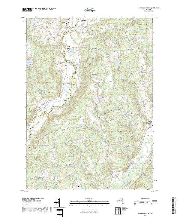 2023 New Berlin South2023 Print · USGSThe Unadilla River valley comes to life in this contemporary study of the Otsego County highlands. Researchers can pinpoint historic family sites like the Morris Family Burial Ground or trace the rural road networks surrounding New Berlin and Hoboken.
 - 2023 Map of Norwich, 2023 Print
 2023 Norwich2023 Print · USGSThe Chenango River valley and the city of Norwich are captured here in the early twenty-first century. Researchers can locate numerous family burial grounds like Packer - Mason Cem and landmarks such as the Chenango County Court House.
 - 2023 Map of Holmesville, 2023 Print
 2023 Holmesville2023 Print · USGSChenango County is mapped here in the early twenty-first century, showing the rural hills and river valleys between the Unadilla River and Chenango Lake. Genealogists can locate several family burial grounds like Bloom Cem and Edmonds Cem near the historic King Settlement.
 - 2023 Map of Brisben, 2023 Print
 2023 Brisben2023 Print · USGSChenango County highlands are depicted in the early 2020s, showing a rural landscape defined by the Chenango River and its tributary brooks. Researchers can trace local lineage through several burial grounds, including Upper Page Brook Cem, Wylie Cem, and Coventry Union Cem.
 - 2023 Map of Tyner, 2023 Print
 2023 Tyner2023 Print · USGSChenango County uplands and the river valley are captured here in the early twenty-first century. Researchers can trace family history through numerous burial sites like Beardsley Cem and Stafford Cem or explore the terrain around Buckley Hollow.
 - 2023 Map of Cuyler, 2023 Print
 2023 Cuyler2023 Print · USGSCortland County’s rural highlands are shown here in the 2020s, featuring the valleys of the Tioughnioga River and Maxon Creek. Trace family history at Cuyler Cem and Potter Hill Cem or explore trails through Dog Hollow.
 - 2023 Map of Belden, 2023 Print
 2023 Belden2023 Print · USGSEastern Broome County shows its deep rural roots in this contemporary survey of the high country and river valleys. Genealogists and historians can locate family landmarks like New Ohio Cem, North Colesville, and the waters of Sage Creek.
 - 2023 Map of New Berlin North, 2023 Print
 2023 New Berlin North2023 Print · USGSUpper Chenango and Otsego counties appear here in the early twenty-first century, centered on the winding Unadilla River. Researchers can trace family history through numerous small burial grounds like Gazlay Cem and Greenwood Cem or explore the rural hamlets of Sweets and Five Corners.
 - 2023 Map of Chenango Forks, 2023 Print
 2023 Chenango Forks2023 Print · USGSThe northern Broome County landscape is captured here where the Tioughnioga River and Chenango River meet. Genealogists and local researchers can trace historic burial sites like Toombs Cem and Collins-Hall Cem alongside the small hamlets of Sanitaria Springs and Port Crane.
 - 2023 Map of East Pharsalia, 2023 Print
 2023 East Pharsalia2023 Print · USGSChenango County’s upland terrain is captured here in the modern era, showing the resilient rural hamlets and water systems of central New York. Genealogists can trace family names through the Kirk Cem, Lewis Cem, and East Pharsalia Cem.
 - 2023 Map of Afton, 2023 Print
 2023 Afton2023 Print · USGSThe Susquehanna River valley in the Southern Tier is shown here in the early twenty-first century as it winds through a landscape of historic river towns. Researchers can trace the layout of Afton, Nineveh, and Doraville, or locate family sites like Stevens Cem and Huggins Cem.
 - 2023 Map of Smithville Flats, 2023 Print
 2023 Smithville Flats2023 Print · USGSThe rural uplands of Chenango County are captured here in recent years, centered on the historic village of Smithville Flats. Genealogists can trace family names through local landmarks like Knickerbocker Cem or the summits of Bolster Hill and Meeker Hill.
 - 2023 Map of Sidney, 2023 Print
 2023 Sidney2023 Print · USGSChenango County's river valleys and upland forests are captured here in the early twenty-first century as the area's industrial and agricultural history endures. Researchers can trace family sites at Saint Peters Churchyard Cem, navigate the rural roads of Bennettsville, or locate the Sidney Municipal Airport.
 - 2023 Map of West Bainbridge, 2023 Print
 2023 West Bainbridge2023 Print · USGSChenango County's rolling upland valleys and quiet rural crossroads appear in detail in this recent survey. Researchers can locate family burial sites at Coventryville Cem or trace the course of Kelsey Creek past Union Valley and North Afton.
 - 2024 Map of Guilford, 2024 Print
 2024 Guilford2024 Print · USGSThe Unadilla River valley in Chenango County remains a landscape of small hamlets and riverside settlements as seen in this recent survey. Genealogists and local historians can locate many family burial grounds including Evergreen Cem, Godfrey Corners Cem, and the quiet crossroads of Rockwells Mills.
End of results
Showing maps 1-25 of 25
Top cities of Chenango County
- Norwich historical maps
- Greene historical maps
- Sherburne historical maps
- Oxford historical maps
- Norwich historical maps
- Bainbridge historical maps
See more
Frequently asked questions
- What are the different types of historical maps available for Chenango County?
- What is the oldest map of Chenango County?
- Where can I purchase historical maps of Chenango County for my home or office?
- Where can I download high-res historical maps of Chenango County?
- Are there historical topographic maps available for Chenango County?
- Is there historical aerial imagery available for Chenango County?
- Where are historical maps of Chenango County sourced from?