1910s Maps of Clinton County, New York
Explore 5 historic maps of Clinton County from the 1910s. These maps offer a rare glimpse into what life looked like during the 1910s — showing old roads, neighborhoods, homes, and landmarks that have changed or disappeared over time.
Whether you're researching your family's past, planning a metal detecting trip, or studying how Clinton County's landscape evolved across the 1910s, these high-resolution maps are a powerful tool for exploring the history of this region.
- Focus on a specific era: All maps on this page are from the 1910s, giving you a focused view of this time period.
- See what’s changed: Compare century-old streets, trails, and buildings to today's modern landscape using overlays and satellite layers.
- Research with precision: Use these maps for genealogy, historical research, land use analysis, or educational projects.
- View, download, or print: Maps are fully viewable online in high resolution, and can be downloaded or printed for your own records.
Start exploring Clinton County's history through authentic maps from the 1910s. This is your window into the past.
Clinton County, NY maps
(5)- 1911 Map of Lyon Mountain, 1956 Print
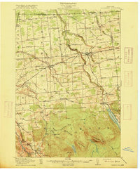
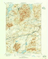 1911 Lyon Mountain1956 Print · USGSThe northern Adirondacks at the peak of the iron era reveal a landscape of mining hamlets and mountain kilns. Genealogists can trace family footprints in Loudell PO, Standish, and Sugarbush, or follow the industrial path of the Delaware and Hudson RR.2 unique versions available
 - 1913 Map of Dannemora
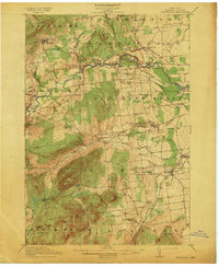 1913 Dannemora1913 Print · USGSClinton County's industrial and correctional history is frozen in time at the edge of the Adirondacks before the First World War. Trace the Chateaugay Branch rail line to the State Penitentiary or locate old schoolhouses like Grand Hill School.5 unique versions available
 - 1913 Map of Lyon Mountain
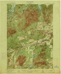 1913 Lyon Mountain1913 Print · USGSThe northern Adirondacks in the pre-war years were a landscape of mountain hamlets and industrial outposts. Genealogists and historians can trace the foundations of Lyon Mountain, locate the Loudell P.O., and follow the Delaware and Hudson RR through the high country.5 unique versions available
 - 1915 Map of Churubusco
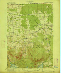 1915 Churubusco1915 Print · USGSNorthern Clinton County is documented here in the early twentieth century, showing a landscape of boundary settlements and mountain lakes. Genealogists can trace family footprints through numerous rural schoolhouses and junctions like Harrigan Corners, Churubusco, and the Halfway House.7 unique versions available
 - 1915 Map of Chateaugay
 1915 Chateaugay1915 Print · USGSNorthern Franklin County appears here during the height of its rail-and-mill era, bordering the international boundary with Canada. Genealogists can trace family footprints through dozens of numbered schoolhouses, the White Church, and industrial sites like Cooks Mill or The Forge.4 unique versions available
End of results
Showing maps 1-5 of 5
Top cities of Clinton County
- Plattsburgh historical maps
- Plattsburgh historical maps
- Peru historical maps
- Champlain historical maps
- Beekmantown historical maps
- Schuyler Falls historical maps
See more
Frequently asked questions
- What are the different types of historical maps available for Clinton County?
- What is the oldest map of Clinton County?
- Where can I purchase historical maps of Clinton County for my home or office?
- Where can I download high-res historical maps of Clinton County?
- Are there historical topographic maps available for Clinton County?
- Is there historical aerial imagery available for Clinton County?
- Where are historical maps of Clinton County sourced from?