1960s Maps of Clinton County, New York
Explore 28 historic maps of Clinton County from the 1960s. These maps offer a rare glimpse into what life looked like during the 1960s — showing old roads, neighborhoods, homes, and landmarks that have changed or disappeared over time.
Whether you're researching your family's past, planning a metal detecting trip, or studying how Clinton County's landscape evolved across the 1960s, these high-resolution maps are a powerful tool for exploring the history of this region.
- Focus on a specific era: All maps on this page are from the 1960s, giving you a focused view of this time period.
- See what’s changed: Compare century-old streets, trails, and buildings to today's modern landscape using overlays and satellite layers.
- Research with precision: Use these maps for genealogy, historical research, land use analysis, or educational projects.
- View, download, or print: Maps are fully viewable online in high resolution, and can be downloaded or printed for your own records.
Start exploring Clinton County's history through authentic maps from the 1960s. This is your window into the past.
Clinton County, NY maps
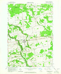
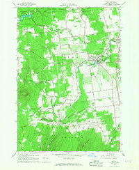
(28)- 1961 Map of Ogdensburg
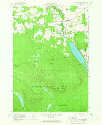
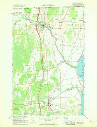
 1961 Ogdensburg1961 Print · USGSThe St. Lawrence valley and the Adirondack high country meet in this early sixties survey during a peak era for rail and river commerce. Genealogists and historians can trace the paths of the New York Central railroad through remote settlements like Wanakena, Conifer, and Piercefield.
 - 1962 Map of Lake Champlain, 1975 Print
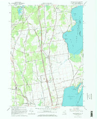
 1962 Lake Champlain1975 Print · USGSLake Champlain and the high peaks of the Adirondacks and Green Mountains are captured here during the mid-twentieth century. Researchers can trace the industrial legacy of the Lyon Mountain Mine and the rail corridors of the Central Vermont RR and Delaware & Hudson RR.3 unique versions available
 - 1964 Map of Chateaugay, 1965 Print
 1964 Chateaugay1965 Print · USGSUpper New York State meets the Canadian border in the mid-1960s, a landscape defined by the Chateaugay River and its deep gorges. Genealogists can locate family-named roads and several burial sites including Evergreen Cem and Brayton Hollow Cem.3 unique versions available
 - 1964 Map of Churubusco, 1965 Print
 1964 Churubusco1965 Print · USGSUpper Clinton County sits right on the Canadian border in the mid-1960s, showing a landscape shaped by timber, stone, and the international line. Genealogists can trace family holdings along Santamore Road or Looby Road, while historians can locate the Old RR Grade Abandoned near Clinton Mills.2 unique versions available
 - 1964 Map of Ellenburg Center, 1966 Print
 1964 Ellenburg Center1966 Print · USGSNorthern Clinton County in the 1960s was a landscape where the Adirondack wilderness met the farming communities of the Chazy River valley. Researchers can trace family homesteads near Ellenburg Center and Harrigan, or locate lakefront sites at Merrill and Moffitt Island.
 - 1964 Map of Ellenburg Depot, 1966 Print
 1964 Ellenburg Depot1966 Print · USGSClinton County’s northern borderlands are captured here in the mid-1960s as a landscape of rural hamlets and state timberlands. Researchers can locate family sites near Ellenburg Depot, St Edmunds Cem, and along the historic Military Turnpike.2 unique versions available
 - 1964 Map of Ellenburg Mountain, 1966 Print
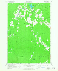
 1964 Ellenburg Mountain1966 Print · USGSClinton County's high country is captured here in the mid-1960s, showing a landscape defined by the expansive Adirondack wilderness and deep blue waters. Genealogists and hikers can trace the old corridors of Plank Road, locate the settlement at Ledger Corners, or find family landmarks like Eagle Point on Chazy Lake.2 unique versions available
 - 1964 Map of Brainardsville, 1966 Print
 1964 Brainardsville1966 Print · USGSFranklin and Clinton counties meet here in the mid-sixties, where the northern Adirondack wilderness transitions into the Chateaugay River valley. Researchers can locate remote burial grounds like Bunker Hill Cem, industrial remnants at Blairs Kiln, and the shoreline of Lower Chateaugay Lake.2 unique versions available
 - 1966 Map of Beekmantown, 1968 Print
 1966 Beekmantown1968 Print · USGSThe Lake Champlain shoreline in the mid-sixties reveals a landscape of quiet coastal points and expanding interstate infrastructure. Genealogists and historians can trace family road names and locate several burial sites including Point Au Roche Cem and Doane Cem.2 unique versions available
 - 1966 Map of Altona, 1968 Print
 1966 Altona1968 Print · USGSIn the mid-1960s, this Clinton County borderland shows the international line meeting rural New York hamlets. Genealogists and local historians can trace family sites at Walker Cem, follow the Old Railroad Grade, and locate landmarks like the U S Customs post.2 unique versions available
 - 1966 Map of Rouses Point, 1968 Print
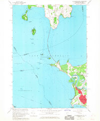
 1966 Rouses Point1968 Print · USGSUpper Lake Champlain sat at a crossroads of international trade and military history during the mid-sixties. Genealogists and historians can trace family-named points and early religious sites like St Annes Shrine, the Fort Montgomery Ruins, and the settlement of Isle La Motte.
 - 1966 Map of Morrisonville, 1968 Print
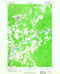
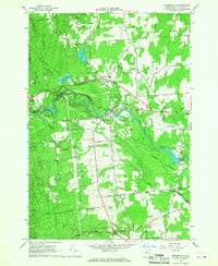 1966 Morrisonville1968 Print · USGSClinton County's river valleys and rural settlements are captured here in the mid-1960s as the region's industrial and civic landscape evolved. Genealogists and local historians can locate several family burial grounds and community landmarks, including the Irish Settlement Cem, St Alexanders Sch, and the Delaware and Hudson rail line.2 unique versions available
 - 1966 Map of North Hero, 1968 Print
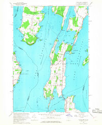 1966 North Hero1968 Print · USGSLake Champlain's islands in the mid-1960s reveal a landscape of seasonal camps, quarries, and historic crossings. Genealogists and local historians can trace family-named sites like Fisk Point and Hyde Cem or follow the path of the Old Railroad Grade.3 unique versions available
 - 1966 Map of Jericho, 1968 Print
 1966 Jericho1968 Print · USGSIn the mid-sixties, the wooded northern reaches of Clinton County show a sparse network of mountain roads and remote settlements. Genealogists and historians can trace family locations near Jericho, Purdys Mill, and Alder Bend, or find old pathways like Old Town Hall Road.2 unique versions available
 - 1966 Map of Keeseville, 1968 Print
 1966 Keeseville1968 Print · USGSLake Champlain's western shore in the mid-1960s reveals a mix of rugged Adirondack river gorges and quiet lakeside hamlets. Genealogists and local historians can trace the paths of the Delaware and Hudson RR through Port Kent or locate family sites near Blockhouse Cem and Ausable Chasm.2 unique versions available
 - 1966 Map of Champlain, 1968 Print
 1966 Champlain1968 Print · USGSThe northern New York borderlands near the Canadian line show a blend of historic river settlements and mid-century infrastructure. Researchers can trace family sites like St Marys Cem or locate local landmarks including Chazy Landing and the Plattsburgh AFB Auxiliary Site.2 unique versions available
 - 1966 Map of Mooers, 1968 Print
 1966 Mooers1968 Print · USGSClinton County’s northern borderlands come into focus in the mid-1960s, showing the rural communities along the river just south of Quebec. Genealogists can locate family names on local routes and trace history at St Josephs Cem, Perry Mills, or the Mooers Camp Meeting Association.
 - 1966 Map of Plattsburgh, 1968 Print
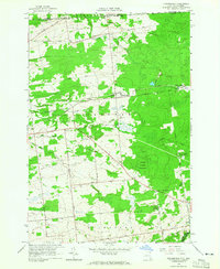
 1966 Plattsburgh1968 Print · USGSThe Lake Champlain shoreline during the mid-sixties reveals a city shaped by its massive military airfield and expanding university campus. Trace the development of Plattsburgh Air Force Base and find local landmarks like Cliff Haven or the Riverside Cem.2 unique versions available
 - 1966 Map of Dannemora, 1968 Print
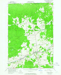
 1966 Dannemora1968 Print · USGSClinton County in the 1960s reveals a unique intersection of state institutional land and river-valley industry. Genealogists and historians can trace the Clinton State Prison grounds, family-named roads, and settlements like Picketts Corners and Cadyville.2 unique versions available
 - 1966 Map of West Chazy, 1968 Print
 1966 West Chazy1968 Print · USGSClinton County in the 1960s was a landscape of deep forests and quiet hamlets centered around the Little Chazy River. Genealogists can locate family sites at West Chazy Rural Cemetery or trace the old Military Turnpike through Beartown.2 unique versions available
 - 1966 Map of Colchester Point, 1968 Print
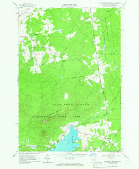
 1966 Colchester Point1968 Print · USGSLake Champlain's waters and the South Hero shoreline are captured here in the mid-sixties as post-war growth reaches the coast. Genealogists and local historians can trace family-named sites like Robinson Pt, or locate the Colchester Point Upper Sch and Mt Calvary Cem.3 unique versions available
 - 1966 Map of Peru, 1968 Print
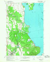
 1966 Peru1968 Print · USGSClinton County's agricultural and forest lands are captured here in the mid-sixties as the region balanced traditional industry with new transit. Researchers can trace local heritage through the Mother Cabrini Shrine, the tracks of the Delaware and Hudson, and the riverside hamlet of Laphams Mills.2 unique versions available
 - 1966 Map of South Hero, 1968 Print
 1966 South Hero1968 Print · USGSThe island towns of South Hero and Grand Isle are captured here in the mid-sixties, showing a landscape shaped by Lake Champlain and old transit lines. Genealogists and local historians can trace family-named sites like Hoag Cem, Adams Landing, and the Folsom Sch.
 - 1966 Map of Peasleeville, 1968 Print
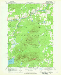
 1966 Peasleeville1968 Print · USGSPeasleeville and the surrounding Adirondack foothills are captured in the mid-sixties, showing a landscape of state forests and mountain peaks. Genealogists and hikers can trace old routes like Military Road and locate local landmarks such as Zion Ch and the Peasleeville Cem.2 unique versions available
 - 1968 Map of Redford, 1970 Print
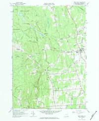
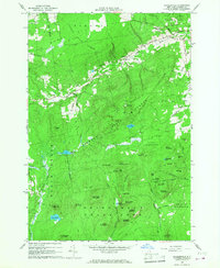
 1968 Redford1970 Print · USGSClinton County during the late 1960s shows a landscape of mountain peaks and river valley settlements. Genealogists and historians can trace the streets of Redford, locate the Assumption of Mary Ch, and find outlying hamlets like Swastika and Hawkeye.
Showing maps 1-25 of 28
Top cities of Clinton County
- Plattsburgh historical maps
- Plattsburgh historical maps
- Peru historical maps
- Champlain historical maps
- Beekmantown historical maps
- Schuyler Falls historical maps
See more
Frequently asked questions
- What are the different types of historical maps available for Clinton County?
- What is the oldest map of Clinton County?
- Where can I purchase historical maps of Clinton County for my home or office?
- Where can I download high-res historical maps of Clinton County?
- Are there historical topographic maps available for Clinton County?
- Is there historical aerial imagery available for Clinton County?
- Where are historical maps of Clinton County sourced from?