Old Maps of Newstead, New York for Hiking & Exploration
Hike through history with 51 historic maps of Newstead. Explore old trails, ghost towns, and forgotten backroads — perfect for outdoor adventurers and local explorers.
- Rediscover forgotten places: Map out old mining camps, roads, and footpaths that no longer exist on modern maps.
- Layer with modern tools: Combine with LiDAR or satellite views to plan hikes through historical terrain.
- Made for exploration: Popular among hikers, overlanders, and local history lovers.
Use these maps to find adventure and explore the hidden past of Newstead.
Newstead, NY maps
(51)- 1897 Map of Medina
 1897 Medina1897 Print · USGSWestern New York at the close of the nineteenth century reveals a landscape defined by the Erie Canal and the Tonawanda Indian Reservation. Researchers can trace the early rail-and-water economy through settlements like Medina, Akron, and the vanished stops of Smithville Sta.7 unique versions available
 - 1897 Map of Lockport
 1897 Lockport1897 Print · USGSNiagara County was a powerhouse of canal and rail commerce during the 1890s, centered on the engineering marvels at Lockport. Genealogists and historians can trace the early foundations of Clarence Center, locate Swifts Mills, or follow the original path of the Erie Canal past Raynales Basin.
 - 1899 Map of Niagara
 1899 Niagara1899 Print · USGSThe Niagara Frontier is mapped here in the late nineteenth century as a bustling corridor of trade and transport. Researchers can trace the path of the Erie Canal through Lockport or locate early rural settlements like Ransomville and the Tuscarora Indian Reservation.6 unique versions available
 - 1902 Map of Lockport
 1902 Lockport1902 Print · USGSNiagara and Erie Counties thrived at the turn of the century as the Erie Canal and heavy rail transformed the region. Researchers can trace ancestral property near Lockport or locate vanished stops along the Batavia and Tonawanda Shore Line and near Reynales Basin.6 unique versions available
 - 1905 Map of Attica
 1905 Attica1905 Print · USGSWestern New York at the turn of the century shows a landscape dominated by a massive web of competing railroads. Genealogists can trace family names and small hamlets like Folsomdale, Darien Center, and the industrial hub at Attica.5 unique versions available
 - 1905 Map of Depew
 1905 Depew1905 Print · USGSEastern Erie County at the height of the steam era reveals a complex network of major rail lines and rural hamlets. Genealogists and historians can trace old property lines and rail stations like Looneyville, Grimesville, and the early development of Depew.6 unique versions available
 - 1905 Map of Lockport, 1906 Print
 1905 Lockport1906 Print · USGSNiagara and Erie counties at the height of the canal and rail era show a landscape defined by the Erie Canal. Trace family roots in Lockport or explore early transit networks through Transit Sta., Akron, and the Electric R. R.
 - 1948 Map of Depew, 1953 Print
 1948 Depew1953 Print · USGSErie County's industrial and civic heart comes into focus during this post-war era of rail and aviation expansion. Researchers can trace ancestral roots at Clarence Fillmore Cemetery or locate old schoolhouses like School No 1 and School No 8 across Harris Hill and Marilla.3 unique versions available
 - 1948 Map of Lockport, 1953 Print
 1948 Lockport1953 Print · USGSNiagara and Erie Counties are shown here during the late forties, when the canal and rail lines still anchored the regional economy. Researchers can locate numerous numbered rural schoolhouses and vanished stops like Hodgeville Sta or Akron Junction.3 unique versions available
 - 1949 Map of Attica, 1953 Print
 1949 Attica1953 Print · USGSWestern New York at mid-century reveals a dense network of major railroads and rural hamlets across Genesee and Wyoming counties. Genealogists and historians can trace family locations through numerous numbered schools, named crossroads like Brick House Corners, and landmarks such as the Attica State Prison.
 - 1949 Map of Akron, 1965 Print
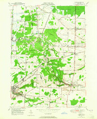 1949 Akron1965 Print · USGSWestern New York at mid-century reveals a landscape shaped by indigenous heritage and rural development. Genealogists and historians can trace family-named roads and old rail stops like Basom and Pembroke Sta, or locate sites like the Council House and Evergreen Cem.
 - 1950 Map of Corfu
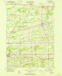 1950 Corfu1950 Print · USGSThe Erie and Genesee County borderlands thrived at mid-century as a vital railroad corridor between Buffalo and Batavia. Researchers can trace the path of four major rail lines and locate rural landmarks like Brick House Corners, School No. 13, and Fargo.2 unique versions available
 - 1950 Map of Wolcottsville
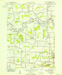 1950 Wolcottsville1950 Print · USGSNiagara and Erie Counties are captured here at the start of the 1950s, showing a transition from rural farming to structured township growth. Researchers can trace family history through numerous district schools and landmarks like Swifts Mills, Akron Junction, and the Clarence Center Church.
 - 1950 Map of Clarence
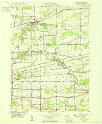 1950 Clarence1950 Print · USGSMid-century Erie County comes into focus through this survey of the rail-and-road network connecting Clarence and Alden. You can trace old property contexts via landmarks like Trinity Ch, Mt Olive Cem, and the various numbered schools scattered across the township lines.
 - 1950 Map of Medina, 1956 Print
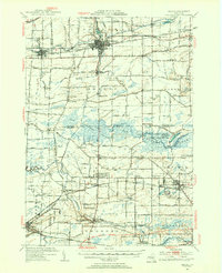 1950 Medina1956 Print · USGSOrleans and Genesee Counties are mapped here in the mid-fifties, showing the industrial pulse of the Erie Canal and New York Central corridor. Genealogists can locate numerous rural schools and landmarks like the Site of Neuter Fort, Boxwood Cem, and the Tonawanda Indian Reservation.2 unique versions available
 - 1951 Map of Akron
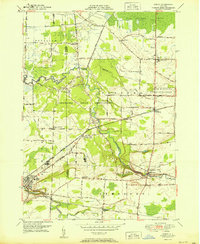 1951 Akron1951 Print · USGSThe Tonawanda Indian Reservation and the village of Akron are documented here at the start of the 1950s. Genealogists can trace family burial sites at Evergreen Cem and Long House Cem, or locate historic civic hubs like the Council House and Basom.2 unique versions available
 - 1952 Map of Toronto, 1954 Print
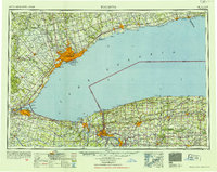 1952 Toronto1954 Print · USGSLake Ontario and the international border define this mid-century landscape of rapid industrial and suburban growth. Researchers can trace the vital shipping and rail corridors of the era, from the Welland Canal to the New York Central Railroad.
 - 1960 Map of Buffalo
 1960 Buffalo1960 Print · USGSWestern New York and the Niagara Peninsula thrive during the mid-twentieth century industrial peak. Genealogists and historians can trace family-named points and early settlements from Dunkirk Light to the Allegany Indian Reservation.
 - 1962 Map of Buffalo, 1980 Print
 1962 Buffalo1980 Print · USGSThe Niagara Frontier and Western New York are captured here in the early sixties, showing the vital industrial and maritime nexus between the U.S. and Canada. Researchers can trace the path of the Welland Canal, locate the Allegany Indian Reservation, or find family sites near Chautauqua Lake.2 unique versions available
 - 1962 Map of Toronto, 1982 Print
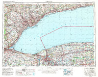 1962 Toronto1982 Print · USGSThe Golden Horseshoe and the Niagara Frontier meet in this early 1960s study of a growing international border region. Trace the path of the Welland Canal and locate land marks like the Scarborough Bluffs and Tuscarora Indian Reservation.
 - 1965 Map of Toronto
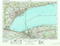 1965 Toronto1965 Print · USGSThe Golden Horseshoe and Niagara Frontier are shown in detail during the early sixties, highlighting the international shipping and transit networks. Trace the path of the Erie Canal, the Welland Canal, and rail lines connecting Toronto and Niagara Falls.2 unique versions available
 - 1965 Map of Wolcottsville, 1967 Print
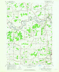 1965 Wolcottsville1967 Print · USGSThe rural borderlands between Erie and Niagara Counties are captured here in the mid-1960s as a network of small hamlets and agricultural crossroads. Researchers can trace family ties through St Michaels Ch, locate the Elridge Cem, or follow the old New York Central Railroad through Akron Junction.
 - 1965 Map of Clarence, 1967 Print
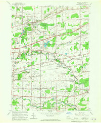 1965 Clarence1967 Print · USGSErie County in the mid-1960s reveals a transition from rural farming to expanding infrastructure between the townships of Clarence and Alden. Researchers can locate distinct landmarks such as the County Penitentiary, the Clarence Fillmore Cem, and the Town Line Station rail stop.
 - 1967 Map of Buffalo
 1967 Buffalo1967 Print · USGSWestern New York and the Lake Erie shoreline are shown here during the mid-1960s industrial peak. Researchers can trace the massive rail networks of the Erie Railroad, locate the Cattaraugus Indian Reservation, or find historic sites like Fort Erie.
 - 1973 Map of Buffalo
 1973 Buffalo1973 Print · USGSWestern New York and Ontario's Golden Horseshoe meet in the early seventies, spanning from the industrial waterfronts of Buffalo to the hills of Allegany State Park. Trace the paths of the Welland Canal and Erie Lackawanna railroad through the lakefront towns of Dunkirk and Port Colborne.
Showing maps 1-25 of 51
Top cities near Newstead
- Amherst historical maps
- Cheektowaga historical maps
- West Seneca historical maps
- Lancaster historical maps
- Clarence historical maps
- Orchard Park historical maps
See more
Top neighborhoods of Newstead
- South Newstead historical maps
- Sand Hill historical maps
- Swifts Mills historical maps
- Murrays Corner historical maps
- Akron historical maps
Frequently asked questions
- What are the different types of historical maps available for Newstead?
- What is the oldest map of Newstead?
- Where can I purchase historical maps of Newstead for my home or office?
- Where can I download high-res historical maps of Newstead?
- Are there historical topographic maps available for Newstead?
- Is there historical aerial imagery available for Newstead?
- Where are historical maps of Newstead sourced from?