1970s Maps of Wales, New York
Explore 2 historic maps of Wales from the 1970s. These maps offer a rare glimpse into what life looked like during the 1970s — showing old roads, neighborhoods, homes, and landmarks that have changed or disappeared over time.
Whether you're researching your family's past, planning a metal detecting trip, or studying how Wales's landscape evolved across the 1970s, these high-resolution maps are a powerful tool for exploring the history of this region.
- Focus on a specific era: All maps on this page are from the 1970s, giving you a focused view of this time period.
- See what’s changed: Compare century-old streets, trails, and buildings to today's modern landscape using overlays and satellite layers.
- Research with precision: Use these maps for genealogy, historical research, land use analysis, or educational projects.
- View, download, or print: Maps are fully viewable online in high resolution, and can be downloaded or printed for your own records.
Start exploring Wales's history through authentic maps from the 1970s. This is your window into the past.
Wales, NY maps
(2)- 1973 Map of Buffalo
 1973 Buffalo1973 Print · USGSWestern New York and Ontario's Golden Horseshoe meet in the early seventies, spanning from the industrial waterfronts of Buffalo to the hills of Allegany State Park. Trace the paths of the Welland Canal and Erie Lackawanna railroad through the lakefront towns of Dunkirk and Port Colborne.
 - 1979 Map of Holland
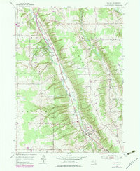 1979 Holland1979 Print · USGSErie County's rural character is on full display in the late 1970s as agricultural valleys and wooded ridges meet along the East Branch Cazenovia Creek. Family historians can trace numerous burial sites like Humphrey Cem and local landmarks such as the Gow Sch and Emery Park.
End of results
Showing maps 1-2 of 2
Top cities near Wales
- Amherst historical maps
- Cheektowaga historical maps
- West Seneca historical maps
- Lancaster historical maps
- Clarence historical maps
- Orchard Park historical maps
See more
Top neighborhoods of Wales
Frequently asked questions
- What are the different types of historical maps available for Wales?
- What is the oldest map of Wales?
- Where can I purchase historical maps of Wales for my home or office?
- Where can I download high-res historical maps of Wales?
- Are there historical topographic maps available for Wales?
- Is there historical aerial imagery available for Wales?
- Where are historical maps of Wales sourced from?