Old Maps of Paul Smiths, Brighton for Hiking & Exploration
Hike through history with 24 historic maps of Paul Smiths. Explore old trails, ghost towns, and forgotten backroads — perfect for outdoor adventurers and local explorers.
- Rediscover forgotten places: Map out old mining camps, roads, and footpaths that no longer exist on modern maps.
- Layer with modern tools: Combine with LiDAR or satellite views to plan hikes through historical terrain.
- Made for exploration: Popular among hikers, overlanders, and local history lovers.
Use these maps to find adventure and explore the hidden past of Paul Smiths.
Paul Smiths, Brighton maps
(24)- 1902 Map of Saranac, 1953 Print
 1902 Saranac1953 Print · USGSThe Adirondack High Peaks region comes alive in this survey from the early 1900s, showcasing the expansion of rail and water-based commerce. Researchers can trace the development of Saranac Lake, locate early industrial sites like Ames Mills, and follow the path of the Adirondack Division railroad.
 - 1904 Map of Saranac
 1904 Saranac1904 Print · USGSSaranac Lake and the northern Adirondacks are captured here during the height of the early railroad era. Genealogists and historians can trace the paths of the Adirondack Division and Chateaugay Branch through settlements like Bloomingdale, Gabriels, and Onchiota.10 unique versions available
 - 1905 Map of Saint Regis
 1905 Saint Regis1905 Print · USGSFranklin County's wilderness is captured at the height of the early resort and logging era, showing the rail lines that opened these woods to the world. Trace the paths of the Adirondack Division or locate historic outposts like Brandon, Paul Smiths, and Wawbeek.9 unique versions available
 - 1948 Map of Ogdensburg, 1973 Print
 1948 Ogdensburg1973 Print · USGSThe international border along the St Lawrence River comes to life in the late 1940s, showing the vital rail and water connections between New York and Ontario. Researchers can trace the grounds of St Lawrence University, the massive Camp Drum military reservation, and the historic Rideau River and Canal.2 unique versions available
 - 1951 Map of Ogdensburg
 1951 Ogdensburg1951 Print · USGSThe St. Lawrence frontier and the North Country are captured here during the post-war era, from the river ports to the high Adirondacks. Genealogists and historians can trace the rail-and-river economy through Ogdensburg, the Rutland rail lines, and Potsdam.
 - 1953 Map of Ogdensburg
 1953 Ogdensburg1953 Print · USGSThe North Country and St. Lawrence Valley are shown here in the early fifties, just as the region’s rail-and-river economy remained in full swing. Genealogists and historians can trace family-named corners and rural hubs along the Rutland railroad or locate heritage sites near Ogdensburg, Potsdam, and the St Regis Indian Reservation.
 - 1955 Map of Saranac Lake, 1957 Print
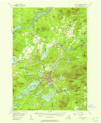 1955 Saranac Lake1957 Print · USGSSaranac Lake and its surrounding mountain communities were flourishing hubs of the Adirondacks during the mid-fifties. Researchers can trace family history through sites like St Pauls Cem, rural landmarks like Eight Square Sch, and the rail infrastructure at Lake Clear Junction.5 unique versions available
 - 1955 Map of Saint Regis, 1957 Print
 1955 Saint Regis1957 Print · USGSThe Adirondack lake country comes alive in the mid-1950s, showing the intersection of remote wilderness and early tourism. Researchers can trace the sprawling grounds of Paul Smiths College, the route of the New York Central Railroad, and landmarks like Keese Mill.5 unique versions available
 - 1961 Map of Ogdensburg
 1961 Ogdensburg1961 Print · USGSThe St. Lawrence valley and the Adirondack high country meet in this early sixties survey during a peak era for rail and river commerce. Genealogists and historians can trace the paths of the New York Central railroad through remote settlements like Wanakena, Conifer, and Piercefield.
 - 1978 Map of Bloomingdale
 1978 Bloomingdale1978 Print · USGSThe Adirondack High Peaks region during the late 1970s shows a landscape of mountain hamlets and sprawling lakes. Local researchers can trace family names and institutions from Paul Smiths College to quiet burial grounds like Mountain View Cemetery and St Johns Cem.
 - 1979 Map of Saint Regis Mtn
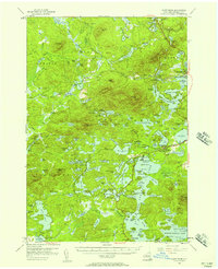
 1979 Saint Regis Mtn1979 Print · USGSFranklin County's high peaks and interconnected lakes are captured here in the late seventies as the region balanced wilderness and settlement. Researchers can trace historic locations like Keese Mill, the lakeside community of Paul Smiths, and the rugged trails leading to Saint Regis Mtn.2 unique versions available
 - 1985 Map of Tupper Lake, 1986 Print
 1985 Tupper Lake1986 Print · USGSThe Adirondacks in the mid-1980s reveal a network of mountain villages and timber-connected outposts. Researchers can trace the Adirondack RR through Saranac Lake or locate old industrial hamlets like Newton Falls and Gleasons Mill.2 unique versions available
 - 1999 Map of Saint Regis Mtn., 2001 Print
 1999 Saint Regis Mtn.2001 Print · USGSFranklin County at the close of the twentieth century remains a landscape of deep woods and glacial lakes within the Adirondack Park. Researchers can trace the layout of Paul Smiths and Keese Mill, or locate landmarks like the Lookout Tower on Saint Regis Mtn and the waterfront near Spitfire Lake.
 - 1999 Map of Bloomingdale, 2001 Print
 1999 Bloomingdale2001 Print · USGSThe northern Adirondack high country is shown in the late 1990s, centering on the communities of Bloomingdale and Vermontville. Trace local history at Paul Smiths College or find family roots at Mountain View Cemetery and St Pauls Cem.
 - 2010 Map of Saint Regis Mountain, 2010 Print
 2010 Saint Regis Mountain2010 Print · USGSCovers Paul Smiths, including Harrietstown, Brighton, and other nearby areas
 - 2010 Map of Gabriels, 2010 Print
 2010 Gabriels2010 Print · USGSCovers Paul Smiths, including Harrietstown, Saint Armand, and other nearby areas
 - 2013 Map of Saint Regis Mountain, 2013 Print
 2013 Saint Regis Mountain2013 Print · USGSCovers Paul Smiths, including Harrietstown, Brighton, and other nearby areas
 - 2013 Map of Gabriels, 2013 Print
 2013 Gabriels2013 Print · USGSCovers Paul Smiths, including Harrietstown, Saint Armand, and other nearby areas
 - 2016 Map of Gabriels, 2016 Print
 2016 Gabriels2016 Print · USGSCovers Paul Smiths, including Harrietstown, Saint Armand, and other nearby areas
 - 2016 Map of Saint Regis Mountain, 2016 Print
 2016 Saint Regis Mountain2016 Print · USGSCovers Paul Smiths, including Harrietstown, Brighton, and other nearby areas
 - 2019 Map of Gabriels, 2019 Print
 2019 Gabriels2019 Print · USGSCovers Paul Smiths, including Harrietstown, Saint Armand, and other nearby areas
 - 2019 Map of Saint Regis Mountain, 2019 Print
 2019 Saint Regis Mountain2019 Print · USGSCovers Paul Smiths, including Harrietstown, Brighton, and other nearby areas
 - 2023 Map of Saint Regis Mountain, 2023 Print
 2023 Saint Regis Mountain2023 Print · USGSThe Adirondack lake country around the turn of the twenty-first century remains defined by its historic water routes and mountain camps. Genealogists and hikers can trace the old portages like St Regis Carry and find landmarks at Paul Smiths and Keese Mill.
 - 2023 Map of Gabriels, 2023 Print
 2023 Gabriels2023 Print · USGSThe lake-strewn landscape near Gabriels and Paul Smiths is documented here in the early twenty-first century. Researchers can trace family history at Saint Johns Cem, explore the winding Osgood River, or locate the historic settlement of Onchiota.
End of results
Showing maps 1-24 of 24
Top cities near Paul Smiths
- North Elba historical maps
- Harrietstown historical maps
- Tupper Lake historical maps
- Saranac Lake historical maps
- Tupper Lake historical maps
- Saint Armand historical maps
See more
Frequently asked questions
- What are the different types of historical maps available for Paul Smiths?
- What is the oldest map of Paul Smiths?
- Where can I purchase historical maps of Paul Smiths for my home or office?
- Where can I download high-res historical maps of Paul Smiths?
- Are there historical topographic maps available for Paul Smiths?
- Is there historical aerial imagery available for Paul Smiths?
- Where are historical maps of Paul Smiths sourced from?