Old Maps of Chateaugay, New York
Explore 15 old maps of Chateaugay, spanning from 1915 to today. These high-resolution historic maps reveal how streets, neighborhoods, landmarks, and natural features evolved over time — perfect for genealogy, metal detecting, research, and local history exploration.
What you can do with these maps:
- See how Chateaugay changed over time: Compare historical maps to modern-day views to trace roads, homesites, rail lines & more.
- View detailed metadata: Each map includes creators, publishers, year, scale, and archive source.
- Overlay maps with satellite & LiDAR: Visualize the past alongside modern tools to explore terrain & human change.
- Trusted historical sources: Maps sourced from the USGS, Library of Congress, and other archives.
- Access maps your way: View online, download high-res files, or order prints for personal or research use.
Start exploring old maps of Chateaugay to uncover forgotten places, hidden landmarks, and the deep history beneath your feet.
Chateaugay, NY maps
(15)- 1915 Map of Chateaugay
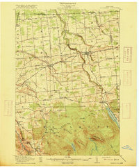 1915 Chateaugay1915 Print · USGSCovers Chateaugay, including Malone, Ellenburg, and other nearby areas4 unique versions available
 - 1943 Map of Chateaugay
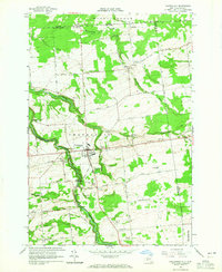
 1943 Chateaugay1943 Print · USGSCovers Chateaugay, including Malone, Ellenburg, and other nearby areas
 - 1948 Map of Ogdensburg, 1973 Print
 1948 Ogdensburg1973 Print · USGSCovers Chateaugay, including Le Ray, Brockville, and other nearby areas2 unique versions available
 - 1951 Map of Ogdensburg
 1951 Ogdensburg1951 Print · USGSCovers Chateaugay, including Le Ray, Brockville, and other nearby areas
 - 1953 Map of Ogdensburg
 1953 Ogdensburg1953 Print · USGSCovers Chateaugay, including Le Ray, Brockville, and other nearby areas
 - 1961 Map of Ogdensburg
 1961 Ogdensburg1961 Print · USGSCovers Chateaugay, including Le Ray, Brockville, and other nearby areas
 - 1964 Map of Chateaugay, 1965 Print
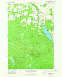
 1964 Chateaugay1965 Print · USGSCovers Chateaugay, including Ellenburg, Burke, and other nearby areas3 unique versions available
 - 1964 Map of Burke, 1965 Print
 1964 Burke1965 Print · USGSCovers Chateaugay, including Malone, Constable, and other nearby areas
 - 1964 Map of Brainardsville, 1966 Print
 1964 Brainardsville1966 Print · USGSCovers Chateaugay, including Ellenburg, Burke, and other nearby areas2 unique versions available
 - 1977 Map of Chateaugay Port of Entry, 1978 Print
 1977 Chateaugay Port of Entry1978 Print · USGSCovers Chateaugay, including Ormstown, Clinton, and other nearby areas
 - 1977 Map of Jamiesons Line Station, 1978 Print
 1977 Jamiesons Line Station1978 Print · USGSCovers Chateaugay, including Constable, Burke, and other nearby areas
 - 1985 Map of Massena
 1985 Massena1985 Print · USGSCovers Chateaugay, including Potsdam, South Stormont, and other nearby areas
 - 1993 Map of Burke, 1995 Print
 1993 Burke1995 Print · USGSCovers Chateaugay, including Malone, Constable, and other nearby areas
 - 1993 Map of Chateaugay, 1995 Print
 1993 Chateaugay1995 Print · USGSCovers Chateaugay, including Ellenburg, Burke, and other nearby areas
 - 1994 Map of Massena
 1994 Massena1994 Print · USGSCovers Chateaugay, including Potsdam, South Stormont, and other nearby areas
End of results
Showing maps 1-15 of 15
Top cities near Chateaugay
- Malone historical maps
- Malone historical maps
- Dannemora historical maps
- Saranac historical maps
- Ellenburg historical maps
- Constable historical maps
See more
Top neighborhoods of Chateaugay
- Brayton Hollow historical maps
- Cooks Mill historical maps
- Earlville historical maps
- Chateaugay historical maps
Frequently asked questions
- What are the different types of historical maps available for Chateaugay?
- What is the oldest map of Chateaugay?
- Where can I purchase historical maps of Chateaugay for my home or office?
- Where can I download high-res historical maps of Chateaugay?
- Are there historical topographic maps available for Chateaugay?
- Is there historical aerial imagery available for Chateaugay?
- Where are historical maps of Chateaugay sourced from?