1900-1909 Maps of Franklin, New York
Explore 4 historic maps of Franklin from 1900-1909. These maps offer a rare glimpse into what life looked like during the 1900s — showing old roads, neighborhoods, homes, and landmarks that have changed or disappeared over time.
Whether you're researching your family's past, planning a metal detecting trip, or studying how Franklin's landscape evolved across the 1900s, these high-resolution maps are a powerful tool for exploring the history of this region.
- Focus on a specific era: All maps on this page are from the 1900s, giving you a focused view of this time period.
- See what’s changed: Compare century-old streets, trails, and buildings to today's modern landscape using overlays and satellite layers.
- Research with precision: Use these maps for genealogy, historical research, land use analysis, or educational projects.
- View, download, or print: Maps are fully viewable online in high resolution, and can be downloaded or printed for your own records.
Start exploring Franklin's history through authentic maps from the 1900s. This is your window into the past.
Franklin, NY maps
(4)- 1902 Map of Saranac, 1953 Print
 1902 Saranac1953 Print · USGSThe Adirondack High Peaks region comes alive in this survey from the early 1900s, showcasing the expansion of rail and water-based commerce. Researchers can trace the development of Saranac Lake, locate early industrial sites like Ames Mills, and follow the path of the Adirondack Division railroad.
 - 1904 Map of Saranac
 1904 Saranac1904 Print · USGSSaranac Lake and the northern Adirondacks are captured here during the height of the early railroad era. Genealogists and historians can trace the paths of the Adirondack Division and Chateaugay Branch through settlements like Bloomingdale, Gabriels, and Onchiota.10 unique versions available
 - 1906 Map of Loon Lake, 1958 Print
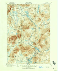 1906 Loon Lake1958 Print · USGSThe northern Adirondacks at the turn of the century are shown here as a landscape of remote mountain outposts and expanding rail lines. Researchers can trace early family-named sites like Hunter Home, local industries at Upper Kilns, and the junction of the Delaware and Hudson railroad.2 unique versions available
 - 1908 Map of Loon Lake
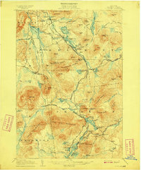 1908 Loon Lake1908 Print · USGSFranklin County's mountain wilderness is captured here in the early twentieth century, showing a landscape defined by timber kilns and nascent rail travel. Genealogists and historians can trace old homesteads and landmarks like Inman PO, Bryants Mill, and the historic Port Kent and Hopkinton Turnpike.6 unique versions available
End of results
Showing maps 1-4 of 4
Top cities near Franklin
- Malone historical maps
- North Elba historical maps
- Harrietstown historical maps
- Saranac Lake historical maps
- Dannemora historical maps
- Saranac historical maps
See more
Top neighborhoods of Franklin
- Sugarbush historical maps
- Two Brooks historical maps
- Alder Brook historical maps
- Franklin Falls historical maps
- Onchiota historical maps
- Vermontville historical maps
See more
Frequently asked questions
- What are the different types of historical maps available for Franklin?
- What is the oldest map of Franklin?
- Where can I purchase historical maps of Franklin for my home or office?
- Where can I download high-res historical maps of Franklin?
- Are there historical topographic maps available for Franklin?
- Is there historical aerial imagery available for Franklin?
- Where are historical maps of Franklin sourced from?