Old Maps of Franklin, New York for Metal Detecting
Plan your next treasure hunt with 77 historic maps of Franklin. Find old homesites, ghost towns, trails, and gathering spots that may be lost to time — perfect for identifying promising metal detecting locations.
- Locate forgotten sites: Uncover places like long-lost settlements, abandoned rail lines, or gathering spots.
- Plan better hunts: Use map overlays combined with LiDAR or satellite views to narrow in on historically rich areas.
- Made for detectorists: Thousands of hobbyists use these maps to discover relics, coins, and hidden history.
Use these historic maps to boost your research and find new opportunities beneath the surface of Franklin.
Franklin, NY maps
(77)- 1896 Map of Lake Placid
 1896 Lake Placid1896 Print · USGSThe High Peaks wilderness of the 1890s reveals a landscape of early iron industry and burgeoning mountain tourism. Genealogists and hikers can trace the original paths around John Browns Grave, the industry at West Kilns, and the early buildings at Undercliff.
 - 1898 Map of Lake Placid
 1898 Lake Placid1898 Print · USGSThe Adirondack High Peaks are captured here in the late nineteenth century as the region evolved into a premier destination for hikers and historians. Trace the early settlement of Lake Placid, the industrial sites at West Kilns, and the landmark John Browns Grave.12 unique versions available
 - 1902 Map of Saranac, 1953 Print
 1902 Saranac1953 Print · USGSThe Adirondack High Peaks region comes alive in this survey from the early 1900s, showcasing the expansion of rail and water-based commerce. Researchers can trace the development of Saranac Lake, locate early industrial sites like Ames Mills, and follow the path of the Adirondack Division railroad.
 - 1904 Map of Saranac
 1904 Saranac1904 Print · USGSSaranac Lake and the northern Adirondacks are captured here during the height of the early railroad era. Genealogists and historians can trace the paths of the Adirondack Division and Chateaugay Branch through settlements like Bloomingdale, Gabriels, and Onchiota.10 unique versions available
 - 1906 Map of Loon Lake, 1958 Print
 1906 Loon Lake1958 Print · USGSThe northern Adirondacks at the turn of the century are shown here as a landscape of remote mountain outposts and expanding rail lines. Researchers can trace early family-named sites like Hunter Home, local industries at Upper Kilns, and the junction of the Delaware and Hudson railroad.2 unique versions available
 - 1908 Map of Loon Lake
 1908 Loon Lake1908 Print · USGSFranklin County's mountain wilderness is captured here in the early twentieth century, showing a landscape defined by timber kilns and nascent rail travel. Genealogists and historians can trace old homesteads and landmarks like Inman PO, Bryants Mill, and the historic Port Kent and Hopkinton Turnpike.6 unique versions available
 - 1911 Map of Lyon Mountain, 1956 Print
 1911 Lyon Mountain1956 Print · USGSThe northern Adirondacks at the peak of the iron era reveal a landscape of mining hamlets and mountain kilns. Genealogists can trace family footprints in Loudell PO, Standish, and Sugarbush, or follow the industrial path of the Delaware and Hudson RR.2 unique versions available
 - 1913 Map of Lyon Mountain
 1913 Lyon Mountain1913 Print · USGSThe northern Adirondacks in the pre-war years were a landscape of mountain hamlets and industrial outposts. Genealogists and historians can trace the foundations of Lyon Mountain, locate the Loudell P.O., and follow the Delaware and Hudson RR through the high country.5 unique versions available
 - 1931 Map of Lyon Mountain
 1931 Lyon Mountain1931 Print · USGSThe northern Adirondack mining and timber lands are shown here in the early 1900s, centered on the heights of Lyon Mountain. Researchers can trace the Chateaugay R.R. as it serves industrial sites like Junction Kilns and the settlement at Standish.
 - 1948 Map of Ogdensburg, 1973 Print
 1948 Ogdensburg1973 Print · USGSThe international border along the St Lawrence River comes to life in the late 1940s, showing the vital rail and water connections between New York and Ontario. Researchers can trace the grounds of St Lawrence University, the massive Camp Drum military reservation, and the historic Rideau River and Canal.2 unique versions available
 - 1950 Map of Lake Champlain
 1950 Lake Champlain1950 Print · USGSThe Lake Champlain valley and its surrounding peaks are captured in detail during the late 1940s, showing the vital rail and road connections between New York and Vermont. Researchers can trace the routes of the Central Vermont Railway or locate old industrial centers like Mineville and Witherbee.2 unique versions available
 - 1951 Map of Ogdensburg
 1951 Ogdensburg1951 Print · USGSThe St. Lawrence frontier and the North Country are captured here during the post-war era, from the river ports to the high Adirondacks. Genealogists and historians can trace the rail-and-river economy through Ogdensburg, the Rutland rail lines, and Potsdam.
 - 1953 Map of Ogdensburg
 1953 Ogdensburg1953 Print · USGSThe North Country and St. Lawrence Valley are shown here in the early fifties, just as the region’s rail-and-river economy remained in full swing. Genealogists and historians can trace family-named corners and rural hubs along the Rutland railroad or locate heritage sites near Ogdensburg, Potsdam, and the St Regis Indian Reservation.
 - 1953 Map of Lake Placid, 1957 Print
 1953 Lake Placid1957 Print · USGSThe High Peaks region during the mid-fifties shows a landscape defined by mountain hamlets and early Adirondack tourism. Genealogists and historians can trace family sites at Quaker Cem, the John Browns Grave historic site, and early industrial landmarks like West Kilns.4 unique versions available
 - 1955 Map of Saranac Lake, 1957 Print
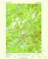 1955 Saranac Lake1957 Print · USGSSaranac Lake and its surrounding mountain communities were flourishing hubs of the Adirondacks during the mid-fifties. Researchers can trace family history through sites like St Pauls Cem, rural landmarks like Eight Square Sch, and the rail infrastructure at Lake Clear Junction.5 unique versions available
 - 1958 Map of Lake Champlain
 1958 Lake Champlain1958 Print · USGSThe Champlain Valley and surrounding high peaks are captured here in the late fifties, showcasing the cross-border region from the Adirondacks to the Green Mountains. Researchers can trace historic rail routes like the Rutland Railway or locate old valley settlements such as Keeseville and Vergennes.2 unique versions available
 - 1961 Map of Ogdensburg
 1961 Ogdensburg1961 Print · USGSThe St. Lawrence valley and the Adirondack high country meet in this early sixties survey during a peak era for rail and river commerce. Genealogists and historians can trace the paths of the New York Central railroad through remote settlements like Wanakena, Conifer, and Piercefield.
 - 1962 Map of Lake Champlain, 1975 Print
 1962 Lake Champlain1975 Print · USGSLake Champlain and the high peaks of the Adirondacks and Green Mountains are captured here during the mid-twentieth century. Researchers can trace the industrial legacy of the Lyon Mountain Mine and the rail corridors of the Central Vermont RR and Delaware & Hudson RR.3 unique versions available
 - 1968 Map of Loon Lake, 1970 Print
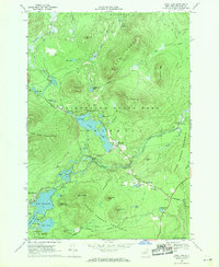 1968 Loon Lake1970 Print · USGSFranklin County's high country is captured here in the late sixties as recreation began to define the Adirondacks. Genealogists and historians can trace the foundations of Merrillsville, locate the White Fathers property, and follow an Old Railroad Grade past Lake Kushaqua.2 unique versions available
 - 1968 Map of Ragged Lake, 1970 Print
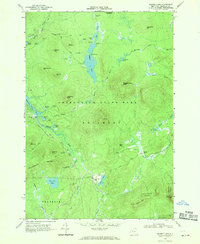 1968 Ragged Lake1970 Print · USGSFranklin County's remote timber and tanning history is preserved here in the late sixties, just as the forest was reclaiming industrial sites. Trace the path of the Old Railroad Grade to find Upper Kilns and Bryants Mill along the Salmon River.2 unique versions available
 - 1968 Map of Lyon Mountain, 1970 Print
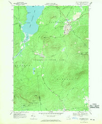 1968 Lyon Mountain1970 Print · USGSAdirondack mining and wilderness intersect in the late sixties as iron works and rail lines define the rugged terrain. Researchers can trace the industrial layout of Lyon Mountain and Standish, from the St Bernards Ch to the sprawling Mine Dumps.
 - 1968 Map of Debar Mountain, 1970 Print
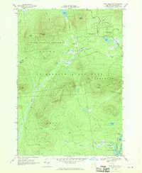 1968 Debar Mountain1970 Print · USGSThe Adirondack wilderness in the late sixties is captured here, showing the protected forest lands of Franklin County. Researchers can trace historical routes along the Old RR Grade or locate landmarks like the Lookout Tower and Debar Pond.3 unique versions available
 - 1968 Map of Owls Head, 1970 Print
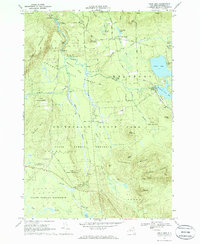 1968 Owls Head1970 Print · USGSThe Adirondack highlands near Duane and Mountain View are captured in the late sixties, showcasing a landscape of high-country lakes and timber-industry remnants. Researchers can locate the Hoose Cem, St Josephs Ch, and old logging routes like Benoit Road.3 unique versions available
 - 1968 Map of Alder Brook, 1970 Print
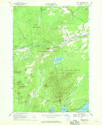 1968 Alder Brook1970 Print · USGSThe Adirondack wilderness of the late sixties is documented here as the Saranac River system winds through the Clinton and Franklin county line. Researchers can locate remote settlements like Goldsmith and Sugarbush or find family names at St Rose Cem.
 - 1978 Map of Bloomingdale
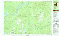 1978 Bloomingdale1978 Print · USGSThe Adirondack High Peaks region during the late 1970s shows a landscape of mountain hamlets and sprawling lakes. Local researchers can trace family names and institutions from Paul Smiths College to quiet burial grounds like Mountain View Cemetery and St Johns Cem.
Showing maps 1-25 of 77
Top cities near Franklin
- Malone historical maps
- North Elba historical maps
- Harrietstown historical maps
- Saranac Lake historical maps
- Dannemora historical maps
- Saranac historical maps
See more
Top neighborhoods of Franklin
- Sugarbush historical maps
- Two Brooks historical maps
- Alder Brook historical maps
- Franklin Falls historical maps
- Onchiota historical maps
- Vermontville historical maps
See more
Frequently asked questions
- What are the different types of historical maps available for Franklin?
- What is the oldest map of Franklin?
- Where can I purchase historical maps of Franklin for my home or office?
- Where can I download high-res historical maps of Franklin?
- Are there historical topographic maps available for Franklin?
- Is there historical aerial imagery available for Franklin?
- Where are historical maps of Franklin sourced from?