1980s Maps of Genesee County, New York
Explore 6 historic maps of Genesee County from the 1980s. These maps offer a rare glimpse into what life looked like during the 1980s — showing old roads, neighborhoods, homes, and landmarks that have changed or disappeared over time.
Whether you're researching your family's past, planning a metal detecting trip, or studying how Genesee County's landscape evolved across the 1980s, these high-resolution maps are a powerful tool for exploring the history of this region.
- Focus on a specific era: All maps on this page are from the 1980s, giving you a focused view of this time period.
- See what’s changed: Compare century-old streets, trails, and buildings to today's modern landscape using overlays and satellite layers.
- Research with precision: Use these maps for genealogy, historical research, land use analysis, or educational projects.
- View, download, or print: Maps are fully viewable online in high resolution, and can be downloaded or printed for your own records.
Start exploring Genesee County's history through authentic maps from the 1980s. This is your window into the past.
Genesee County, NY maps
(6)- 1981 Map of Akron
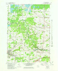 1981 Akron1981 Print · USGSThe Erie and Genesee county border in the early eighties centers on the Tonawanda Indian Reservation and the industrial village of Akron. Genealogists and historians can trace family sites at Four Corners Cem or locate industrial relics like the Mine Shaft near Basom.
 - 1983 Map of Canandaigua, 1985 Print
 1983 Canandaigua1985 Print · USGSThe Finger Lakes and Genesee Valley appear in high detail in the early 1980s as the region's transport and academic centers reached a peak. Researchers can trace rail lines like the Lehigh Valley RR and find landmarks such as the Mount Morris Dam and Gannagaro State Historical Site.2 unique versions available
 - 1984 Map of Rochester
 1984 Rochester1984 Print · USGSThe Rochester lakefront and Genesee Valley are shown here in the mid-eighties as suburban growth reached historic canal towns and rural outposts. Genealogists can locate family landmarks like Mud Mills, the Angel Moroni Monument, and Lake View Cemetery.2 unique versions available
 - 1984 Map of Corfu
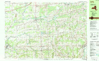 1984 Corfu1984 Print · USGSWestern New York in the early eighties shows a mix of growing recreation and established rail corridors. Trace family roots at Hillside Cem, locate the old Corfu Station, or explore the early footprint of Darien Lakes State Park.2 unique versions available
 - 1984 Map of Buffalo, 1985 Print
 1984 Buffalo1985 Print · USGSWestern New York's industrial and transport hubs are in full view during the mid-eighties, from the Lake Erie waterfront to the Genesee Valley. Researchers can trace the legacy of the Erie Canal, find ancestral sites like Mount Calvary Cem, or locate the Attica Correctional Facility.2 unique versions available
 - 1984 Map of Lockport, 1985 Print
 1984 Lockport1985 Print · USGSWestern New York in the 1980s shows a landscape of lakefront parks, industrial rail corridors, and vast protected wetlands. Genealogists and historians can trace the legacy of local families through sites like Acacia Park Cem or the Tuscarora Indian Reservation.2 unique versions available
End of results
Showing maps 1-6 of 6
Top cities of Genesee County
- Batavia historical maps
- LeRoy historical maps
- Batavia historical maps
- Pembroke historical maps
- Oakfield historical maps
- Bergen historical maps
See more
Frequently asked questions
- What are the different types of historical maps available for Genesee County?
- What is the oldest map of Genesee County?
- Where can I purchase historical maps of Genesee County for my home or office?
- Where can I download high-res historical maps of Genesee County?
- Are there historical topographic maps available for Genesee County?
- Is there historical aerial imagery available for Genesee County?
- Where are historical maps of Genesee County sourced from?