1900s (20th Century) Maps of Inwood, Hempstead
Explore 23 historic maps of Inwood from the 1900s (20th Century). These maps offer a rare glimpse into what life looked like during the 1900s — showing old roads, neighborhoods, homes, and landmarks that have changed or disappeared over time.
Whether you're researching your family's past, planning a metal detecting trip, or studying how Inwood's landscape evolved across the 1900s, these high-resolution maps are a powerful tool for exploring the history of this region.
- Focus on a specific era: All maps on this page are from the 1900s, giving you a focused view of this time period.
- See what’s changed: Compare century-old streets, trails, and buildings to today's modern landscape using overlays and satellite layers.
- Research with precision: Use these maps for genealogy, historical research, land use analysis, or educational projects.
- View, download, or print: Maps are fully viewable online in high resolution, and can be downloaded or printed for your own records.
Start exploring Inwood's history through authentic maps from the 1900s. This is your window into the past.
Inwood, Hempstead maps
(23)- 1900 Map of Brooklyn
 1900 Brooklyn1900 Print · USGSBrooklyn and Queens are shown here at the turn of the century as the urban grid begins to overtake rural villages and coastal marshes. Genealogists can locate family plots in Greenwood Cemetery or Evergreen Cemetery and trace early transit routes like the Electric R.R. and Kings Highway.11 unique versions available
 - 1903 Map of Hempstead
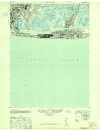
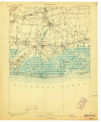 1903 Hempstead1903 Print · USGSSouthern Nassau County at the turn of the century shows a landscape transitioning from rural estates and marshlands to rail-connected villages. Genealogists can trace family footprints in Hempstead or Garden City and locate coastal landmarks like Christian Hook and the Camp Meeting Grounds.9 unique versions available
 - 1947 Map of Jamaica
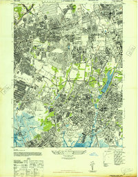
 1947 Jamaica1947 Print · USGSQueens and Brooklyn are shown in a period of rapid post-war expansion, where the traditional rail-oriented neighborhoods met the dawn of the parkway era. Researchers can trace the development of South Ozone Park, locate the now-redeveloped Jamaica Race Track, or study the marshlands around Sunrise Airport before the landscape was fully transformed.
 - 1947 Map of Lynbrook
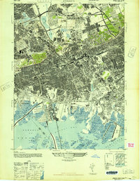
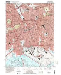
 1947 Lynbrook1947 Print · USGSNassau County and the Queens border are shown here in the late forties during a period of massive suburban growth. Genealogists and historians can trace rail-centered communities, family sites near Elmont Cem, and major landmarks like Belmont Park Race Track or the Curtiss Wright Airport.
 - 1947 Map of Far Rockaway
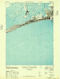 1947 Far Rockaway1947 Print · USGSThe Rockaway Peninsula and Jamaica Bay thrive in the late 1940s, showing a densely developed coastline of hotels and boardwalks. Trace the vanished stops of the Long Island Railroad and find landmarks like the Arverne Hotel or Jacob Riis Park.
 - 1947 Map of Lawrence
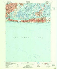
 1947 Lawrence1947 Print · USGSThe South Shore of Long Island in the late 1940s reveals a thriving coastal culture of yacht clubs and beachfront hotels. Genealogists and local historians can trace the mid-century layout of Long Beach and Lawrence, locating landmarks like St Marys of the Isle and the Nassau Hotel.
 - 1949 Map of New York, 1951 Print
 1949 New York1951 Print · USGSLong Island and its surrounding waters are documented here in the late 1940s, just as the postwar suburban boom began to transform the region. Genealogists and historians can trace the early layouts of Idlewild Airport, Mitchell Field, and the established routes of the Long Island RR.
 - 1954 Map of New York
 1954 New York1954 Print · USGSLong Island and the New York metropolitan area are shown during the height of post-war suburbanization. Genealogists and historians can trace the growth of Levittown, the infrastructure of the Long Island Rail Road, and landmarks like Mitchel Afb.2 unique versions available
 - 1954 Map of Lawrence, 1956 Print
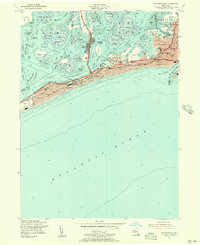
 1954 Lawrence1956 Print · USGSNassau County’s South Shore and the Rockaway Peninsula are captured here in the mid-fifties as coastal suburbs expanded along the Atlantic. Researchers can trace the Long Island Rail Road corridor and locate local landmarks like St Marys Cem, Sch No 4, and the Rockaway Hunt Club.
 - 1954 Map of Far Rockaway, 1956 Print
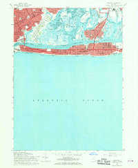
 1954 Far Rockaway1956 Print · USGSQueens and the Rockaway Peninsula are captured here during the mid-century peak of coastal development. Genealogists and local historians can trace street-level details across Far Rockaway, Seaside, and Hammel, or locate landmarks like Jacob Riis Park and St Josephs Sch.
 - 1954 Map of Lynbrook, 1957 Print
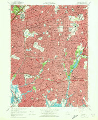
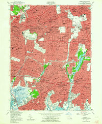 1954 Lynbrook1957 Print · USGSWestern Nassau County and eastern Queens hum with post-war suburban energy at the height of the mid-century. Genealogists and local historians can trace the neighborhood structures of New Hyde Park and Lynbrook, or locate specific landmarks like the Cathedral of the Incarnation and Old Springfield Cem.2 unique versions available
 - 1957 Map of Jamaica, 1959 Print
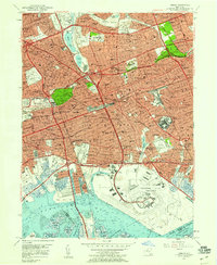 1957 Jamaica1959 Print · USGSQueens is pictured during a mid-century period of rapid growth, defined by massive transit hubs and residential expansion. Genealogists and local historians can trace the development of Jamaica, locate family plots in Maple Grove Cemetery, or see the original layout of Idlewild Field.
 - 1957 Map of New York, 1975 Print
 1957 New York1975 Print · USGSLong Island and the New York metropolitan area are shown in this mid-century survey during a period of massive suburban growth and industrial expansion. Researchers can trace the Long Island RR network and locate landmarks like Fort Tilden or the Brookhaven National Laboratory.
 - 1958 Map of New York
 1958 New York1958 Print · USGSLong Island at the height of its postwar expansion reveals a landscape of rapidly growing suburbs and critical military installations. Genealogists and historians can trace the early footprints of Levittown, the terminals of Idlewild Airport, and the grounds of Brookhaven National Laboratory.3 unique versions available
 - 1960 Map of New York, 1979 Print
 1960 New York1979 Print · USGSLong Island and the five boroughs are shown at a transformative moment mid-century as suburban expansion reshaped the landscape. Researchers can trace family roots through evolving neighborhoods from Rockville Centre to Sayville, or locate historic maritime landmarks like Eatons Neck and Montauk Point.2 unique versions available
 - 1966 Map of Lawrence, 1968 Print
 1966 Lawrence1968 Print · USGSCoastal Nassau County is shown in the mid-1960s as a thriving network of barrier island communities and mainland suburbs. Local historians can trace the development of Island Park, find old family plots at St Marys Cemetery, or locate the Long Island RR stops.3 unique versions available
 - 1966 Map of Jamaica, 1969 Print
 1966 Jamaica1969 Print · USGSQueens was undergoing a massive mid-century transformation as the jet age redefined its southern shoreline. Genealogists and urban historians can trace the development of Howard Beach and Jamaica, or locate family plots in St Johns Cemetery and Bayside Cem.2 unique versions available
 - 1969 Map of New York
 1969 New York1969 Print · USGSLong Island and the New York harbor area are shown here during a peak era of suburban expansion and Cold War defense. Trace the growth of Levittown, the infrastructure of Idlewild NY International Airport, and the reach of the Long Island RR.
 - 1969 Map of Far Rockaway, 1971 Print
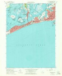 1969 Far Rockaway1971 Print · USGSThe Rockaway Peninsula and Jamaica Bay appear in detail during the late sixties, showing the reach of urban development across the marshes. Researchers can trace neighborhood growth through local landmarks like Rockaway Playland, Jacob Riis Park, and Broad Channel.2 unique versions available
 - 1969 Map of Lynbrook, 1972 Print
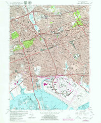
 1969 Lynbrook1972 Print · USGSNassau County and the edge of Queens are shown here at a peak of mid-century suburban development. Researchers can trace the layout of Floral Park and Rockville Centre or find family landmarks like Creedmoor State Hospital and Beth David Cemetery.2 unique versions available
 - 1979 Map of Jamaica
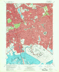
 1979 Jamaica1979 Print · USGSQueens in the late seventies reveals a bustling urban landscape defined by major aviation hubs and historic neighborhoods. Genealogists and historians can trace local landmarks like St Johns Cemetery, the Aqueduct Racetrack, and the St Albans Naval Hospital.
 - 1984 Map of Long Island West, 1986 Print
 1984 Long Island West1986 Print · USGSWestern Long Island in the mid-eighties shows a mature suburban landscape defined by its famous expressways and historic rail lines. Researchers can trace the development of planned communities like Levittown or locate landmarks such as Fort Totten Mil Res and Stony Brook.2 unique versions available
 - 1994 Map of Jamaica, 2000 Print
 1994 Jamaica2000 Print · USGSCentral Queens in the 1990s reveals a dense network of neighborhoods, major transit corridors, and massive coastal infrastructure. Trace local landmarks from Aqueduct Racetrack and St Johns University to the historic Bayside Cem.
End of results
Showing maps 1-23 of 23
Top cities near Inwood
- New York historical maps
- Hempstead historical maps
- Oyster Bay historical maps
- North Hempstead historical maps
- Middletown Township historical maps
- Hempstead historical maps
See more
Top neighborhoods of Inwood
Frequently asked questions
- What are the different types of historical maps available for Inwood?
- What is the oldest map of Inwood?
- Where can I purchase historical maps of Inwood for my home or office?
- Where can I download high-res historical maps of Inwood?
- Are there historical topographic maps available for Inwood?
- Is there historical aerial imagery available for Inwood?
- Where are historical maps of Inwood sourced from?