1900s (20th Century) Maps of Oswego County, New York
Explore 98 historic maps of Oswego County from the 1900s (20th Century). These maps offer a rare glimpse into what life looked like during the 1900s — showing old roads, neighborhoods, homes, and landmarks that have changed or disappeared over time.
Whether you're researching your family's past, planning a metal detecting trip, or studying how Oswego County's landscape evolved across the 1900s, these high-resolution maps are a powerful tool for exploring the history of this region.
- Focus on a specific era: All maps on this page are from the 1900s, giving you a focused view of this time period.
- See what’s changed: Compare century-old streets, trails, and buildings to today's modern landscape using overlays and satellite layers.
- Research with precision: Use these maps for genealogy, historical research, land use analysis, or educational projects.
- View, download, or print: Maps are fully viewable online in high resolution, and can be downloaded or printed for your own records.
Start exploring Oswego County's history through authentic maps from the 1900s. This is your window into the past.
Oswego County, NY maps
(98)- 1900 Map of Baldwinsville
 1900 Baldwinsville1900 Print · USGSCovers Oswego County, including Clay, Salina, and other nearby areas9 unique versions available
 - 1900 Map of Oswego
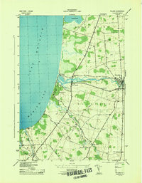
 1900 Oswego1900 Print · USGSCovers Oswego County, including Oswego, Oswego, and other nearby areas8 unique versions available
 - 1900 Map of Fulton
 1900 Fulton1900 Print · USGSCovers Oswego County, including Oswego, Fulton, and other nearby areas7 unique versions available
 - 1902 Map of Chittenango
 1902 Chittenango1902 Print · USGSCovers Oswego County, including Manlius, Cicero, and other nearby areas7 unique versions available
 - 1903 Map of Orwell, 1955 Print
 1903 Orwell1955 Print · USGSCovers Oswego County, including Albion, Williamstown, and other nearby areas
 - 1905 Map of Orwell
 1905 Orwell1905 Print · USGSCovers Oswego County, including Albion, Williamstown, and other nearby areas6 unique versions available
 - 1905 Map of Mexico
 1905 Mexico1905 Print · USGSCovers Oswego County, including Clay, Hastings, and other nearby areas6 unique versions available
 - 1906 Map of Kasoag
 1906 Kasoag1906 Print · USGSCovers Oswego County, including Vienna, Camden, and other nearby areas7 unique versions available
 - 1940 Map of Brewerton
 1940 Brewerton1940 Print · USGSCovers Oswego County, including Clay, Salina, and other nearby areas
 - 1940 Map of Cicero, 1957 Print
 1940 Cicero1957 Print · USGSCovers Oswego County, including Cicero, North Syracuse, and other nearby areas
 - 1941 Map of Cleveland
 1941 Cleveland1941 Print · USGSCovers Oswego County, including Cicero, Sullivan, and other nearby areas2 unique versions available
 - 1941 Map of Jewell
 1941 Jewell1941 Print · USGSCovers Oswego County, including Sullivan, Lenox, and other nearby areas
 - 1942 Map of Sandy Creek, 1957 Print
 1942 Sandy Creek1957 Print · USGSCovers Oswego County, including Sandy Creek, Ellisburg, and other nearby areas
 - 1942 Map of Redfield, 1958 Print
 1942 Redfield1958 Print · USGSCovers Oswego County, including Redfield, Osceola, and other nearby areas
 - 1943 Map of Pulaski
 1943 Pulaski1943 Print · USGSCovers Oswego County, including Richland, Sandy Creek, and other nearby areas
 - 1943 Map of Boylston
 1943 Boylston1943 Print · USGSCovers Oswego County, including Lorraine, Boylston, and other nearby areas
 - 1943 Map of Oswego East
 1943 Oswego East1943 Print · USGSCovers Oswego County, including Oswego, Oswego, and other nearby areas
 - 1943 Map of Redfield
 1943 Redfield1943 Print · USGSCovers Oswego County, including Redfield, Osceola, and other nearby areas
 - 1943 Map of Lysander
 1943 Lysander1943 Print · USGSCovers Oswego County, including Lysander, Van Buren, and other nearby areas
 - 1943 Map of Westdale
 1943 Westdale1943 Print · USGSCovers Oswego County, including Camden, Williamstown, and other nearby areas
 - 1943 Map of New Haven
 1943 New Haven1943 Print · USGSCovers Oswego County, including Scriba, Volney, and other nearby areas
 - 1943 Map of Camden West
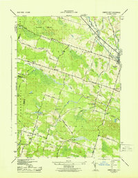 1943 Camden West1943 Print · USGSCovers Oswego County, including Vienna, Camden, and other nearby areas2 unique versions available
 - 1943 Map of Oswego West
 1943 Oswego West1943 Print · USGSCovers Oswego County, including Oswego, Oswego, and other nearby areas
 - 1943 Map of Richland
 1943 Richland1943 Print · USGSCovers Oswego County, including Richland, Sandy Creek, and other nearby areas
 - 1943 Map of Mallory
 1943 Mallory1943 Print · USGSCovers Oswego County, including Hastings, Constantia, and other nearby areas
Showing maps 1-25 of 98
Top cities of Oswego County
- Oswego historical maps
- Fulton historical maps
- Hastings historical maps
- Schroeppel historical maps
- Oswego historical maps
- Scriba historical maps
See more
Frequently asked questions
- What are the different types of historical maps available for Oswego County?
- What is the oldest map of Oswego County?
- Where can I purchase historical maps of Oswego County for my home or office?
- Where can I download high-res historical maps of Oswego County?
- Are there historical topographic maps available for Oswego County?
- Is there historical aerial imagery available for Oswego County?
- Where are historical maps of Oswego County sourced from?