1940s Maps of Saint Lawrence County, New York
Explore 41 historic maps of Saint Lawrence County from the 1940s. These maps offer a rare glimpse into what life looked like during the 1940s — showing old roads, neighborhoods, homes, and landmarks that have changed or disappeared over time.
Whether you're researching your family's past, planning a metal detecting trip, or studying how Saint Lawrence County's landscape evolved across the 1940s, these high-resolution maps are a powerful tool for exploring the history of this region.
- Focus on a specific era: All maps on this page are from the 1940s, giving you a focused view of this time period.
- See what’s changed: Compare century-old streets, trails, and buildings to today's modern landscape using overlays and satellite layers.
- Research with precision: Use these maps for genealogy, historical research, land use analysis, or educational projects.
- View, download, or print: Maps are fully viewable online in high resolution, and can be downloaded or printed for your own records.
Start exploring Saint Lawrence County's history through authentic maps from the 1940s. This is your window into the past.
Saint Lawrence County, NY maps
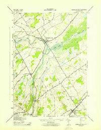
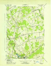
(41)- 1940 Map of Stark
 1940 Stark1940 Print · USGSSt. Lawrence County was a landscape of remote logging camps and private sporting clubs during the interwar years. Genealogists can locate family outposts like Sellecks Cors or trace the early rural education system at Littlejohn School and Cold Brook School.
 - 1942 Map of Waddington, 1957 Print
 1942 Waddington1957 Print · USGSSt. Lawrence County is captured during the early 1940s, showing the riverside docks of Waddington and the international channel of the St Lawrence River. Researchers can locate numerous local landmarks including St Marys Cem, Chipman, and over ten numbered schoolhouses scattered across the rural township.
 - 1942 Map of Morristown, 1958 Print
 1942 Morristown1958 Print · USGSThe international border along the St Lawrence River comes alive in the 1940s, showing the vital connection between Morristown and Brockville. Genealogists can trace early rural life through named roads like Yankee Street and local landmarks like Chippewa Street Church.
 - 1942 Map of Long Bow, 1958 Print
 1942 Long Bow1958 Print · USGSSt. Lawrence County’s timbered foothills appear in detail during the early 1940s as the Raquette River flows toward the St. Lawrence. Researchers can locate remote schoolhouses like School No 6 and trace the original path of the Russell Turnpike Rd past Pickettsville.
 - 1942 Map of Chase Mills, 1961 Print
 1942 Chase Mills1961 Print · USGSSt. Lawrence County was a landscape of river-driven hamlets and rural school districts in the early 1940s. Genealogists can trace family lines through landmarks like Haskell Ridge Cem, the Norwood and St Lawrence rail line, and Chase Mills.
 - 1942 Map of Murphy Island, 1961 Print
 1942 Murphy Island1961 Print · USGSThe St. Lawrence River frontier is captured here in the early 1940s, showing a landscape of international shipping canals and riverside villages. Researchers can trace the original rail line of the Canadian National and locate homesteads near Williamsburg, Morrisburg, and Mariatown.
 - 1942 Map of Norfolk, 1961 Print
 1942 Norfolk1961 Print · USGSSt. Lawrence County in the early 1940s was a bustling corridor of river power and rail transport. Genealogists and historians can trace the foundations of Norfolk and Norwood or locate rural landmarks like Bixby Cem and School No 17.
 - 1942 Map of Barnhart Island, 1961 Print
 1942 Barnhart Island1961 Print · USGSThe St. Lawrence River corridor and the international border appear here in the early 1940s, highlighting a landscape of canals and islands. Trace the locations of riverfront towns like Moulinette and Milles Roches or follow the Raisin River inland to St Andrews West.
 - 1942 Map of Massena, 1961 Print
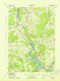
 1942 Massena1961 Print · USGSThe St. Lawrence River frontier is captured here just before mid-century engineering altered the shoreline. Trace the pre-seaway river landscape through Long Sault Rapids, Louisville Landing, and the many numbered schoolhouses like School No 10.
 - 1943 Map of Ogdensburg East
 1943 Ogdensburg East1943 Print · USGSThe St. Lawrence riverfront hums with activity during the early 1940s as Ogdensburg serves as a critical junction for rail and river transit. Genealogists can trace family homesteads near Northrup Corners or locate ancestors at Notre Dame Cem and dozens of rural school sites like School No 29.
 - 1943 Map of Rensselaer Falls
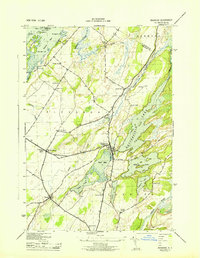
 1943 Rensselaer Falls1943 Print · USGSSt. Lawrence County in the early 1940s is shown here as a landscape of rural school districts and river-bound settlements. You can trace family homesteads near Kendrew Corners or follow the New York Central rail lines into DeKalb Junction.
 - 1943 Map of Waddington
 1943 Waddington1943 Print · USGSSt. Lawrence County in the mid-1940s was a landscape of tightly-knit rural townships and family-named crossroads. Genealogists can trace family footprints through numerous numbered district schools and local landmarks like Drews Corner, Halfway House Corners, and St Marys Cem.
 - 1943 Map of Potsdam
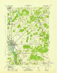 1943 Potsdam1943 Print · USGSSt. Lawrence County during the early war years reveals a landscape of river-powered industry and dispersed school districts. Researchers can locate family heritage at Bayside Cem and St Marys Cem or trace the early industrial footprint of the Sugar Island Dam and the Garfield Gem mine.2 unique versions available
 - 1943 Map of Morristown
 1943 Morristown1943 Print · USGSThe international border along the St Lawrence River comes alive in the 1940s, showing the cross-river connection between Brockville and Morristown. Researchers can trace old family sites near Chippewa Street Church, numerous rural schools, and the path of the New York Central rail line.
 - 1943 Map of Colton
 1943 Colton1943 Print · USGSSt. Lawrence County is shown during the early 1940s as its river-driven economy and rural school districts remained the heart of local life. Genealogists can trace family locations near Riverside Cem or find the numerous numbered schoolhouses serving Hannawa Falls and West Parishville.2 unique versions available
 - 1943 Map of Barnhart Island
 1943 Barnhart Island1943 Print · USGSThe international border along the St. Lawrence River is frozen in time here during the 1940s, prior to the major flooding and seaway construction. Researchers can trace the riverfront settlements of Moulinette and Milles Roches and locate the Barnhart Cemetery on Barnhart Island.
 - 1943 Map of Redwood
 1943 Redwood1943 Print · USGSJefferson County was defined by its lakeside settlements and heavy rail traffic during the early 1940s. Genealogists can trace family lines through the Barnes Cem and numerous rural schoolhouses like School No 14 or locate the village of Plessis.
 - 1943 Map of Lisbon
 1943 Lisbon1943 Print · USGSLisbon and the surrounding St. Lawrence County farm country are captured here during the early 1940s. Genealogists can trace family connections through a dozen local schools and landmarks like White Ch, Flackville Cem, and the Rutland rail line.
 - 1943 Map of Parishville
 1943 Parishville1943 Print · USGSSt. Lawrence County during the early years of the war reveals a landscape of river-powered hamlets and numerous rural school districts. Researchers can trace family origins across the townships of Stockholm and Hopkinton or locate sites like Fairview Cem and Allens Falls Reservoir.2 unique versions available
 - 1943 Map of Red Mills
 1943 Red Mills1943 Print · USGSThe international border along the St. Lawrence River is frozen in time here during the mid-forties, showing the landscape before modern seaway construction. Local historians can trace the riverside community of Red Mills, the industrial layout of Cardinal, and the island-filled waters of the Galop Rapids.
 - 1943 Map of Murphy Island
 1943 Murphy Island1943 Print · USGSThe international border along the St. Lawrence River is captured here in the early 1940s, showing the region before major modern seaway developments. Genealogists can trace family locations in Morrisburg, Williamsburg, and Mariatown, or locate School No 7 and old farms along Hoasic Creek.
 - 1943 Map of Sparrowhawk Point
 1943 Sparrowhawk Point1943 Print · USGSThe international border along the St. Lawrence River is captured here in the 1940s, showing the intersection of Canadian rail and American rural life. Researchers can find numerous local landmarks including School No 17, Union Cem, and Iroquois.
 - 1943 Map of Edwardsville
 1943 Edwardsville1943 Print · USGSSt. Lawrence County townships are captured here in the early 1940s, showing a landscape of lakeside settlements and rural school districts. Genealogists can locate family landmarks like Davies Cem, Stone Church, and numerous schoolhouses from Morristown Center to Galilee.
 - 1943 Map of Ogdensburg West
 1943 Ogdensburg West1943 Print · USGSThe international border at the St. Lawrence River is captured here during the 1940s, showing the vital rail and ferry links between Ogdensburg and Prescott. Researchers can locate rural landmarks like the Pythian Home and numerous district schools, or trace old family routes along Lost Village Rd.
 - 1943 Map of Massena
 1943 Massena1943 Print · USGSSt. Lawrence County sits at the edge of the Canadian border during the early 1940s, showing a river landscape before the modern seaway. Genealogists and local historians can locate early district landmarks like Louisville Landing Ch, the Kent Mill Cem, and the Massena Power Canal.
Showing maps 1-25 of 41
Top cities of Saint Lawrence County
- Potsdam historical maps
- Massena historical maps
- Canton historical maps
- Ogdensburg historical maps
- Gouverneur historical maps
- Norfolk historical maps
See more
Frequently asked questions
- What are the different types of historical maps available for Saint Lawrence County?
- What is the oldest map of Saint Lawrence County?
- Where can I purchase historical maps of Saint Lawrence County for my home or office?
- Where can I download high-res historical maps of Saint Lawrence County?
- Are there historical topographic maps available for Saint Lawrence County?
- Is there historical aerial imagery available for Saint Lawrence County?
- Where are historical maps of Saint Lawrence County sourced from?