1990s Maps of Saint Lawrence County, New York
Explore 9 historic maps of Saint Lawrence County from the 1990s. These maps offer a rare glimpse into what life looked like during the 1990s — showing old roads, neighborhoods, homes, and landmarks that have changed or disappeared over time.
Whether you're researching your family's past, planning a metal detecting trip, or studying how Saint Lawrence County's landscape evolved across the 1990s, these high-resolution maps are a powerful tool for exploring the history of this region.
- Focus on a specific era: All maps on this page are from the 1990s, giving you a focused view of this time period.
- See what’s changed: Compare century-old streets, trails, and buildings to today's modern landscape using overlays and satellite layers.
- Research with precision: Use these maps for genealogy, historical research, land use analysis, or educational projects.
- View, download, or print: Maps are fully viewable online in high resolution, and can be downloaded or printed for your own records.
Start exploring Saint Lawrence County's history through authentic maps from the 1990s. This is your window into the past.
Saint Lawrence County, NY maps
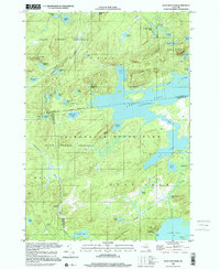
(9)- 1990 Map of Little Tupper Lake
 1990 Little Tupper Lake1990 Print · USGSAdirondack wilderness in the 1990s reveals a landscape of massive lakes and isolated outposts across Hamilton and St. Lawrence counties. Trace the remote settlement of Sabattis, the facility at Whitney Headquarters, or the old route of Robinson Rd.
 - 1990 Map of Piercefield
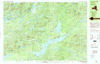
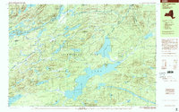
 1990 Piercefield1990 Print · USGSPiercefield and the surrounding Adirondack wilderness are captured here in the early 1990s as the region maintained its quiet North Country character. Genealogists and hikers can trace old pathways around Conifer, the waters of Eagle Crag Lake, and the summit at Arab Mountain.2 unique versions available
 - 1994 Map of Massena
 1994 Massena1994 Print · USGSThe St. Lawrence River valley and northern Adirondacks meet in the mid-1990s, revealing a landscape of international shipping, rail corridors, and dense state forests. Genealogists and historians can trace the foundations of Massena, the St Regis Indian Reservation, and small hamlets like Brasher Iron Works.
 - 1999 Map of Wolf Mountain, 2001 Print
 1999 Wolf Mountain2001 Print · USGSThe northern Adirondacks at the close of the twentieth century remain a vast wilderness of interconnected waterways and isolated peaks. Researchers can trace remote campsites and landings around Lows Lake, the historic site of Nehasane, and the Lookout Tower atop Cat Mountain.
 - 1999 Map of Little Tupper Lake, 2001 Print
 1999 Little Tupper Lake2001 Print · USGSIn the late nineties, this portion of the central Adirondacks remained a landscape of isolated outposts and deep water networks. Researchers can locate the Whitney Headquarters and trace the remote settlements of Sabattis and Robinwood among the glacial ponds.
 - 1999 Map of Five Ponds, 2001 Print
 1999 Five Ponds2001 Print · USGSThe Adirondack wilderness in the late twentieth century remains a network of secluded waterways and remote shelters. Hikers and historians can trace routes to Janacks Landing, High Falls, and the namesake Five Ponds cluster.
 - 1999 Map of Newton Falls, 2001 Print
 1999 Newton Falls2001 Print · USGSThe St. Lawrence County highlands near the turn of the millennium reveal a landscape shaped by both Adirondack wilderness and industrial extraction. Local historians can trace the development of Newton Falls and Wanakena, locating the State Ranger Sch, mining operations, and the remote Cook Corners settlement.
 - 1999 Map of Cranberry Lake, 2001 Print
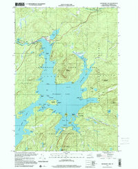 1999 Cranberry Lake2001 Print · USGSAdirondack wilderness and the complex shores of Cranberry Lake are captured here at the end of the millennium. Trace lakefront geography and research outposts like Joe Indian Island and the Cranberry Lake Biological Station.
 - 1999 Map of Piercefield, 2001 Print
 1999 Piercefield2001 Print · USGSThe Adirondack wilderness of the late 1990s is captured here at the junction of the Raquette River and Tupper Lake. Researchers can trace the layout of small settlements like Conifer and Piercefield, or locate specific landmarks like the Mt Arab Station and Mountain Camp.
End of results
Showing maps 1-9 of 9
Top cities of Saint Lawrence County
- Potsdam historical maps
- Massena historical maps
- Canton historical maps
- Ogdensburg historical maps
- Gouverneur historical maps
- Norfolk historical maps
See more
Frequently asked questions
- What are the different types of historical maps available for Saint Lawrence County?
- What is the oldest map of Saint Lawrence County?
- Where can I purchase historical maps of Saint Lawrence County for my home or office?
- Where can I download high-res historical maps of Saint Lawrence County?
- Are there historical topographic maps available for Saint Lawrence County?
- Is there historical aerial imagery available for Saint Lawrence County?
- Where are historical maps of Saint Lawrence County sourced from?