2020s Maps of Washington County, New York
Explore 33 historic maps of Washington County from the 2020s. These maps offer a rare glimpse into what life looked like during the 2020s — showing old roads, neighborhoods, homes, and landmarks that have changed or disappeared over time.
Whether you're researching your family's past, planning a metal detecting trip, or studying how Washington County's landscape evolved across the 2020s, these high-resolution maps are a powerful tool for exploring the history of this region.
- Focus on a specific era: All maps on this page are from the 2020s, giving you a focused view of this time period.
- See what’s changed: Compare century-old streets, trails, and buildings to today's modern landscape using overlays and satellite layers.
- Research with precision: Use these maps for genealogy, historical research, land use analysis, or educational projects.
- View, download, or print: Maps are fully viewable online in high resolution, and can be downloaded or printed for your own records.
Start exploring Washington County's history through authentic maps from the 2020s. This is your window into the past.
Washington County, NY maps
(33)- 2021 Map of West Pawlet, 2021 Print
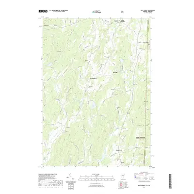 2021 West Pawlet2021 Print · USGSCovers Washington County, including Granville, Hartford, and other nearby areas
 - 2021 Map of Poultney, 2021 Print
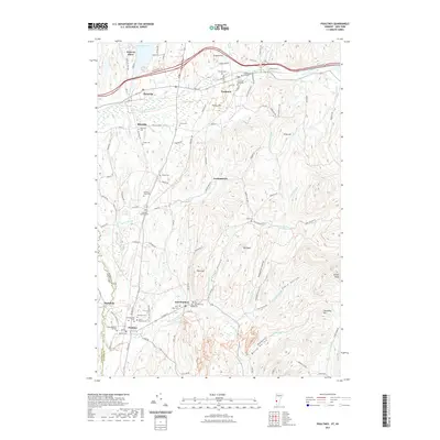 2021 Poultney2021 Print · USGSCovers Washington County, including Poultney, Poultney Village, and other nearby areas
 - 2021 Map of Wells, 2021 Print
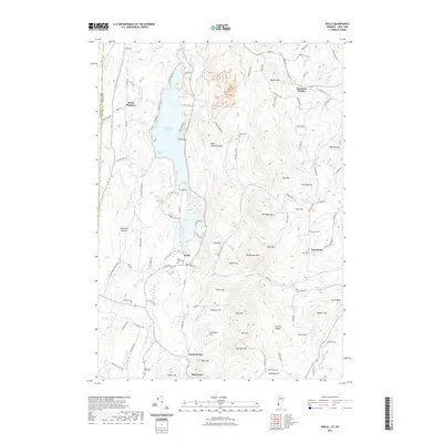 2021 Wells2021 Print · USGSCovers Washington County, including Granville, Poultney, and other nearby areas
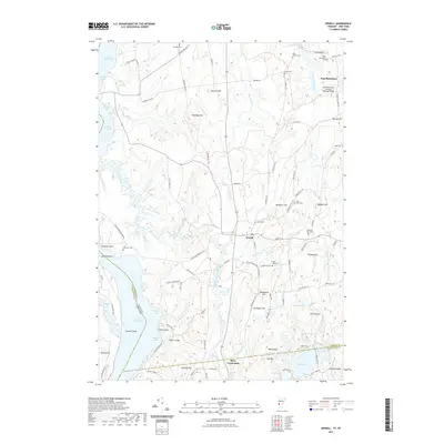
 - 2021 Map of Benson, 2021 Print
 2021 Benson2021 Print · USGSCovers Washington County, including Whitehall, Fair Haven, and other nearby areas
 - 2021 Map of Orwell, 2021 Print
 2021 Orwell2021 Print · USGSCovers Washington County, including Ticonderoga, Shoreham, and other nearby areas
 - 2023 Map of Schaghticoke, 2023 Print
 2023 Schaghticoke2023 Print · USGSThe Hoosic River valley and the tri-county borders of Rensselaer, Washington, and Saratoga are captured in this modern survey. Researchers can trace the Old Champlain Canal or locate family plots at Saint Johns Cem and Brownell Cem.
 - 2023 Map of Hoosick Falls, 2023 Print
 2023 Hoosick Falls2023 Print · USGSThe New York and Vermont border country comes alive in this survey of the river valleys north of Hoosick Falls. Genealogists can trace family names at Maple Grove Cem or Kingsley Cem while following the path of the Pan Am Southern rail line.
 - 2023 Map of Eagle Bridge, 2023 Print
 2023 Eagle Bridge2023 Print · USGSRensselaer and Washington counties meet along the Hoosic River in the early twenty-first century, showing a landscape shaped by water and hills. Trace family roots and old land ties near Eagle Bridge, Buskirk, and the West Hoosick Rural Cem.
 - 2023 Map of Fort Miller, 2023 Print
 2023 Fort Miller2023 Print · USGSUpper Hudson River settlements and islands are captured in this contemporary look at the Washington and Saratoga County border. Researchers can trace family plots at Thompson Cem and Bacon Hill Cem or explore the riverfronts of Fort Miller and Northumberland.
 - 2023 Map of Hudson Falls, 2023 Print
 2023 Hudson Falls2023 Print · USGSThe industrial corridor of Hudson Falls and Fort Edward is captured here alongside the historic Old Champlain Canal. Genealogists and historians can trace family plots at Union Cem and Saint Pauls Cem or locate the Washington County Courthouse.
 - 2023 Map of Thorn Hill, 2023 Print
 2023 Thorn Hill2023 Print · USGSThe borderlands of New York and Vermont come alive in this detailed look at the rural landscape during the early twenty-first century. Genealogists can trace family names through numerous burial sites like Sciota Cem, Miller Cem, and the historic clusters in Fair Haven.
 - 2023 Map of Granville, 2023 Print
 2023 Granville2023 Print · USGSThe borderlands of Washington County come alive in this recent survey of the hamlets and river valleys along the Vermont state line. Researchers can trace family history through numerous burial grounds like Old Quaker Cem or locate rural settlements such as Raceville and Slyboro.
 - 2023 Map of Fort Ann, 2023 Print
 2023 Fort Ann2023 Print · USGSWashington County settlement and rugged Adirondack foothills meet in this contemporary survey of the Fort Ann area. Genealogists and hikers can trace local lineages at Baker Cem or navigate the elevations of Battle Hill and The Pinnacle.
 - 2023 Map of Putnam Mountain, 2023 Print
 2023 Putnam Mountain2023 Print · USGSUpper Washington County's highlands are shown in contemporary detail, where the rugged terrain of the Adirondack Park fringe meets quiet valley settlements. Genealogists and historians can trace family locations near Orcutt Cem, the old Iron Furnace, or the community at West Fort Ann.
 - 2023 Map of Mechanicville, 2023 Print
 2023 Mechanicville2023 Print · USGSSouthern Saratoga County's riverfront heritage is on full display in this modern survey of the Hudson Valley corridor. Researchers can trace family history through local landmarks like Yellow Meeting House Cem, the Old Champlain Canal, and Stillwater.
 - 2023 Map of Shushan, 2023 Print
 2023 Shushan2023 Print · USGSThe New York and Vermont borderlands come alive in this recent survey of the Shushan area, where the Batten Kill flows through a valley of deep-rooted family farms. Genealogists can trace local heritage through numerous rural burial grounds like Rhoda Blowers Cem and Shushan and Eagleville Cem.
 - 2023 Map of Salem, 2023 Print
 2023 Salem2023 Print · USGSThe borderlands of eastern New York and Vermont are captured here during the 2020s, centered on the historic town of Salem. Genealogists and local historians can trace family plots at the Revolutionary War Cem or explore the river-driven history of Rexleigh and the Batten-Kill.
 - 2023 Map of Hartford, 2023 Print
 2023 Hartford2023 Print · USGSThe Hartford area of Washington County exhibits a classic rural landscape defined by central hamlets and family-run airports. Researchers can trace lineage at the Adamsville Cem or locate old community centers like North Argyle and Belcher.
 - 2023 Map of Cambridge, 2023 Print
 2023 Cambridge2023 Print · USGSModern-day Washington County retains its historic village character and upland terrain in this 2023 survey. Genealogists and local historians can trace the roads connecting Battenville, Coila, and the Woodlands Cem while exploring the banks of the Batten Kill.
 - 2023 Map of Cossayuna, 2023 Print
 2023 Cossayuna2023 Print · USGSWashington County remains a landscape of rolling hills and quiet hamlets in this recent survey. Researchers can trace family sites at Old Scots Cem and South Argyle Cem or explore the shores of Cossayuna Lake.
 - 2023 Map of Bolton Landing, 2023 Print
 2023 Bolton Landing2023 Print · USGSThe Lake George shoreline and Adirondack highlands come into focus in this recent survey of the Warren County coast. Researchers can locate family burial sites like Federal Hill Cem and Herrick Cem or trace the docks of Bolton Landing.
 - 2023 Map of Ticonderoga, 2023 Print
 2023 Ticonderoga2023 Print · USGSThe strategic waterway of La Chute and the town of Ticonderoga are shown in detail during the early 2020s. Researchers can trace the shoreline of Lake George to find Indian Kettles, Friends Point, and the Meadow Knoll Cemetery.
 - 2023 Map of Whitehall, 2023 Print
 2023 Whitehall2023 Print · USGSThe village of Whitehall serves as the gateway to the Champlain Valley during this modern era of New York and Vermont history. Researchers can trace the path of the Champlain Canal and locate numerous family burial grounds including Neddo Cem and Rodd - Elbow Cem.
 - 2023 Map of Schuylerville, 2023 Print
 2023 Schuylerville2023 Print · USGSThe Saratoga and Washington County borderlands appear in this modern survey of the upper Hudson valley. Trace Revolutionary War sites near Saratoga National Historical Park and find local landmarks like Starks Knob and Powers Briggs Ferry.
 - 2023 Map of Lake George, 2023 Print
 2023 Lake George2023 Print · USGSThe southern basin of Lake George is captured here in the early twenty-first century, showing the established communities of Cleverdale and Diamond Point. Researchers can trace local heritage at Caldwell Cem or follow the terrain from French Mountain to the shores of Harris Bay.
Showing maps 1-25 of 33
Top cities of Washington County
- Kingsbury historical maps
- Granville historical maps
- Fort Edward historical maps
- Fort Ann historical maps
- Greenwich historical maps
- Whitehall historical maps
See more
Frequently asked questions
- What are the different types of historical maps available for Washington County?
- What is the oldest map of Washington County?
- Where can I purchase historical maps of Washington County for my home or office?
- Where can I download high-res historical maps of Washington County?
- Are there historical topographic maps available for Washington County?
- Is there historical aerial imagery available for Washington County?
- Where are historical maps of Washington County sourced from?