Old Maps of Burke County, North Carolina for Academic Research
Study the evolution of Burke County with 143 high-resolution historic maps. Whether you're teaching, researching, or modeling changes in land use, these maps provide essential visual documentation of urban, environmental, and geographic change.
- Analyze long-term change: Track patterns in development, transportation, and natural features.
- Ideal for environmental or urban studies: Support academic projects with primary historical map data.
- Use in the classroom or lab: Educators and researchers rely on these maps to bring historical context to life.
These maps are a powerful tool for teaching, research, and visualizing how Burke County has changed over the decades.
Burke County, NC maps
(143)- 1895 Map of Hickory
 1895 Hickory1895 Print · USGSThe North Carolina foothills come alive in the late nineteenth century as the rail lines reached Hickory and Newton. Genealogists can trace family roots through numerous country landmarks like Tuttle's Store, Emmanuel Church, and Cloninger's Mill.5 unique versions available
 - 1905 Map of Morganton, 1941 Print
 1905 Morganton1941 Print · USGSThe foothills and high peaks of the Blue Ridge come alive in the early twentieth century, centered on the growing towns of Morganton and Lenoir. Genealogists and historians can trace the early rail corridor of the Southern Railway and locate vanished landmarks like Arneys Store and Rutherford College.2 unique versions available
 - 1934 Map of Linville Falls
 1934 Linville Falls1934 Print · USGSAvery County mountain life in the mid-thirties centered on the North Toe River and its rugged ridges. Genealogists can locate family landmarks like Walnut Grove Ch, Brushy Creek Sch, and the Hemphill Mine near the crossing at Heffner Gap.
 - 1953 Map of Charlotte, 1968 Print
 1953 Charlotte1968 Print · USGSThe North Carolina Piedmont and South Carolina borderlands are shown in detail during a period of significant growth and reservoir development. Trace the rail corridors of the Southern Railway or find family roots in towns like China Grove, Misenheimer, and Lincolnton.3 unique versions available
 - 1954 Map of Charlotte
 1954 Charlotte1954 Print · USGSThe North Carolina Piedmont in the mid-1950s shows a region of rapid growth and industrial expansion centered around Charlotte. Trace the era's infrastructure through the Southern railroad lines and locate significant landmarks like the Charlotte Naval Ammunition Depot and Lake Norman.2 unique versions available
 - 1956 Map of Valdese, 1958 Print
 1956 Valdese1958 Print · USGSBurke County in the mid-fifties shows a landscape of busy textile and furniture towns connected by the rail corridor. Genealogists can locate family sites among numerous landmarks like Bollingers Chapel, Hildebran Sch, and Connellys Springs.2 unique versions available
 - 1956 Map of Oak Hill, 1958 Print
 1956 Oak Hill1958 Print · USGSBurke County in the mid-fifties is characterized by the meeting of the Pisgah National Forest and the upper waters of Lake James. Genealogists and historians can trace the foundations of rural community life through sites like Tablerock State Fish Hatchery, Willow Tree Sch, and Quaker Meadow Ch.2 unique versions available
 - 1956 Map of Collettsville, 1958 Print
 1956 Collettsville1958 Print · USGSCaldwell County’s deep river valleys and high forest ridges are captured here in the mid-fifties, centered on the community of Collettsville. Researchers can trace old family sites and rural landmarks like the Sand Mtn Lookout Tower, Adako, and Conways Chapel.3 unique versions available
 - 1956 Map of Benn Knob, 1958 Print
 1956 Benn Knob1958 Print · USGSThe upland borders of Cleveland and Rutherford counties appear here as they were in the mid-1950s, a landscape of high peaks and secluded valleys. Genealogists can trace family footprints at Mt Moriah Ch, Corinth Ch, and the small Moriah Sch.2 unique versions available
 - 1956 Map of Morganton North, 1958 Print
 1956 Morganton North1958 Print · USGSMorganton and the river valleys of Burke County are captured in the mid-fifties, showing the rural landscapes of Quaker Meadow. Researchers can trace family sites like Arneys Store, Corpening Sch, and several mission churches along the Johns River.2 unique versions available
 - 1956 Map of Casar, 1958 Print
 1956 Casar1958 Print · USGSThe rural foothills of the South Mountains come alive in this mid-fifties study of the Cleveland and Lincoln county line. Genealogists and local historians can trace family land around Casar, Ramsey, and Shoups Ford or locate several country churches like Carpenters Grove Ch.2 unique versions available
 - 1956 Map of Ashford, 1958 Print
 1956 Ashford1958 Print · USGSThe Linville Gorge and Pisgah National Forest meet in the mid-1950s as the river valleys transition to mountain wilderness. Trace family roots at South Mtn Institute, Brown Cem, or the old settlement of North Cove.3 unique versions available
 - 1956 Map of Linville Falls, 1958 Print
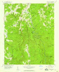 1956 Linville Falls1958 Print · USGSThe High Country of western North Carolina in the mid-fifties is captured here during the development of the Blue Ridge Parkway. Genealogists and hikers can locate Wise Cem, Walnut Grove Ch, and the subterranean depths of Linville Caverns.4 unique versions available
 - 1956 Map of Morganton South, 1958 Print
 1956 Morganton South1958 Print · USGSMorganton and its mountain periphery are captured here in the mid-fifties, showing the town's expansion toward the South Mountains. Genealogists can locate family sites near Pumpkin Center, the State Sch for the Deaf, or Mull Grove Ch.2 unique versions available
 - 1956 Map of Chestnut Mtn., 1958 Print
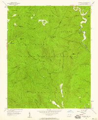 1956 Chestnut Mtn.1958 Print · USGSThe Blue Ridge wilderness of Burke and Avery counties is captured here in the mid-1950s as a landscape of isolated mountain settlements and national forest. Researchers can locate family sites and historical landmarks like Kawana Cem, the community of Mortimer, and the Lookout Tower atop Chestnut Mtn.4 unique versions available
 - 1956 Map of Drexel, 1959 Print
 1956 Drexel1959 Print · USGSThe Catawba River valley in the mid-1950s is captured here just as the region’s industrial and transit networks were maturing. Local historians can trace the development of Drexel and Valdese along the Southern railroad or locate family-named sites like Puett Cem and Corpening Bridge.
 - 1956 Map of Linville Falls, 1962 Print
 1956 Linville Falls1962 Print · USGSThe North Carolina high country is captured here during the mid-fifties, centered on the steep descent of the Linville River. Genealogists and hikers can trace old mountain communities and landmarks like the South Mtn Institute, Linville Caverns, and Wise Cem.2 unique versions available
 - 1956 Map of Lenoir, 1963 Print
 1956 Lenoir1963 Print · USGSCaldwell and Burke Counties come alive in the 1950s, showing the Foothills region as it transitioned from mountain timberlands to bustling rail towns. Trace old community hubs like Arneys Store, family-named creeks such as Elijah Bates Mill Creek, and the many churches like St Marys Mission Ch.
 - 1960 Map of Charlotte
 1960 Charlotte1960 Print · USGSMid-century North Carolina and South Carolina meet in this 1960 survey of the Piedmont's industrial and textile heartland. Trace the growth of Charlotte alongside historic landmarks like Kings Mountain National Military Park and the Charlotte Naval Ammunition Depot.2 unique versions available
 - 1962 Map of Charlotte
 1962 Charlotte1962 Print · USGSThe North Carolina Piedmont in the early sixties showcases a landscape transformed by massive reservoirs and industrial growth. Researchers can trace the development of Lake Norman, locate the Charlotte Naval Ammunition Depot, or find family landmarks like Wesley Chapel and Brown & Norcott Mills.
 - 1962 Map of Glen Alpine, 1964 Print
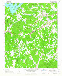 1962 Glen Alpine1964 Print · USGSWestern Burke County comes into focus in the early sixties as the Catawba River valley balances hydroelectric development with deep-rooted rural life. Researchers can trace historic church sites like Bridgewater Ch, old schoolhouses such as Pilot Mtn Sch, and the industrial footprint of the Linville Dam Powerhouse.
 - 1962 Map of Dysartsville, 1964 Print
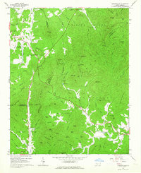 1962 Dysartsville1964 Print · USGSThe foothills of the South Mountains come alive in the early sixties, showing where Burke, McDowell, and Rutherford counties meet. Genealogists can locate family names and sites like Logans Store, Fortune Cem, and Missionary Ch.3 unique versions available
 - 1962 Map of Marion East, 1964 Print
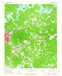 1962 Marion East1964 Print · USGSMcDowell County's foothills and river valleys are captured here in the early sixties, anchored by the industrial and rail hubs of Marion and East Marion. Genealogists can trace family roots through rural landmarks like Nebo Cem, Dysartsville Ch, and the small settlement of Jacktown.2 unique versions available
 - 1970 Map of Banoak, 1972 Print
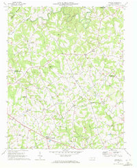 1970 Banoak1972 Print · USGSCatawba and Lincoln counties are shown here in the early seventies, a landscape of rolling Piedmont ridges and family farms. Researchers can trace local heritage through dozens of country landmarks like Cat Square, Hulls Crossroads, and the North Brook Sch No 3.
 - 1970 Map of Bethlehem, 1973 Print
 1970 Bethlehem1973 Print · USGSThe northern edge of Hickory and the waters of Lake Hickory come into sharp focus during this period of 1970s growth. Researchers can trace the development of lakeside communities like Bethlehem or locate family landmarks such as Isaac Creek Ch and Bentley Cem.
Showing maps 1-25 of 143
Top cities of Burke County
- Morganton historical maps
- Valdese historical maps
- Icard historical maps
- Drexel historical maps
- Connelly Springs historical maps
- Hildebran historical maps
See more
Frequently asked questions
- What are the different types of historical maps available for Burke County?
- What is the oldest map of Burke County?
- Where can I purchase historical maps of Burke County for my home or office?
- Where can I download high-res historical maps of Burke County?
- Are there historical topographic maps available for Burke County?
- Is there historical aerial imagery available for Burke County?
- Where are historical maps of Burke County sourced from?